![](/images/other/stat-length.png)
![Trail Walking Dourbies - LE SUQUET - DOURBIES - 14.0 Km - 5h30 - Dénivelé 900 m - Photo](https://media.geolcdn.com/t/1900/400/ext.pjpeg?maxdim=2&url=https%3A%2F%2Fstatic1.geolcdn.com%2Fsiteimages%2Fupload%2Ffiles%2F1553511878bg_sport_marche.png)
LE SUQUET - DOURBIES - 14.0 Km - 5h30 - Dénivelé 900 m
dansmabulle
User
![Length](/images/other/stat-length.png)
![Max alt](https://static1.geolcdn.com/siteimages/upload/files/1508320355ic_sort_altitude_max_24dp.png)
![Uphill gradient](https://static1.geolcdn.com/siteimages/upload/files/1508320355ic_sort_den_pos_24dp.png)
![Km-Effort](/images/other/stat-length.png)
![Min alt](https://static1.geolcdn.com/siteimages/upload/files/1508320355ic_sort_altitude_min_24dp.png)
![Downhill gradient](https://static1.geolcdn.com/siteimages/upload/files/1508320355ic_sort_den_neg_24dp.png)
![Boucle](https://static1.geolcdn.com/siteimages/upload/files/16400158638029165_repeat_loop_refresh_sync_direction_icon.png)
![Walking](https://static1.geolcdn.com/sitytour/trail-icons/101.png)
4h59
Difficulty : Difficult
![Scan this QR Code to open this trail in the SityTrail application](https://capi.geolives.com/qq0zvz2zws4bq2lad0pu/sitytour/trails/244589/qr.png?size=200)
FREE GPS app for hiking
About
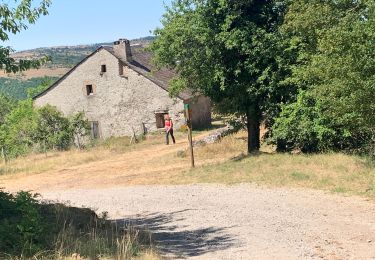
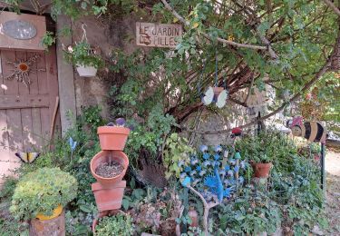
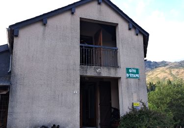
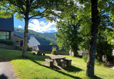
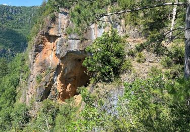
Trail Walking of 14.6 km to be discovered at Occitania, Gard, Dourbies. This trail is proposed by dansmabulle.
Description
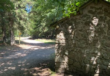
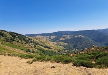
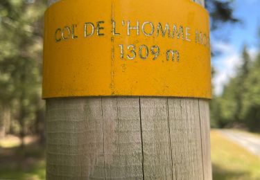
Description dans les topo-guides de la région, ONF PCN et mairie. Une belle randonnée d'abord sur les crêtes puis en bord de rivière, qui fait découvrir tous les aspects de la montagne cévenole. La Dourbie est une belle "rivière à truites" et les pêcheurs ne sont pas rares. Attention, en fonction du débit de la rivière il est impératif de traverser la rivière au "Pont des chèvres" .Suivez bien la trace GPS. Bonne rando !
Positioning
Comments
Trails nearby
![Trail Walking Saint-Sauveur-Camprieu - Dourbies Camprieu boucle - Photo](https://media.geolcdn.com/t/375/260/773150fb-e481-46d1-aed3-630ac5bd1b85.jpg&format=jpg&maxdim=2)
![Walking Walking](https://static1.geolcdn.com/sitytour/trail-icons/101.png)
Walking
![](/images/other/stat-length.png)
![](https://static1.geolcdn.com/siteimages/upload/files/16400158638029165_repeat_loop_refresh_sync_direction_icon.png)
![Trail Walking Dourbies - Dourbies à Camprieu en boucle - Photo](https://media.geolcdn.com/t/375/260/7560d4ec-5fb6-44ba-b835-af6c5175cd0a.jpg&format=jpg&maxdim=2)
![Walking Walking](https://static1.geolcdn.com/sitytour/trail-icons/101.png)
Walking
![](/images/other/stat-length.png)
![](https://static1.geolcdn.com/siteimages/upload/files/16400158638029165_repeat_loop_refresh_sync_direction_icon.png)
![Trail Walking Dourbies - rando 2 jours - Photo](https://media.geolcdn.com/t/375/260/e4a982c9-8006-4ddd-961f-710ce825fe0a.jpg&format=jpg&maxdim=2)
![Walking Walking](https://static1.geolcdn.com/sitytour/trail-icons/101.png)
![Trail Walking Trèves - rando 2 jours - Photo](https://media.geolcdn.com/t/375/260/88ae978a-b078-4a84-af61-470b5d0ccef8.jpg&format=jpg&maxdim=2)
![Walking Walking](https://static1.geolcdn.com/sitytour/trail-icons/101.png)
![Trail Walking Dourbies - Dourbies -Meyruis 23 km - deuxième étape tour du mont Aigual - Photo](https://media.geolcdn.com/t/375/260/52458433-a83a-4257-9972-4552b12cb0f6.jpg&format=jpg&maxdim=2)
![Walking Walking](https://static1.geolcdn.com/sitytour/trail-icons/101.png)
Walking
![](/images/other/stat-length.png)
![](https://static1.geolcdn.com/siteimages/upload/files/16400158638029165_repeat_loop_refresh_sync_direction_icon.png)
![Trail Walking Trèves - st firmin - Photo](https://media.geolcdn.com/t/375/260/ext.jpg?maxdim=2&url=https%3A%2F%2Fstatic1.geolcdn.com%2Fsiteimages%2Fupload%2Ffiles%2F1553511878bg_sport_marche.png)
![Walking Walking](https://static1.geolcdn.com/sitytour/trail-icons/101.png)
![Trail Walking Trèves - Trêves via Dourbies - Photo](https://media.geolcdn.com/t/375/260/2256ed53-dfb6-4e83-a261-f985f7675860.jpg&format=jpg&maxdim=2)
![Walking Walking](https://static1.geolcdn.com/sitytour/trail-icons/101.png)
Walking
![](/images/other/stat-length.png)
![](https://static1.geolcdn.com/siteimages/upload/files/16400158638029165_repeat_loop_refresh_sync_direction_icon.png)
![Trail Walking Arrigas - Col de l’Homme mort le Saint Guiral - Photo](https://media.geolcdn.com/t/375/260/261f46b4-fe0a-4f99-bec2-77703f139aba.jpg&format=jpg&maxdim=2)
![Walking Walking](https://static1.geolcdn.com/sitytour/trail-icons/101.png)
Walking
![](/images/other/stat-length.png)
![](https://static1.geolcdn.com/siteimages/upload/files/16400158638029165_repeat_loop_refresh_sync_direction_icon.png)
![Trail Walking Lanuéjols - Commeiras - Photo](https://media.geolcdn.com/t/375/260/dbaa3b33-bf1b-43cb-b30a-b330865bb26f.jpg&format=jpg&maxdim=2)
![Walking Walking](https://static1.geolcdn.com/sitytour/trail-icons/101.png)