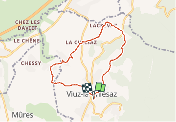
![](/images/other/stat-length.png)
![Trail Walking Viuz-la-Chiésaz - Circuit de Viuz La Chiesaz - Photo](https://media.geolcdn.com/t/1900/400/5ec881e2-7522-436f-aeef-d18c681a45ff.jpg&format=pjpeg&maxdim=2)
Circuit de Viuz La Chiesaz
HERRY
User GUIDE
![Length](/images/other/stat-length.png)
![Max alt](https://static1.geolcdn.com/siteimages/upload/files/1508320355ic_sort_altitude_max_24dp.png)
![Uphill gradient](https://static1.geolcdn.com/siteimages/upload/files/1508320355ic_sort_den_pos_24dp.png)
![Km-Effort](/images/other/stat-length.png)
![Min alt](https://static1.geolcdn.com/siteimages/upload/files/1508320355ic_sort_altitude_min_24dp.png)
![Downhill gradient](https://static1.geolcdn.com/siteimages/upload/files/1508320355ic_sort_den_neg_24dp.png)
![Boucle](https://static1.geolcdn.com/siteimages/upload/files/16400158638029165_repeat_loop_refresh_sync_direction_icon.png)
![Walking](https://static1.geolcdn.com/sitytour/trail-icons/101.png)
1h46
Difficulty : Unknown
![Scan this QR Code to open this trail in the SityTrail application](https://capi.geolives.com/qq0zvz2zws4bq2lad0pu/sitytour/trails/2444959/qr.png?size=200)
FREE GPS app for hiking
About
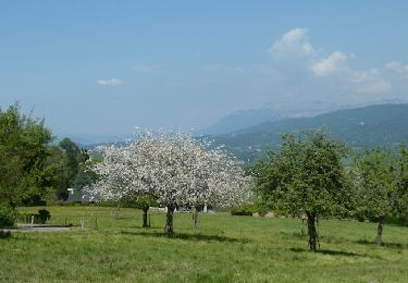
Trail Walking of 7.3 km to be discovered at Auvergne-Rhône-Alpes, Upper Savoy, Viuz-la-Chiésaz. This trail is proposed by HERRY.
Description
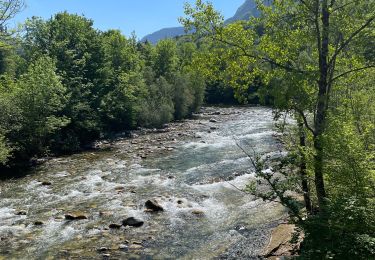
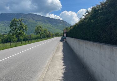
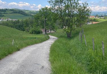
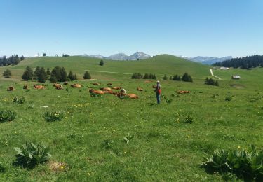
Se garer au parking à proximité des commerces ,mairie. Suivre le sentier du "bois de Marie" qui s'engage en montant sur la gauche. Après le croisement de route suivre entre deux haies de propriétés le chemin qui enjambe un ruisseau. Remonter ensuite en direction du hameau de Lacrevaz à travers bois. Traverser la route de Viuz à Quintal , tourner à droite puis 50 mètres plus loin à gauche dans le bois. Les passages peuvent être humides car Viuz est connu pour un nombre important de ruisseaux. Après Lacrevaz il y a un cheminement sur la route jusqu'à l'intersection avec celle de Viuz à Balmont. A cette intersection, tourner à gauche puis 30 mètres plus loin à droite vers la ferme. suivre le chemin du "bénitier" , bénitier que vous apercevez sur la gauche du sentier ( voir photo). Le sentier balisé descend vers la route pour ensuite reprendre un sentier qui monte au crêt ( commune de Mûres). Après le Crêt descente vers le site d'atterrissage des parapentes puis retour vers le chef-lieu de Viuz la Chiesaz.
Positioning
Comments
Trails nearby
![Trail Walking Cusy - 14-08-2022 Pont de Cusy - Pont de l'abîme - Photo](https://media.geolcdn.com/t/375/260/afefb47b-f53a-4dff-bf88-24c102fec5de.jpg&format=jpg&maxdim=2)
![Walking Walking](https://static1.geolcdn.com/sitytour/trail-icons/101.png)
Walking
![](/images/other/stat-length.png)
![](https://static1.geolcdn.com/siteimages/upload/files/16400158638029165_repeat_loop_refresh_sync_direction_icon.png)
![Trail Walking Viuz-la-Chiésaz - Semnoz, mon tour des lacs et des crêts - Photo](https://media.geolcdn.com/t/375/260/783af83e-3511-42c6-b5b4-a812fdab5578.jpg&format=jpg&maxdim=2)
![Walking Walking](https://static1.geolcdn.com/sitytour/trail-icons/101.png)
Walking
![](/images/other/stat-length.png)
![](https://static1.geolcdn.com/siteimages/upload/files/16400158638029165_repeat_loop_refresh_sync_direction_icon.png)
![Trail Walking Cusy - Grosse balade du cheran - Photo](https://media.geolcdn.com/t/375/260/4b4c750e-7c06-406a-b59d-9d7896a078f2.jpg&format=jpg&maxdim=2)
![Walking Walking](https://static1.geolcdn.com/sitytour/trail-icons/101.png)
Walking
![](/images/other/stat-length.png)
![](https://static1.geolcdn.com/siteimages/upload/files/16400158638029165_repeat_loop_refresh_sync_direction_icon.png)
![Trail Walking Cusy - Vers le cheran - Photo](https://media.geolcdn.com/t/375/260/0fcf1c81-bbc6-4eda-956d-4d71d9ae46a9.jpg&format=jpg&maxdim=2)
![Walking Walking](https://static1.geolcdn.com/sitytour/trail-icons/101.png)
Walking
![](/images/other/stat-length.png)
![](https://static1.geolcdn.com/siteimages/upload/files/16400158638029165_repeat_loop_refresh_sync_direction_icon.png)
![Trail Walking Cusy - Le château de Cusy - Photo](https://media.geolcdn.com/t/375/260/167f6246-a2b3-4044-a388-d72786f82051.jpg&format=jpg&maxdim=2)
![Walking Walking](https://static1.geolcdn.com/sitytour/trail-icons/101.png)
Walking
![](/images/other/stat-length.png)
![](https://static1.geolcdn.com/siteimages/upload/files/16400158638029165_repeat_loop_refresh_sync_direction_icon.png)
![Trail Walking Cusy - Premier essai chavonnes - Photo](https://media.geolcdn.com/t/375/260/95a83f1f-49d0-492e-932e-3d8f6072d577.jpg&format=jpg&maxdim=2)
![Walking Walking](https://static1.geolcdn.com/sitytour/trail-icons/101.png)
Walking
![](/images/other/stat-length.png)
![](https://static1.geolcdn.com/siteimages/upload/files/16400158638029165_repeat_loop_refresh_sync_direction_icon.png)
![Trail Walking Viuz-la-Chiésaz - semnoz - Photo](https://media.geolcdn.com/t/375/260/ext.jpg?maxdim=2&url=https%3A%2F%2Fstatic1.geolcdn.com%2Fsiteimages%2Fupload%2Ffiles%2F1553511878bg_sport_marche.png)
![Walking Walking](https://static1.geolcdn.com/sitytour/trail-icons/101.png)
Walking
![](/images/other/stat-length.png)
![](https://static1.geolcdn.com/siteimages/upload/files/16400158638029165_repeat_loop_refresh_sync_direction_icon.png)
![Trail Walking Viuz-la-Chiésaz - SEMNOZ: BALADE EN ALPAGE - Photo](https://media.geolcdn.com/t/375/260/19c134fc-0563-4bfd-bfc1-8b04a3c8503d.jpg&format=jpg&maxdim=2)
![Walking Walking](https://static1.geolcdn.com/sitytour/trail-icons/101.png)
Walking
![](/images/other/stat-length.png)
![](https://static1.geolcdn.com/siteimages/upload/files/16400158638029165_repeat_loop_refresh_sync_direction_icon.png)
![Trail Walking Héry-sur-Alby - Les Hauts d'Héry - Photo](https://media.geolcdn.com/t/375/260/ext.jpg?maxdim=2&url=https%3A%2F%2Fservices.sitytrail.com%2FGeolivesWS%2FDownloadMedia.ashx%3FTrailID%3D959976%26Media%3D176a85ed-1de6-40ed-a0ca-4d079ee50053.jpg)
![Walking Walking](https://static1.geolcdn.com/sitytour/trail-icons/101.png)
Walking
![](/images/other/stat-length.png)
![](https://static1.geolcdn.com/siteimages/upload/files/16400158638029165_repeat_loop_refresh_sync_direction_icon.png)