![](/images/other/stat-length.png)
![Trail Walking Jarrier - Le Grand Chatelard - Photo](https://media.geolcdn.com/t/1900/400/6bb8f149-56d8-4aef-a523-7fd8a8be5000.jpg&format=pjpeg&maxdim=2)
Le Grand Chatelard
jibebouvier
User
![Length](/images/other/stat-length.png)
![Max alt](https://static1.geolcdn.com/siteimages/upload/files/1508320355ic_sort_altitude_max_24dp.png)
![Uphill gradient](https://static1.geolcdn.com/siteimages/upload/files/1508320355ic_sort_den_pos_24dp.png)
![Km-Effort](/images/other/stat-length.png)
![Min alt](https://static1.geolcdn.com/siteimages/upload/files/1508320355ic_sort_altitude_min_24dp.png)
![Downhill gradient](https://static1.geolcdn.com/siteimages/upload/files/1508320355ic_sort_den_neg_24dp.png)
![Boucle](https://static1.geolcdn.com/siteimages/upload/files/16400158638029165_repeat_loop_refresh_sync_direction_icon.png)
![Walking](https://static1.geolcdn.com/sitytour/trail-icons/101.png)
3h26
Difficulty : Medium
![Scan this QR Code to open this trail in the SityTrail application](https://capi.geolives.com/qq0zvz2zws4bq2lad0pu/sitytour/trails/2444600/qr.png?size=200)
FREE GPS app for hiking
About
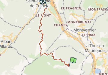
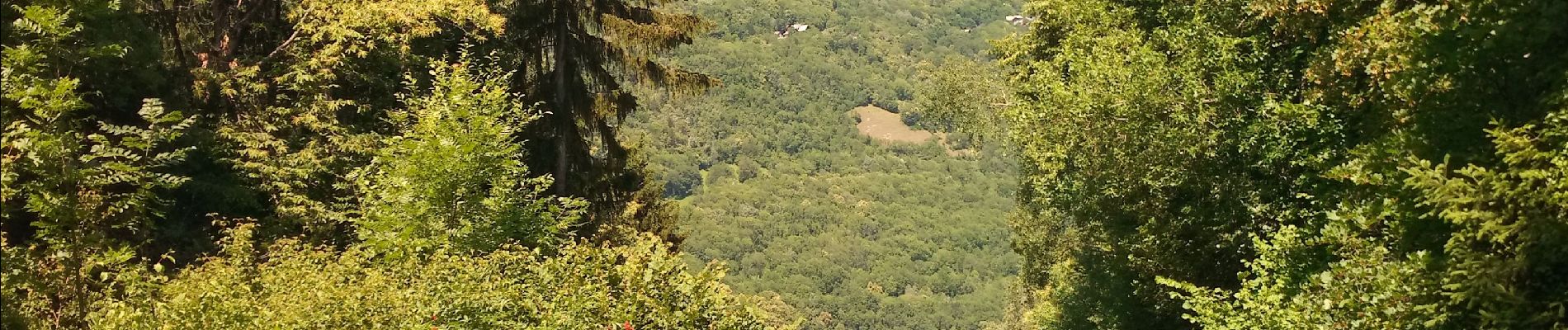
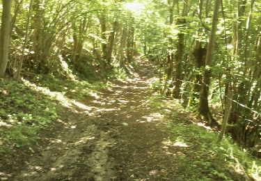
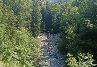
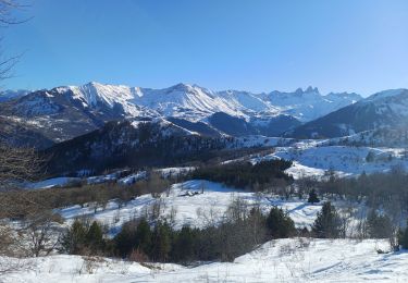
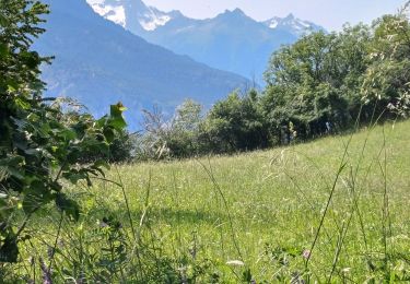
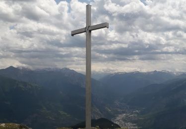
Trail Walking of 11.6 km to be discovered at Auvergne-Rhône-Alpes, Savoy, Jarrier. This trail is proposed by jibebouvier.
Description
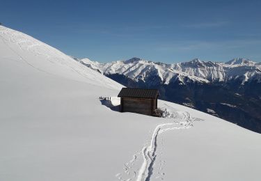
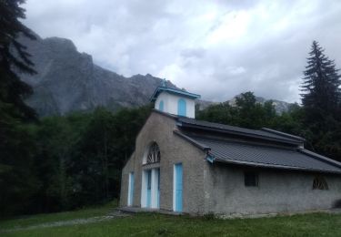
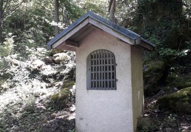
parti du chalet forestier de l'Oullaz au dessus de Jarier, arrivée à l'église de Ste Mary de Cuines, attente au petit bar juste derrière ouvert le dimanche ;-)
montée facile, pour la descente, le chemin est très mal tracé sur le haut, après c'est mieux, y a même pas mal de traces de VTT
Positioning
Comments
Trails nearby
![Trail Mountain bike La Tour-en-Maurienne - Le châtel-Le Chaussy-Le Melezet - Photo](https://media.geolcdn.com/t/375/260/ext.jpg?maxdim=2&url=https%3A%2F%2Fservices.sitytrail.com%2FGeolivesWS%2FDownloadMedia.ashx%3FTrailID%3D204099%26Media%3Dfix__20130711114109.jpg)
![Mountain bike Mountain bike](https://static1.geolcdn.com/sitytour/trail-icons/202.png)
Mountain bike
![](/images/other/stat-length.png)
![](https://static1.geolcdn.com/siteimages/upload/files/16400158638029165_repeat_loop_refresh_sync_direction_icon.png)
![Trail Walking Jarrier - le grand Chatelard - Photo](https://media.geolcdn.com/t/375/260/ext.jpg?maxdim=2&url=https%3A%2F%2Fservices.sitytrail.com%2FGeolivesWS%2FDownloadMedia.ashx%3FTrailID%3D142418%26Media%3D20120730134347.jpg)
![Walking Walking](https://static1.geolcdn.com/sitytour/trail-icons/101.png)
Walking
![](/images/other/stat-length.png)
![](https://static1.geolcdn.com/siteimages/upload/files/16400158638029165_repeat_loop_refresh_sync_direction_icon.png)
![Trail Road bike Saint-Alban-des-Villards - col du Glandon et de la croix de fer en boucle - Photo](https://media.geolcdn.com/t/375/260/490b9fa3-96b7-42bd-8ddb-4092c9cd4940.jpg&format=jpg&maxdim=2)
![Road bike Road bike](https://static1.geolcdn.com/sitytour/trail-icons/201.png)
Road bike
![](/images/other/stat-length.png)
![](https://static1.geolcdn.com/siteimages/upload/files/16400158638029165_repeat_loop_refresh_sync_direction_icon.png)
![Trail Snowshoes Fontcouverte-la-Toussuire - la Toussuire - cret Morandet -le grand Truc - Photo](https://media.geolcdn.com/t/375/260/fee9ac41-4d71-474f-9f58-d2d69fce61ea.jpg&format=jpg&maxdim=2)
![Snowshoes Snowshoes](https://static1.geolcdn.com/sitytour/trail-icons/504.png)
Snowshoes
![](/images/other/stat-length.png)
![](https://static1.geolcdn.com/siteimages/upload/files/16400158638029165_repeat_loop_refresh_sync_direction_icon.png)
![Trail Snowshoes Saint-Pancrace - les Bottieres - La Cochette - la Verpilliere Les Chenaviers - Photo](https://media.geolcdn.com/t/375/260/840632dc-15ea-423f-8ff5-5b7618383fc5.jpg&format=jpg&maxdim=2)
![Snowshoes Snowshoes](https://static1.geolcdn.com/sitytour/trail-icons/504.png)
Snowshoes
![](/images/other/stat-length.png)
![](https://static1.geolcdn.com/siteimages/upload/files/16400158638029165_repeat_loop_refresh_sync_direction_icon.png)
![Trail Walking La Tour-en-Maurienne - Le Golet - Montandre- chapelle de Grenis - Photo](https://media.geolcdn.com/t/375/260/13d19fed-b851-4a24-9e73-845cc4a770c1.jpg&format=jpg&maxdim=2)
![Walking Walking](https://static1.geolcdn.com/sitytour/trail-icons/101.png)
Walking
![](/images/other/stat-length.png)
![](https://static1.geolcdn.com/siteimages/upload/files/16400158638029165_repeat_loop_refresh_sync_direction_icon.png)
![Trail Road bike Saint-Jean-de-Maurienne - Chaburtan - Photo](https://media.geolcdn.com/t/375/260/28be9886-2421-4baa-a81c-d04bd93a111b.jpg&format=jpg&maxdim=2)
![Road bike Road bike](https://static1.geolcdn.com/sitytour/trail-icons/201.png)
Road bike
![](/images/other/stat-length.png)
![](https://static1.geolcdn.com/siteimages/upload/files/16400158638029165_repeat_loop_refresh_sync_direction_icon.png)
![Trail Walking Jarrier - le chatelard - Photo](https://media.geolcdn.com/t/375/260/11a621b5-b417-489a-865d-4c04bd727237.jpg&format=jpg&maxdim=2)
![Walking Walking](https://static1.geolcdn.com/sitytour/trail-icons/101.png)
Walking
![](/images/other/stat-length.png)
![](https://static1.geolcdn.com/siteimages/upload/files/16400158638029165_repeat_loop_refresh_sync_direction_icon.png)
![Trail Walking La Tour-en-Maurienne - Hermillon- les Grangettes - Montandre - Photo](https://media.geolcdn.com/t/375/260/96fe224a-99bc-4775-b878-ef73fe49e55e.jpg&format=jpg&maxdim=2)
![Walking Walking](https://static1.geolcdn.com/sitytour/trail-icons/101.png)
Walking
![](/images/other/stat-length.png)
![](https://static1.geolcdn.com/siteimages/upload/files/16400158638029165_repeat_loop_refresh_sync_direction_icon.png)