


13.6 km | 21 km-effort


User


FREE GPS app for hiking
 SityTrail
IGN / Geographical institutes
SityTrail World
The world is yours!
Trail Walking of 15.4 km to be discovered at Occitania, Gard, Les Plantiers. This trail is proposed by dansmabulle.
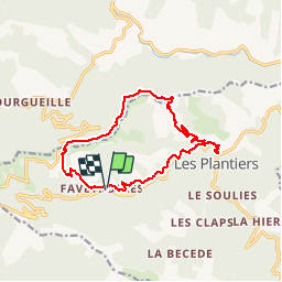
FAVEYROLLES - COL DE L ESPINAS
15.2Km - 04:30
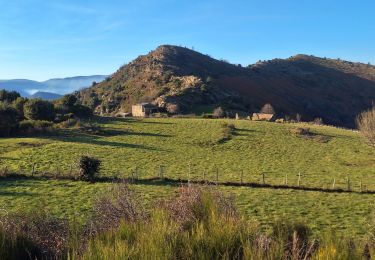
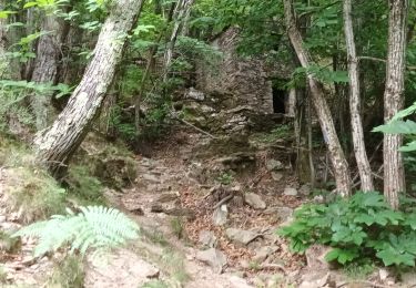
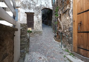
Départ randonnée : Faveyrolles ou Les Plantiers (Gard 30) Parcours créé par OT de la vallée Borgne en Cévennes mais que j'ai réalisé au départ des Plantiers.Départ à midi avec arrêt pique-nique aux Plantiers à l'aire de jeux pour enfants.Des Plantiers, montée vers les ruines de St Marcel de Fontfouillouse ( la visite s'impose ) puis montée progressive et passages en crête au col de l'Espinas. Descente assez sportive et glissante vers Faveyrolle en passant par les ruines de Recoule. Belles cascades après la pluie...ce fut mon cas. Comptez 4h sans les arrêts et de bonnes chaussures...! Bonne randonnée

Walking

Walking

Walking

Walking
Walking

Walking
Walking
Walking