


11 km | 13.1 km-effort


User


FREE GPS app for hiking
 SityTrail
IGN / Geographical institutes
SityTrail World
The world is yours!
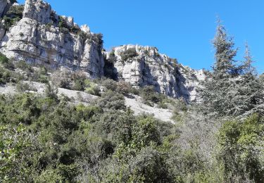
Trail Walking of 2.7 km to be discovered at Occitania, Gard, Corconne. This trail is proposed by dansmabulle.
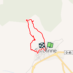
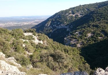
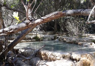
CORCONNE - PONT DU HASARD
2.7Km01h30
Départ randonnée : Parking de la mairie de Corconne (Gard 30) 3kms-1h30 Corconne GardCorconne :Pont du Hasard-ChapelleMontée impressionnante un peu difficile ,ou il faut s'aider des mains pour grimper (à éviter par temps de pluie et à déconseiller aux jeunes enfants),vers "Le Pont du Hasard",arche naturelle reliant 2 falaises .Après le passage du "Pont",cap vers "La Chapelle" .Jolis points de vue à découvrir sur le village et la plaine .Descente vers Corconne et le parking .Bonne randonnée

Walking
On foot
Walking

Walking
Walking
Walking