Trail Walking Aumessas - AUMESSAS - COL MOUZOULES - 13.8Km - 04h30 - Dénivelé 500 m - Photo

AUMESSAS - COL MOUZOULES - 13.8Km - 04h30 - Dénivelé 500 m

© OpenStreetMap contributors
Length
Length
14.1 km
Max alt
Max alt
960 m
Uphill gradient
Uphill gradient
769 m
Km-Effort
Km-Effort  
24 km
Min alt
Min alt
431 m
Downhill gradient
Downhill gradient
770 m
Boucle
Boucle
Yes
Creation date :
2014-12-10 00:00:00.0
Updated on :
2014-12-10 00:00:00.0

(1 Reviews)

Walking
Walking
5h02
Difficulty : Medium

Scan this QR Code to open this trail in the SityTrail application

FREE GPS app for hiking

Logo SityTrail SityTrail

IGN / Geographical institutes

Download SityTrail from the App Store Download SityTrail from Google Play

Logo SityTrail SityTrail World

The world is yours!

Download SityTrail from the App Store Download SityTrail from Google Play Download SityTrail on Huawei AppGallery

About

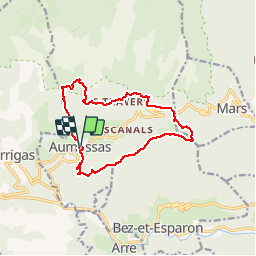
Trail Walking of 14.1 km to be discovered at Occitania, Gard, Aumessas. This trail is proposed by dansmabulle.

Description

AUMESSAS - COL MOUZOULES
13.8Km - 04h30
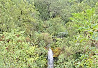
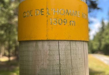
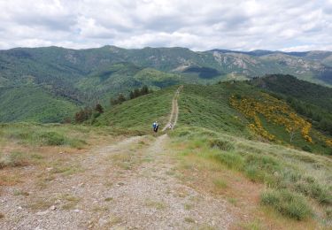
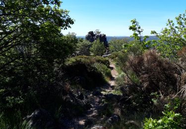
Départ randonnée : Village d'Aumessas ( Gard 30 ) A partir de la place de l'ancienne gare suivre col de mouzoulès.Traverser le village pittoresque.Au débouché sur la route qui traverse le village descendre vers la gauche jusqu'à un virage où se trouve un panneau Les cascades. Suivre cette direction et ensuite au lieu de partir sur Vernes sur la gauche prendre à droite vers les Vernèdes, le travers, col des portes et col de mouzoulès.Au col traverser la route et prendre la piste forestière en face (voir les menhirs au passage). Monter cette piste et au lieu indiqué La Fageole sur la carte prendre la piste à droite vers la ligne de crête que l'on suit jusqu'au Rocher du comte.Là on récupère le tracé d'un PR et au descend vers la droite en suivant ce tracé pour arriver au dessus du tunnel de l'ancienne voie ferrée et on prend vers le viaduc et retour sur le village.Bonne randonnée 

Elevation profile

Positioning

Country:
France
Region :
Occitania
Department/Province :
Gard
Municipality :
Aumessas
Location:
Unknown
Start:(UTM)
540410 ; 4870995 (31T) N.

Comments

Please log in to post a review or rate the element


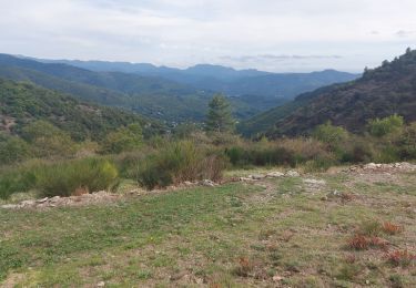
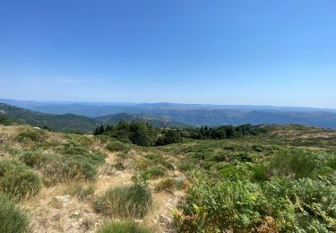
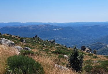
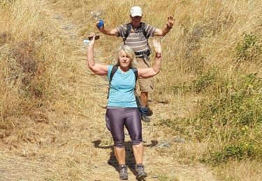
Superbe circuit. Chapelle, menhir, vues panoramiques


Trails nearby

Trail Walking Arre - Vallée de l'Arre - Photo
Walking
GUIDE
nadinebondoux

Walking

Medium
Arre, Occitania, Gard, France
17.7 km | 25 km-effort
5h 57min
Yes
Trail Walking Arrigas - Col de l’Homme mort  le Saint Guiral - Photo
Walking
boudpn

Walking

Difficult
Arrigas, Occitania, Gard, France
9.9 km | 13 km-effort
4h 11min
Yes
Trail Walking Alzon - vers le St guiral puis le rocher de l'aigle - Photo
Walking
labarone

Walking

Difficult
Alzon, Occitania, Gard, France
17.7 km | 29 km-effort
6h 51min
Yes
Trail Walking Aumessas - Aumessas-27-05-21 - Photo
Walking
Christiancordin

Walking

Medium
Aumessas, Occitania, Gard, France
11.8 km | 20 km-effort
4h 51min
Yes
Trail Walking Arrigas - de Arrigas au Mont saint Guiral - Photo
Walking
labarone

Walking

Medium
Arrigas, Occitania, Gard, France
22 km | 35 km-effort
5h 35min
Yes
Trail Walking Alzon - Alzon-Cazebonne - Photo
Walking
JEANJOSY

Walking

Easy
Alzon, Occitania, Gard, France
10.7 km | 16.3 km-effort
3h 54min
Yes
Trail Walking Alzon - Alzon-Cazebonne - Photo
Walking
JEANJOSY

Walking

Easy
Alzon, Occitania, Gard, France
10.7 km | 16.3 km-effort
3h 54min
Yes
Trail Mountain bike Bez-et-Esparon - Fait GTMC 2022 E7 Combe Redonde - Photo
Mountain bike
jl77130

Mountain bike

Medium
Bez-et-Esparon, Occitania, Gard, France
62 km | 80 km-effort
5h 46min
No
Trail Walking Arrigas - aumassas en vrai - Photo
Walking
CASSISFRAMBOISE

Walking

Difficult
Arrigas, Occitania, Gard, France
21 km | 34 km-effort
8h 9min
Yes


Close
My subscriptions