


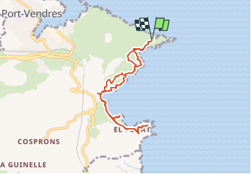


14.5 km | 19.1 km-effort


User


FREE GPS app for hiking
 SityTrail
IGN / Geographical institutes
SityTrail World
The world is yours!
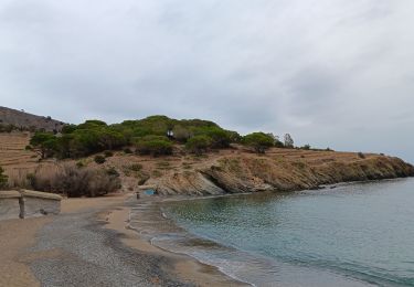
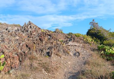
Trail On foot of 8.2 km to be discovered at Occitania, Pyrénées-Orientales, Port-Vendres. This trail is proposed by Marc Auger.

Walking

Walking

Walking

Walking

Walking

Walking
Walking
Walking

Walking