![](/images/other/stat-length.png)
![Trail Walking Arâches-la-Frasse - boucle les Carroz, la forêt d'Araches, Cretoral, retour par la pierre a Laya - Photo](https://media.geolcdn.com/t/1900/400/1f8b8676-81d1-4387-920a-d53a196e6ca7.jpg&format=pjpeg&maxdim=2)
boucle les Carroz, la forêt d'Araches, Cretoral, retour par la pierre a Laya
reneperrin
User
![Length](/images/other/stat-length.png)
Length
13.3 km
![Max alt](https://static1.geolcdn.com/siteimages/upload/files/1508320355ic_sort_altitude_max_24dp.png)
Max alt
1432 m
![Uphill gradient](https://static1.geolcdn.com/siteimages/upload/files/1508320355ic_sort_den_pos_24dp.png)
Uphill gradient
656 m
![Km-Effort](/images/other/stat-length.png)
Km-Effort
22 km
![Min alt](https://static1.geolcdn.com/siteimages/upload/files/1508320355ic_sort_altitude_min_24dp.png)
Min alt
894 m
![Downhill gradient](https://static1.geolcdn.com/siteimages/upload/files/1508320355ic_sort_den_neg_24dp.png)
Downhill gradient
663 m
![Boucle](https://static1.geolcdn.com/siteimages/upload/files/16400158638029165_repeat_loop_refresh_sync_direction_icon.png)
Boucle
Yes
Creation date :
2020-06-16 06:37:19.877
Updated on :
2020-06-16 13:46:56.146
![Walking](https://static1.geolcdn.com/sitytour/trail-icons/101.png)
4h14
Difficulty : Medium
![Scan this QR Code to open this trail in the SityTrail application](https://capi.geolives.com/qq0zvz2zws4bq2lad0pu/sitytour/trails/2438679/qr.png?size=200)
FREE GPS app for hiking
About
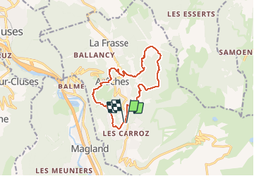
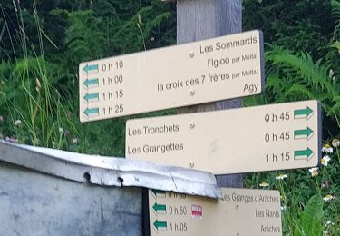
Trail Walking of 13.3 km to be discovered at Auvergne-Rhône-Alpes, Upper Savoy, Arâches-la-Frasse. This trail is proposed by reneperrin.
Description
boucle de randonnée majoritairement en forêt sur les hauteurs d'Araches
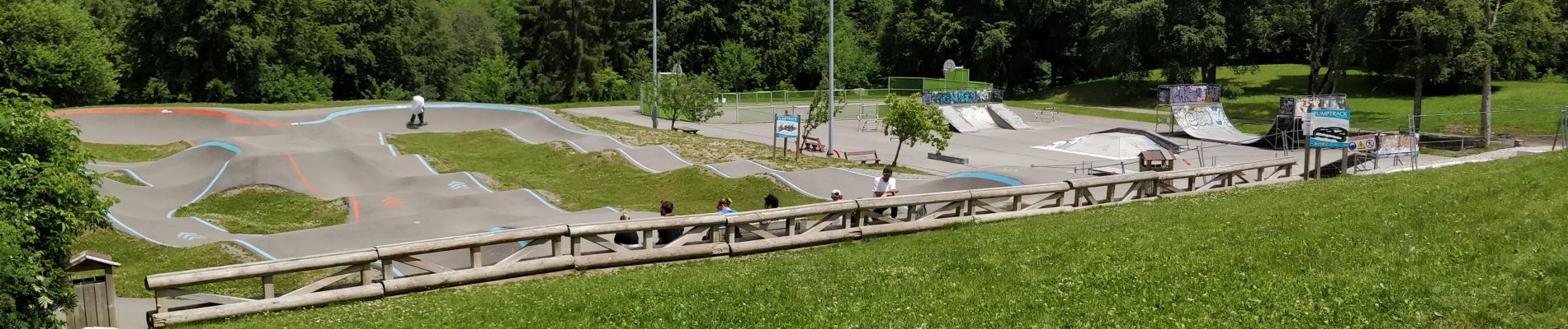
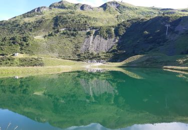
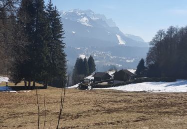
Positioning
Country:
France
Region :
Auvergne-Rhône-Alpes
Department/Province :
Upper Savoy
Municipality :
Arâches-la-Frasse
Location:
Unknown
Start:(Dec)
Start:(UTM)
317259 ; 5099998 (32T) N.
Comments
Trails nearby
![Trail Walking Magland - belvédère d Aulp - Photo](https://media.geolcdn.com/t/375/260/3d7c42d4-f0a9-4769-9285-e47bef46b3ca.jpg&format=jpg&maxdim=2)
![Walking Walking](https://static1.geolcdn.com/sitytour/trail-icons/101.png)
belvédère d Aulp
Walking
Difficult
Magland,
Auvergne-Rhône-Alpes,
Upper Savoy,
France
![](/images/other/stat-length.png)
7.7 km | 14.1 km-effort
4h 2min
![](https://static1.geolcdn.com/siteimages/upload/files/16400158638029165_repeat_loop_refresh_sync_direction_icon.png)
Yes
![Trail Walking Samoëns - plateau des saix . la corne . les biollaires . pointe de cupoire . plateau des saix - Photo](https://media.geolcdn.com/t/375/260/9a31bcfb-eada-4e13-9da7-575e6de96d67.jpg&format=jpg&maxdim=2)
![Walking Walking](https://static1.geolcdn.com/sitytour/trail-icons/101.png)
plateau des saix . la corne . les biollaires . pointe de cupoire . plateau d...
Walking
Medium
Samoëns,
Auvergne-Rhône-Alpes,
Upper Savoy,
France
![](/images/other/stat-length.png)
8.5 km | 15.1 km-effort
3h 54min
![](https://static1.geolcdn.com/siteimages/upload/files/16400158638029165_repeat_loop_refresh_sync_direction_icon.png)
Yes
![Trail Walking Cluses - 08-03-2022 Pointe du Chevran - Photo](https://media.geolcdn.com/t/375/260/6d233612-2dc0-46da-be71-d5cc509b15b1.jpg&format=jpg&maxdim=2)
![Walking Walking](https://static1.geolcdn.com/sitytour/trail-icons/101.png)
08-03-2022 Pointe du Chevran
Walking
Easy
Cluses,
Auvergne-Rhône-Alpes,
Upper Savoy,
France
![](/images/other/stat-length.png)
15.1 km | 26 km-effort
4h 24min
![](https://static1.geolcdn.com/siteimages/upload/files/16400158638029165_repeat_loop_refresh_sync_direction_icon.png)
Yes
![Trail Walking Arâches-la-Frasse - Les Tronchets - Photo](https://media.geolcdn.com/t/375/260/1b22eca5-4d03-4493-9ac5-2c90d211f1bc.jpg&format=jpg&maxdim=2)
![Walking Walking](https://static1.geolcdn.com/sitytour/trail-icons/101.png)
Les Tronchets
Walking
Easy
Arâches-la-Frasse,
Auvergne-Rhône-Alpes,
Upper Savoy,
France
![](/images/other/stat-length.png)
7.4 km | 13.7 km-effort
2h 8min
![](https://static1.geolcdn.com/siteimages/upload/files/16400158638029165_repeat_loop_refresh_sync_direction_icon.png)
Yes
![Trail Walking Arâches-la-Frasse - Vernant Grands Vans par le col de Véret - Photo](https://media.geolcdn.com/t/375/260/06ee9b71-5751-4664-80a4-c98989797b70.jpg&format=jpg&maxdim=2)
![Walking Walking](https://static1.geolcdn.com/sitytour/trail-icons/101.png)
Vernant Grands Vans par le col de Véret
Walking
Easy
Arâches-la-Frasse,
Auvergne-Rhône-Alpes,
Upper Savoy,
France
![](/images/other/stat-length.png)
7.4 km | 13.4 km-effort
2h 15min
![](https://static1.geolcdn.com/siteimages/upload/files/16400158638029165_repeat_loop_refresh_sync_direction_icon.png)
Yes
![Trail Walking Arâches-la-Frasse - Les Carroz l'Arbaron en boucle - Photo](https://media.geolcdn.com/t/375/260/360e8a6b-b503-4616-ba4d-4d21ae7c55c0.jpg&format=jpg&maxdim=2)
![Walking Walking](https://static1.geolcdn.com/sitytour/trail-icons/101.png)
Les Carroz l'Arbaron en boucle
Walking
Difficult
Arâches-la-Frasse,
Auvergne-Rhône-Alpes,
Upper Savoy,
France
![](/images/other/stat-length.png)
20 km | 33 km-effort
6h 5min
![](https://static1.geolcdn.com/siteimages/upload/files/16400158638029165_repeat_loop_refresh_sync_direction_icon.png)
Yes
![Trail Walking Arâches-la-Frasse - les Carroz, tête de Saix boucle - Photo](https://media.geolcdn.com/t/375/260/fc10eab2-e7d0-43c5-ba5e-76349cca3bdc.jpg&format=jpg&maxdim=2)
![Walking Walking](https://static1.geolcdn.com/sitytour/trail-icons/101.png)
les Carroz, tête de Saix boucle
Walking
Medium
Arâches-la-Frasse,
Auvergne-Rhône-Alpes,
Upper Savoy,
France
![](/images/other/stat-length.png)
14.1 km | 27 km-effort
4h 8min
![](https://static1.geolcdn.com/siteimages/upload/files/16400158638029165_repeat_loop_refresh_sync_direction_icon.png)
Yes
![Trail Walking Arâches-la-Frasse - Mont Jovy pierre à Laya - Photo](https://media.geolcdn.com/t/375/260/f39bd061-a8cf-4891-84d8-c02820fed170.jpg&format=jpg&maxdim=2)
![Walking Walking](https://static1.geolcdn.com/sitytour/trail-icons/101.png)
Mont Jovy pierre à Laya
Walking
Very easy
Arâches-la-Frasse,
Auvergne-Rhône-Alpes,
Upper Savoy,
France
![](/images/other/stat-length.png)
5.2 km | 7.1 km-effort
1h 26min
![](https://static1.geolcdn.com/siteimages/upload/files/16400158638029165_repeat_loop_refresh_sync_direction_icon.png)
Yes
![Trail Walking Arâches-la-Frasse - randonnée en forêt, les Carroz, Araches, la Frasse - Photo](https://media.geolcdn.com/t/375/260/266ab88b-3ecc-4762-b4ff-c648b0c4392c.jpg&format=jpg&maxdim=2)
![Walking Walking](https://static1.geolcdn.com/sitytour/trail-icons/101.png)
randonnée en forêt, les Carroz, Araches, la Frasse
Walking
Easy
Arâches-la-Frasse,
Auvergne-Rhône-Alpes,
Upper Savoy,
France
![](/images/other/stat-length.png)
14 km | 23 km-effort
5h 0min
![](https://static1.geolcdn.com/siteimages/upload/files/16400158638029165_repeat_loop_refresh_sync_direction_icon.png)
Yes