Trail Walking La Calmette - La Calmette - Nîmes Avenue Pompidou - Photo

La Calmette - Nîmes Avenue Pompidou

 jll7513
jll7513

User

© OpenStreetMap contributors
Length
Length
16.9 km
Max alt
Max alt
179 m
Uphill gradient
Uphill gradient
177 m
Km-Effort
Km-Effort  
19.4 km
Min alt
Min alt
55 m
Downhill gradient
Downhill gradient
201 m
Boucle
Boucle
No
Creation date :
2020-06-12 15:30:17.537
Updated on :
2020-06-12 16:36:10.953

(0 Reviews)

Walking
Walking
4h03
Difficulty : Difficult

Scan this QR Code to open this trail in the SityTrail application

FREE GPS app for hiking

Logo SityTrail SityTrail

IGN / Geographical institutes

Download SityTrail from the App Store Download SityTrail from Google Play

Logo SityTrail SityTrail World

The world is yours!

Download SityTrail from the App Store Download SityTrail from Google Play Download SityTrail on Huawei AppGallery

About

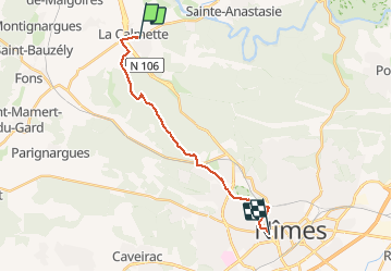
Trail Walking of 16.9 km to be discovered at Occitania, Gard, La Calmette. This trail is proposed by jll7513.

Description

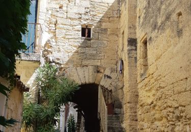
Belle randonnée sans difficulté et pratique car le départ est accessible par le bus 61, arrêt Valfond à La Calmette. Le GR est à quelques mètres de l'arrêt de bus. En cas de chaleur, prévoir de l'eau en suffisance car il n'y en a pas avant le Bois des Espeisses.
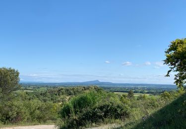
J'abandonne le GR sur la route d'Alès mais ceux qui veulent une arrivée à la Tour Magne et aux Jardins Lafontaine n'auront qu'à poursuivre quelques kilomètres sans se décourager par la montée du tire-cul.

Elevation profile

Positioning

Country:
France
Region :
Occitania
Department/Province :
Gard
Municipality :
La Calmette
Location:
Unknown
Start:(UTM)
601525 ; 4864350 (31T) N.

Trails nearby

Trail On foot Sainte-Anastasie - Les gorges du Gardon - Photo
On foot
GUIDE+

On foot

Easy
Sainte-Anastasie, Occitania, Gard, France
5 km | 6.6 km-effort
1h 29min
No
Trail Walking Sainte-Anastasie - 30 russan - Photo
Walking
GUIDE
randodyssée

Walking

Medium
Sainte-Anastasie, Occitania, Gard, France
15.9 km | 22 km-effort
6h 8min
Yes
Trail Walking Sainte-Anastasie - Russan pont Saint-Nicolas - Photo
Walking
boulesteix

Walking

Medium
Sainte-Anastasie, Occitania, Gard, France
12.2 km | 15.9 km-effort
3h 14min
Yes
Trail Walking Gajan - Rando1 - Photo
Walking
selleck

Walking

Medium
(1)
Gajan, Occitania, Gard, France
10 km | 12.2 km-effort
2h 0min
Yes
Trail Walking Gajan - Plan Rougé2 - Photo
Walking
selleck

Walking

Easy
(1)
Gajan, Occitania, Gard, France
10.9 km | 13.4 km-effort
2h 53min
Yes
Trail Walking Gajan - Mas des Crottes - Photo
Walking
selleck

Walking

Easy
(1)
Gajan, Occitania, Gard, France
13.1 km | 15.7 km-effort
3h 34min
Yes
Trail Walking Gajan - La Rouveyrolle 2 - Photo
Walking
selleck

Walking

Medium
(1)
Gajan, Occitania, Gard, France
12.5 km | 15.2 km-effort
2h 37min
Yes
Trail Walking Gajan - GAJAN / FONS / ST MAMERT / GAJAN - Photo
Walking
jll7513

Walking

Medium
Gajan, Occitania, Gard, France
9.9 km | 11.6 km-effort
2h 36min
Yes
Trail Walking Sainte-Anastasie - Russan plateau St Nicolas et gouffre des Espelugues  - Photo
Walking
GUIDE
nadinebondoux

Walking

Difficult
Sainte-Anastasie, Occitania, Gard, France
20 km | 27 km-effort
6h 4min
Yes


Close
My subscriptions