


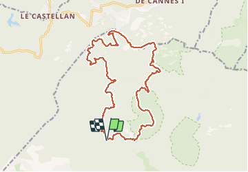


17.7 km | 25 km-effort

User


FREE GPS app for hiking
 SityTrail
IGN / Geographical institutes
SityTrail World
The world is yours!
Trail Walking of 20 km to be discovered at Provence-Alpes-Côte d'Azur, Var, Saint-Raphaël. This trail is proposed by ETMU5496.
Jolie randonnée au coeur du massif de l'Esterel et de la réserve Biologique.
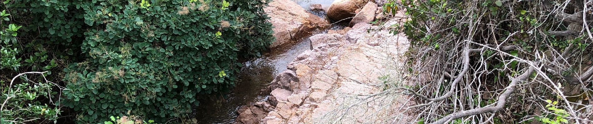
En juin, les nénuphars sont très colorés sur ces petits lacs


Walking

Walking

Walking

Walking

Walking

Mountain bike

Walking

Walking

Walking