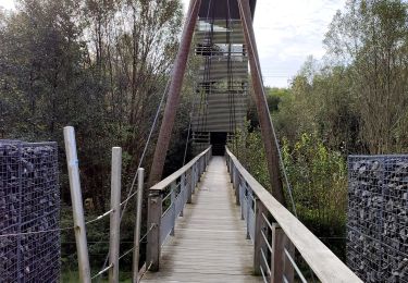
10.7 km | 13.1 km-effort
habay
Airelle
User
Length
24 km
Max alt
525 m
Uphill gradient
516 m
Km-Effort
31 km
Min alt
394 m
Downhill gradient
514 m
Boucle
Yes
Creation date :
2020-06-06 18:18:35.154
Updated on :
2020-06-06 18:21:22.607
6h28
Difficulty : Very difficult
FREE GPS app for hiking
About
Trail Walking of 24 km to be discovered at Wallonia, Luxembourg, Martelange. This trail is proposed by Airelle.
Positioning
Country:
Belgium
Region :
Wallonia
Department/Province :
Luxembourg
Municipality :
Martelange
Location:
Martelange
Start:(Dec)
Start:(UTM)
693919 ; 5519339 (31U) N.
Comments
Trails nearby
RF-Lu-08_Château-du-Pont-d'Oye
Walking
Medium
(2)
Martelange,
Wallonia,
Luxembourg,
Belgium
13.2 km | 16.1 km-effort
3h 27min
Yes
Promenade des souvenirs en passant par la passerelle des oiseaux
Walking
Easy
Martelange,
Wallonia,
Luxembourg,
Belgium
4.6 km | 5.7 km-effort
1h 17min
Yes
RB-PN-05B-QR1-20km3_2022-01-04
Walking
Very difficult
(1)
Martelange,
Wallonia,
Luxembourg,
Belgium
22 km | 29 km-effort
6h 31min
Yes
Vlessart
Walking
Easy
(4)
Martelange,
Wallonia,
Luxembourg,
Belgium
12.5 km | 15.3 km-effort
2h 28min
Yes
Vlessart 8km
Walking
Very easy
(1)
Léglise,
Wallonia,
Luxembourg,
Belgium
8.9 km | 10.9 km-effort
1h 30min
Yes
entre Fauvillers et Louftemont
Walking
Medium
(3)
Martelange,
Wallonia,
Luxembourg,
Belgium
8.1 km | 10.3 km-effort
2h 7min
Yes
Foret Anlier 8kms(Ripé Sart)
Walking
Medium
(4)
Martelange,
Wallonia,
Luxembourg,
Belgium
7.9 km | 9.7 km-effort
Unknown
Yes
Vlessart - forêt Anlier -17 kms
Walking
Medium
(2)
Léglise,
Wallonia,
Luxembourg,
Belgium
17.1 km | 21 km-effort
Unknown
Yes
Très belle Rando 100% forestière