Trail Walking Saint-Raphaël - Les grues et le pic de l'ours depuis la gare du Trayas - Photo

Les grues et le pic de l'ours depuis la gare du Trayas

 ETMU5496
ETMU5496

User

© OpenStreetMap contributors
Length
Length
15.8 km
Max alt
Max alt
491 m
Uphill gradient
Uphill gradient
870 m
Km-Effort
Km-Effort  
27 km
Min alt
Min alt
28 m
Downhill gradient
Downhill gradient
870 m
Boucle
Boucle
Yes
Creation date :
2020-06-06 06:00:32.0
Updated on :
2020-06-07 10:50:45.141

(0 Reviews)

Walking
Walking
3h57
Difficulty : Difficult

Scan this QR Code to open this trail in the SityTrail application

FREE GPS app for hiking

Logo SityTrail SityTrail

IGN / Geographical institutes

Download SityTrail from the App Store Download SityTrail from Google Play

Logo SityTrail SityTrail World

The world is yours!

Download SityTrail from the App Store Download SityTrail from Google Play Download SityTrail on Huawei AppGallery

About

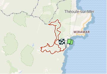
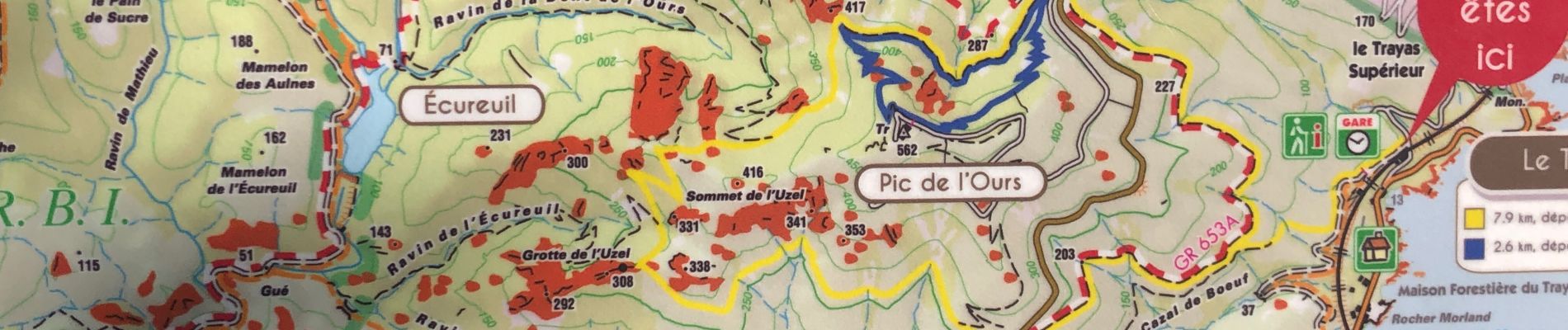
Trail Walking of 15.8 km to be discovered at Provence-Alpes-Côte d'Azur, Var, Saint-Raphaël. This trail is proposed by ETMU5496.

Description

Départ gare du Trayas. Monter au col Notre Dame.
Emprunter la piste DFCI jusqu'au col du Trayas puis col de Cadière.
Ascension Grosse puis petite grue et crête du Trayas.
Redescendre col Notre Dame et ascension Pic de l'Ours par voie directe.
Redescendre au col des Lentisques via la dent de l'Ours et l'Uzel.
Puis poursuivre la descente pour rejoindre la gare du Trayas en contrebas.

Elevation profile

Photos

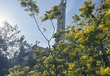
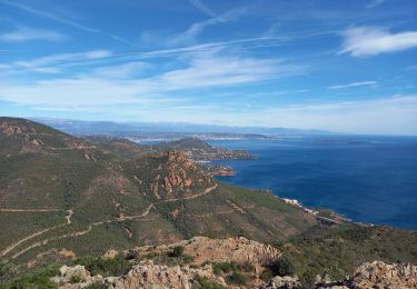
24 photos in total. Please click on a photo to see them all in the gallery.

Positioning

Country:
France
Region :
Provence-Alpes-Côte d'Azur
Department/Province :
Var
Municipality :
Saint-Raphaël
Location:
Unknown
Start:(UTM)
332144 ; 4815660 (32T) N.

Trails nearby

Trail Walking Saint-Raphaël - Massif d'ésterel-grande boucle pic cap roux - Photo
Walking
jeromelacoste

Walking

Medium
(2)
Saint-Raphaël, Provence-Alpes-Côte d'Azur, Var, France
10.4 km | 17.5 km-effort
2h 58min
Yes
Trail Walking Saint-Raphaël - Le tour du Pic du Cap Roux - St Raphaël (Agay) - Photo
Walking
tracegps

Walking

Medium
(2)
Saint-Raphaël, Provence-Alpes-Côte d'Azur, Var, France
7.2 km | 12.8 km-effort
2h 0min
Yes
Trail Walking Saint-Raphaël - Pic du Cap Roux - Photo
Walking
Kilroy06

Walking

Very easy
(4)
Saint-Raphaël, Provence-Alpes-Côte d'Azur, Var, France
4.1 km | 7.8 km-effort
1h 17min
Yes
Trail Walking Saint-Raphaël - SityTrail - ND - Aiguille  - Photo
Walking
GUIDE
jouans

Walking

Very difficult
(1)
Saint-Raphaël, Provence-Alpes-Côte d'Azur, Var, France
18.1 km | 29 km-effort
6h 40min
Yes
Trail Walking Saint-Raphaël - Agay - Sainte-Barbe - Étang des Nénuphares - Photo
Walking
E.BURCK

Walking

Easy
(2)
Saint-Raphaël, Provence-Alpes-Côte d'Azur, Var, France
5 km | 6.2 km-effort
2h 8min
Yes
Trail Walking Saint-Raphaël - Tour du Pic de l'Ours - Le Trayas - Photo
Walking
tracegps

Walking

Medium
(1)
Saint-Raphaël, Provence-Alpes-Côte d'Azur, Var, France
9.5 km | 16 km-effort
3h 0min
Yes
Trail Walking Saint-Raphaël - Esterel Trace réelle - Photo
Walking
GUIDE
jouans

Walking

Very difficult
Saint-Raphaël, Provence-Alpes-Côte d'Azur, Var, France
21 km | 32 km-effort
7h 11min
Yes
Trail Walking Saint-Raphaël - Pic du Cap Roux 1.10.22 - Photo
Walking
GUIDE
fredetpascale

Walking

Easy
Saint-Raphaël, Provence-Alpes-Côte d'Azur, Var, France
8.3 km | 0 m-effort
3h 20min
Yes
Trail Walking Saint-Raphaël - Circuit Esterel Rocher St Barthelemy, Chapelle et Cap Roux - Photo
Walking
GrouGary

Walking

Very easy
(1)
Saint-Raphaël, Provence-Alpes-Côte d'Azur, Var, France
11.4 km | 19.8 km-effort
3h 51min
Yes


Close
My subscriptions