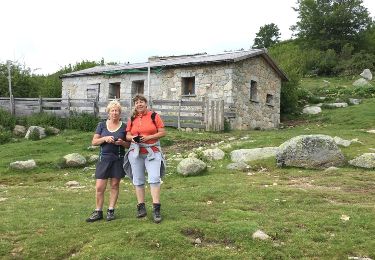
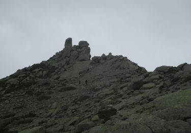
Trail Walking Serra-di-Scopamène - Le plateau du Cuscione et le Mont Incudine - Photo

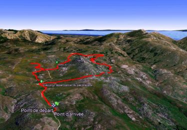
Le plateau du Cuscione et le Mont Incudine

© OpenStreetMap contributors
Length
Length
17.6 km
Max alt
Max alt
2105 m
Uphill gradient
Uphill gradient
768 m
Km-Effort
Km-Effort  
28 km
Min alt
Min alt
1519 m
Downhill gradient
Downhill gradient
772 m
Boucle
Boucle
Yes
Creation date :
2014-12-10 00:00:00.0
Updated on :
2014-12-10 00:00:00.0

(2 Reviews)

Walking
Walking
5h41
Difficulty : Medium

Scan this QR Code to open this trail in the SityTrail application

FREE GPS app for hiking

Logo SityTrail SityTrail

IGN / Geographical institutes

Download SityTrail from the App Store Download SityTrail from Google Play

Logo SityTrail SityTrail World

The world is yours!

Download SityTrail from the App Store Download SityTrail from Google Play Download SityTrail on Huawei AppGallery

About

Trail Walking of 17.6 km to be discovered at Corsica, South Corsica, Serra-di-Scopamène. This trail is proposed by CorsicaNatura.

Description

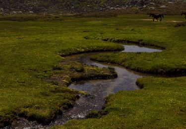
Exceptionnel ! Que dire de plus ? C’est ici que vous verrez les fameux « Pozzine » évoqués plus haut. Quel endroit étrange, ne ressemblant à aucun autre, on se croirait ici sur une autre planète ! Un tapis de mousse où se mêlent somptueusement trous d’eau (« Pozzi »), fleurs rarissimes et animaux sauvages…
Le Mont Incudune, c’est une excursion qui présente deux atouts majeurs : on découvre une vue panoramique au sommet qui est également un des plus beaux points de passage du G.R. 20.

Elevation profile

Positioning

Country:
France
Region :
Corsica
Department/Province :
South Corsica
Municipality :
Serra-di-Scopamène
Location:
Unknown
Start:(UTM)
511796 ; 4630201 (32T) N.

Comments

Please log in to post a review or rate the element


très belle balade à faire


attention trace changeante.


Trails nearby

Trail Walking Serra-di-Scopamène - Coscione-Incudine - Photo
Walking
MarcLEBARON

Walking

Medium
(2)
Serra-di-Scopamène, Corsica, South Corsica, France
18.3 km | 28 km-effort
5h 21min
Yes
Trail Walking Quenza - Plateau de Cuccione - Photo
Walking
GUIDE
affinetataille

Walking

Easy
(1)
Quenza, Corsica, South Corsica, France
12.6 km | 16.3 km-effort
4h 0min
Yes
Trail Walking Zicavo - Gr20 sud 5 ème Jour - Photo
Walking
Roulland

Walking

Medium
Zicavo, Corsica, South Corsica, France
7.1 km | 13.7 km-effort
2h 59min
No
Trail Walking Quenza - corse 3 - Photo
Walking
boulinevelyne

Walking

Very easy
Quenza, Corsica, South Corsica, France
4.9 km | 6.3 km-effort
1h 46min
Yes
Trail Walking Quenza - cosionu - Photo
Walking
dindou67

Walking

Very easy
Quenza, Corsica, South Corsica, France
13.6 km | 19.1 km-effort
3h 59min
Yes
Trail Walking Serra-di-Scopamène - zonza Monte Incudine - Photo
Walking
ferosine

Walking

Medium
Serra-di-Scopamène, Corsica, South Corsica, France
15.7 km | 25 km-effort
5h 35min
Yes
Trail Mountain bike Quenza - corse 3 em jour - Photo
Mountain bike
tintin73

Mountain bike

Very easy
Quenza, Corsica, South Corsica, France
71 km | 101 km-effort
9h 37min
No
Trail Walking Serra-di-Scopamène - Bucchinera - Incudina via Chirabella - Photo
Walking
philippenl

Walking

Difficult
Serra-di-Scopamène, Corsica, South Corsica, France
15.7 km | 25 km-effort
4h 14min
Yes
Trail Walking Aullène - bougle gianvigiola - Photo
Walking
Mpetreto

Walking

Medium
Aullène, Corsica, South Corsica, France
13.1 km | 0 m-effort
5h 19min
No


Close
My subscriptions