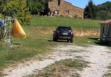
Trail Car Saint-Martin-de-Crau - Mallemort  - Photo
© OpenStreetMap contributors
Length
Length
38 km
Max alt
Max alt
142 m
Uphill gradient
Uphill gradient
269 m
Km-Effort
Km-Effort  
42 km
Min alt
Min alt
16 m
Downhill gradient
Downhill gradient
164 m
Boucle
Boucle
No
Creation date :
2020-06-04 12:28:21.976
Updated on :
2020-06-04 13:06:58.904

(0 Reviews)

Car
Car
38m
Difficulty : Very easy

Scan this QR Code to open this trail in the SityTrail application

FREE GPS app for hiking

Logo SityTrail SityTrail

IGN / Geographical institutes

Download SityTrail from the App Store Download SityTrail from Google Play

Logo SityTrail SityTrail World

The world is yours!

Download SityTrail from the App Store Download SityTrail from Google Play Download SityTrail on Huawei AppGallery

About

Trail Car of 38 km to be discovered at Provence-Alpes-Côte d'Azur, Bouches-du-Rhône, Saint-Martin-de-Crau. This trail is proposed by Jacques Mathieu.

Elevation profile

Positioning

Country:
France
Region :
Provence-Alpes-Côte d'Azur
Department/Province :
Bouches-du-Rhône
Municipality :
Saint-Martin-de-Crau
Location:
Unknown
Start:(UTM)
645627 ; 4832916 (31T) N.

Trails nearby

Trail Walking Saint-Martin-de-Crau - Tour du lac de mondely - Photo
Walking
gege22

Walking

Medium
Saint-Martin-de-Crau, Provence-Alpes-Côte d'Azur, Bouches-du-Rhône, France
286 km | 345 km-effort
1h 42min
No
Trail Running Saint-Martin-de-Crau - reprise gg au tour du lac 4t  - Photo
Running
gege22

Running

Very easy
Saint-Martin-de-Crau, Provence-Alpes-Côte d'Azur, Bouches-du-Rhône, France
5.4 km | 6 km-effort
39min
Yes
Trail Other activity Saint-Martin-de-Crau - 2011-10-07 19h03m41 - Photo
Other activity
gilou83

Other activity

Very easy
Saint-Martin-de-Crau, Provence-Alpes-Côte d'Azur, Bouches-du-Rhône, France
7.1 km | 7.5 km-effort
Unknown
No
Trail Walking Saint-Martin-de-Crau - Les aulnes - Photo
Walking
redessan

Walking

Saint-Martin-de-Crau, Provence-Alpes-Côte d'Azur, Bouches-du-Rhône, France
7.5 km | 8.1 km-effort
1h 54min
Yes
Trail Walking Saint-Martin-de-Crau - tour de l'étang des aulnes - Photo
Walking
hervef13300

Walking

Medium
Saint-Martin-de-Crau, Provence-Alpes-Côte d'Azur, Bouches-du-Rhône, France
7.3 km | 7.9 km-effort
2h 4min
No
Trail Walking Saint-Martin-de-Crau - dd - Photo
Walking
Andre Damien

Walking

Difficult
Saint-Martin-de-Crau, Provence-Alpes-Côte d'Azur, Bouches-du-Rhône, France
13.7 km | 14.5 km-effort
6h 6min
Yes
Trail On foot Saint-Martin-de-Crau - 20-AVR-18 04:13:32 PM - Photo
On foot
mhetpierre

On foot

Easy
Saint-Martin-de-Crau, Provence-Alpes-Côte d'Azur, Bouches-du-Rhône, France
7 km | 7.6 km-effort
1h 43min
Yes
Trail Walking Saint-Martin-de-Crau - Balade avec Thierry Maussane vers Mouries  - Photo
Walking
gege22

Walking

Medium
Saint-Martin-de-Crau, Provence-Alpes-Côte d'Azur, Bouches-du-Rhône, France
20 km | 26 km-effort
2h 49min
No
Trail Running Saint-Martin-de-Crau - st Artin de Crau2017-07-15 08h28m26 - Photo
Running
macenicsan

Running

Easy
Saint-Martin-de-Crau, Provence-Alpes-Côte d'Azur, Bouches-du-Rhône, France
11.3 km | 11.8 km-effort
Unknown
Yes


Close
My subscriptions