


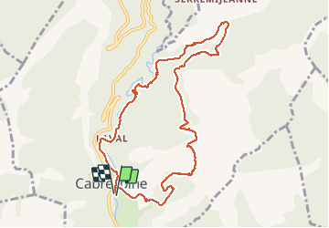

8.3 km | 14.7 km-effort


User


FREE GPS app for hiking
 SityTrail
IGN / Geographical institutes
SityTrail World
The world is yours!
Trail Walking of 10.8 km to be discovered at Occitania, Aude, Cabrespine. This trail is proposed by SoleilMoussanais.
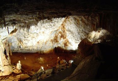
Les pas de l'aube. Randonnée de difficulté moyenne. Plus grande partie sous bois. Ruisseaux à traverser mais sans grande difficulté en mai,juin.
On foot

On foot
Walking
Walking
Walking

On foot

Walking