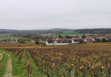
14.1 km | 18.1 km-effort
LES DESSUS DE GLAND
explorateur
User
Length
12.4 km
Max alt
226 m
Uphill gradient
203 m
Km-Effort
15.1 km
Min alt
131 m
Downhill gradient
203 m
Boucle
Yes
Creation date :
2020-05-25 19:29:36.47
Updated on :
2020-06-15 19:43:06.769
--
Difficulty : Medium
FREE GPS app for hiking
About
Trail On foot of 12.4 km to be discovered at Hauts-de-France, Aisne, Gland. This trail is proposed by explorateur.
Positioning
Country:
France
Region :
Hauts-de-France
Department/Province :
Aisne
Municipality :
Gland
Location:
Unknown
Start:(Dec)
Start:(UTM)
533979 ; 5433862 (31U) N.
Comments
Trails nearby
Le coteau des orchidées
Walking
Difficult
(1)
Mont-Saint-Père,
Hauts-de-France,
Aisne,
France
4h 0min
Yes
Le chemin de St Colomban en IDF Etape 1 Chateau Thierry - Nanteuil sur Marne
Walking
Very difficult
Château-Thierry,
Hauts-de-France,
Aisne,
France
35 km | 44 km-effort
7h 12min
No
Les Vignes Castelles trace du 28-04-2024
Walking
Difficult
Château-Thierry,
Hauts-de-France,
Aisne,
France
12.6 km | 16.4 km-effort
3h 43min
Yes
Les vignes Castelles - version 8 km
Walking
Medium
Château-Thierry,
Hauts-de-France,
Aisne,
France
8.2 km | 10.3 km-effort
2h 20min
Yes
Chierry
Walking
Very easy
(1)
Chierry,
Hauts-de-France,
Aisne,
France
10.8 km | 13.3 km-effort
3h 1min
Yes
Compostelle Reims-Paris
Walking
Difficult
(1)
Château-Thierry,
Hauts-de-France,
Aisne,
France
15.5 km | 19 km-effort
4h 18min
No
Nesles la Montagne du 02/06/2020
Walking
Very easy
Nesles-la-Montagne,
Hauts-de-France,
Aisne,
France
8.6 km | 11.1 km-effort
1h 45min
Yes
Verdilly Balcons de la Marne
Running
Medium
(1)
Verdilly,
Hauts-de-France,
Aisne,
France
32 km | 41 km-effort
Unknown
Yes
Les vignes Castelles - parcours B
Walking
Difficult
Château-Thierry,
Hauts-de-France,
Aisne,
France
11.1 km | 14.5 km-effort
3h 17min
Yes