


12.9 km | 15.7 km-effort

Hiking inspiration PRO


FREE GPS app for hiking
 SityTrail
IGN / Geographical institutes
SityTrail World
The world is yours!
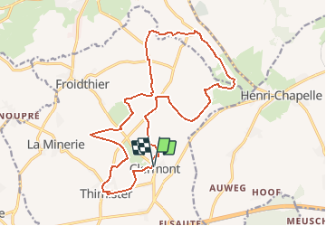
Trail On foot of 18 km to be discovered at Wallonia, Liège, Thimister-Clermont. This trail is proposed by Rando bière.
Hello, 😁
Je vous propose de me rejoindre pour une rando/bière du côté de Thimister-Clermont !
👣 18KM : D 233📈 et D 235-📉
⏳ Durée moyenne : entre 4h30 et 5h30
🚗 25 minutes depuis liège (23KM)
🔵 randonnée moyennement exigeante physiquement.
💧Prévoir au moins 2,5L d'eau (minimum)
🥾 Prévoir des chaussures de marche
🍻 Café au Renouveau : http://www.beauxvillages.be/deguster/cafes-brasseries/renouveau-au.htm?lng=fr
🌡Météo : https://www.meteoblue.com/fr/meteo/semaine/thimister-clermont_belgique_7732060


Walking

Walking

Walking

Walking

Walking

Walking

Walking

Walking
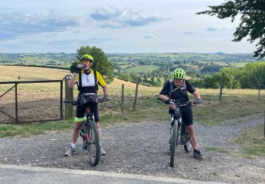
Mountain bike