![](/images/other/stat-length.png)
![Trail Walking Vérin - 42-Vérin Chuyer 18km 520m 18/5/20 - Photo](https://media.geolcdn.com/t/1900/400/d905a890-4d96-4a9e-ac55-e4eba02c50b9.jpg&format=pjpeg&maxdim=2)
42-Vérin Chuyer 18km 520m 18/5/20
SyMA
User
![Length](/images/other/stat-length.png)
Length
17.6 km
![Max alt](https://static1.geolcdn.com/siteimages/upload/files/1508320355ic_sort_altitude_max_24dp.png)
Max alt
505 m
![Uphill gradient](https://static1.geolcdn.com/siteimages/upload/files/1508320355ic_sort_den_pos_24dp.png)
Uphill gradient
521 m
![Km-Effort](/images/other/stat-length.png)
Km-Effort
25 km
![Min alt](https://static1.geolcdn.com/siteimages/upload/files/1508320355ic_sort_altitude_min_24dp.png)
Min alt
142 m
![Downhill gradient](https://static1.geolcdn.com/siteimages/upload/files/1508320355ic_sort_den_neg_24dp.png)
Downhill gradient
522 m
![Boucle](https://static1.geolcdn.com/siteimages/upload/files/16400158638029165_repeat_loop_refresh_sync_direction_icon.png)
Boucle
Yes
Creation date :
2020-05-18 07:12:13.26
Updated on :
2020-05-19 06:32:10.12
![Walking](https://static1.geolcdn.com/sitytour/trail-icons/101.png)
5h12
Difficulty : Medium
![Scan this QR Code to open this trail in the SityTrail application](https://capi.geolives.com/qq0zvz2zws4bq2lad0pu/sitytour/trails/2400676/qr.png?size=200)
FREE GPS app for hiking
About
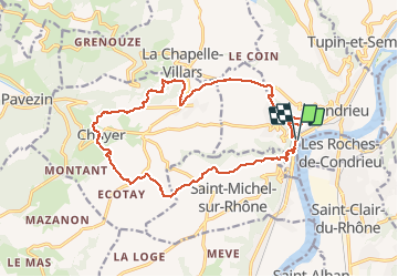
Trail Walking of 17.6 km to be discovered at Auvergne-Rhône-Alpes, Loire, Vérin. This trail is proposed by SyMA.
Description
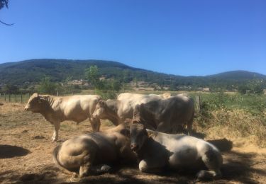
Belle balade à faire mi MAI (cerises!!)
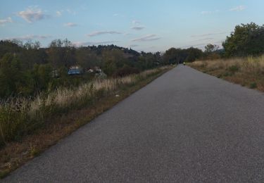
parking (voie verte) juste à gauche (venant de Vienne) juste apres pancarte de sortie de Condrieu
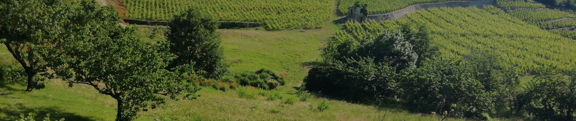
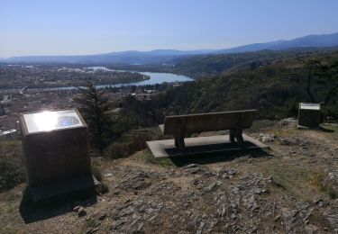
Beau lieu de pique nique 1km apres Chuyer
amelioration au 3 eme km pour eviter macadam aller à droite vers zonas puis trois fortunes
Positioning
Country:
France
Region :
Auvergne-Rhône-Alpes
Department/Province :
Loire
Municipality :
Vérin
Location:
Unknown
Start:(Dec)
Start:(UTM)
637215 ; 5035096 (31T) N.
Comments
Trails nearby
![Trail Walking Chuyer - Autour du mont Ministre - Photo](https://media.geolcdn.com/t/375/260/ext.jpg?maxdim=2&url=https%3A%2F%2Fstatic1.geolcdn.com%2Fsiteimages%2Fupload%2Ffiles%2F1553511878bg_sport_marche.png)
![Walking Walking](https://static1.geolcdn.com/sitytour/trail-icons/101.png)
Autour du mont Ministre
Walking
Easy
(2)
Chuyer,
Auvergne-Rhône-Alpes,
Loire,
France
![](/images/other/stat-length.png)
7.5 km | 11.2 km-effort
Unknown
![](https://static1.geolcdn.com/siteimages/upload/files/16400158638029165_repeat_loop_refresh_sync_direction_icon.png)
Yes
![Trail Walking Condrieu - ravin de l'arbuet - Photo](https://media.geolcdn.com/t/375/260/ext.jpg?maxdim=2&url=https%3A%2F%2Fstatic1.geolcdn.com%2Fsiteimages%2Fupload%2Ffiles%2F1553511878bg_sport_marche.png)
![Walking Walking](https://static1.geolcdn.com/sitytour/trail-icons/101.png)
ravin de l'arbuet
Walking
Very easy
(1)
Condrieu,
Auvergne-Rhône-Alpes,
Rhône,
France
![](/images/other/stat-length.png)
7.2 km | 10 km-effort
2h 52min
![](https://static1.geolcdn.com/siteimages/upload/files/16400158638029165_repeat_loop_refresh_sync_direction_icon.png)
Yes
![Trail Walking Chuyer - 42-Chuyer-mont-Ministre-19km-685m-été - Photo](https://media.geolcdn.com/t/375/260/effa4503-778b-47fa-ac8d-c1f86e2f0d53.jpg&format=jpg&maxdim=2)
![Walking Walking](https://static1.geolcdn.com/sitytour/trail-icons/101.png)
42-Chuyer-mont-Ministre-19km-685m-été
Walking
Medium
Chuyer,
Auvergne-Rhône-Alpes,
Loire,
France
![](/images/other/stat-length.png)
19 km | 28 km-effort
5h 50min
![](https://static1.geolcdn.com/siteimages/upload/files/16400158638029165_repeat_loop_refresh_sync_direction_icon.png)
Yes
![Trail On foot La Chapelle-Villars - Pilat N°30: des «Côteaux à les Haies» - Photo](https://media.geolcdn.com/t/375/260/dcae721c-56d2-4080-8395-c9b2db29b909.jpeg&format=jpg&maxdim=2)
![On foot On foot](https://static1.geolcdn.com/sitytour/trail-icons/100.png)
Pilat N°30: des «Côteaux à les Haies»
On foot
Difficult
La Chapelle-Villars,
Auvergne-Rhône-Alpes,
Loire,
France
![](/images/other/stat-length.png)
29 km | 37 km-effort
8h 27min
![](https://static1.geolcdn.com/siteimages/upload/files/16400158638029165_repeat_loop_refresh_sync_direction_icon.png)
Yes
![Trail Running Condrieu - Condrieu - Photo](https://media.geolcdn.com/t/375/260/ext.jpg?maxdim=2&url=https%3A%2F%2Fservices.sitytrail.com%2FGeolivesWS%2FDownloadMedia.ashx%3FTrailID%3D1024772%26Media%3D20180819155702.jpg)
![Running Running](https://static1.geolcdn.com/sitytour/trail-icons/103.png)
Condrieu
Running
Easy
Condrieu,
Auvergne-Rhône-Alpes,
Rhône,
France
![](/images/other/stat-length.png)
17.5 km | 23 km-effort
2h 23min
![](https://static1.geolcdn.com/siteimages/upload/files/16400158638029165_repeat_loop_refresh_sync_direction_icon.png)
Yes
![Trail Walking Condrieu - condrieu - Photo](https://media.geolcdn.com/t/375/260/e1a46fbc-6017-4173-b237-9fe02fcd6abd.jpg&format=jpg&maxdim=2)
![Walking Walking](https://static1.geolcdn.com/sitytour/trail-icons/101.png)
condrieu
Walking
Difficult
Condrieu,
Auvergne-Rhône-Alpes,
Rhône,
France
![](/images/other/stat-length.png)
14 km | 18.7 km-effort
3h 32min
![](https://static1.geolcdn.com/siteimages/upload/files/16400158638029165_repeat_loop_refresh_sync_direction_icon.png)
Yes
![Trail Road bike Vérin - chavanay jardin velo - Photo](https://media.geolcdn.com/t/375/260/e6d39827-cd8f-428b-83dc-dc69f0c9780d.jpg&format=jpg&maxdim=2)
![Road bike Road bike](https://static1.geolcdn.com/sitytour/trail-icons/201.png)
chavanay jardin velo
Road bike
Medium
Vérin,
Auvergne-Rhône-Alpes,
Loire,
France
![](/images/other/stat-length.png)
35 km | 39 km-effort
2h 5min
![](https://static1.geolcdn.com/siteimages/upload/files/16400158638029165_repeat_loop_refresh_sync_direction_icon.png)
No
![Trail Walking Vérin - 42-VERIN-CHUYER-18km-510m-sept21 - Photo](https://media.geolcdn.com/t/375/260/8821ddff-45bd-49d2-b869-6ce16906a047.jpg&format=jpg&maxdim=2)
![Walking Walking](https://static1.geolcdn.com/sitytour/trail-icons/101.png)
42-VERIN-CHUYER-18km-510m-sept21
Walking
Difficult
Vérin,
Auvergne-Rhône-Alpes,
Loire,
France
![](/images/other/stat-length.png)
18.2 km | 25 km-effort
5h 17min
![](https://static1.geolcdn.com/siteimages/upload/files/16400158638029165_repeat_loop_refresh_sync_direction_icon.png)
Yes
![Trail Walking Condrieu - Condrieu-Les vignes - Photo](https://media.geolcdn.com/t/375/260/50da477f-f51c-4cf2-8a2b-a1971f4c7258.jpg&format=jpg&maxdim=2)
![Walking Walking](https://static1.geolcdn.com/sitytour/trail-icons/101.png)
Condrieu-Les vignes
Walking
Very easy
Condrieu,
Auvergne-Rhône-Alpes,
Rhône,
France
![](/images/other/stat-length.png)
3.3 km | 5.3 km-effort
1h 39min
![](https://static1.geolcdn.com/siteimages/upload/files/16400158638029165_repeat_loop_refresh_sync_direction_icon.png)
Yes