Trail Road bike Vieux-Rouen-sur-Bresle - Vieux Rouen - Photo
 solisolo
solisolo

User

© OpenStreetMap contributors
Length
Length
107 km
Max alt
Max alt
246 m
Uphill gradient
Uphill gradient
1479 m
Km-Effort
Km-Effort  
127 km
Min alt
Min alt
57 m
Downhill gradient
Downhill gradient
1478 m
Boucle
Boucle
Yes
Creation date :
2020-05-15 10:07:51.13
Updated on :
2020-05-17 16:31:57.607

(0 Reviews)

Road bike
Road bike
4h14
Difficulty : Medium

Scan this QR Code to open this trail in the SityTrail application

FREE GPS app for hiking

Logo SityTrail SityTrail

IGN / Geographical institutes

Download SityTrail from the App Store Download SityTrail from Google Play

Logo SityTrail SityTrail World

The world is yours!

Download SityTrail from the App Store Download SityTrail from Google Play Download SityTrail on Huawei AppGallery

About

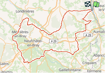
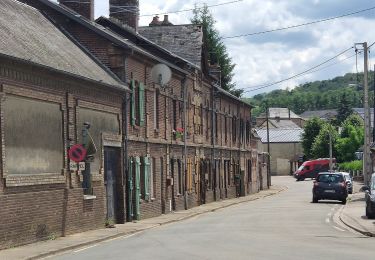
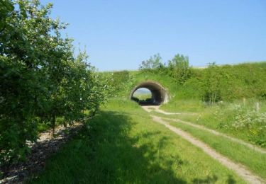
Trail Road bike of 107 km to be discovered at Normandy, Seine-Maritime, Vieux-Rouen-sur-Bresle. This trail is proposed by solisolo.

Elevation profile

Positioning

Country:
France
Region :
Normandy
Department/Province :
Seine-Maritime
Municipality :
Vieux-Rouen-sur-Bresle
Location:
Unknown
Start:(UTM)
408010 ; 5520885 (31U) N.

Trails nearby

Trail On foot Saint-Martin-au-Bosc - Edruchon - Photo
On foot
PRO

On foot

Easy
Saint-Martin-au-Bosc, Normandy, Seine-Maritime, France
8.1 km | 10.2 km-effort
2h 18min
Yes
Trail Equestrian Vieux-Rouen-sur-Bresle - Edruchon (N°12) - Vieux-Rouen-sur-Bresle - Photo
Equestrian
tracegps

Equestrian

Easy
Vieux-Rouen-sur-Bresle, Normandy, Seine-Maritime, France
7.9 km | 9.9 km-effort
1h 19min
Yes
Trail Mountain bike Vieux-Rouen-sur-Bresle - Edruchon (N°12) - Vieux-Rouen-sur-Bresle - Photo
Mountain bike
tracegps

Mountain bike

Easy
Vieux-Rouen-sur-Bresle, Normandy, Seine-Maritime, France
7.9 km | 9.9 km-effort
45min
Yes
Trail Walking Vieux-Rouen-sur-Bresle - Edruchon (N°12) - Vieux-Rouen-sur-Bresle - Photo
Walking
tracegps

Walking

Easy
Vieux-Rouen-sur-Bresle, Normandy, Seine-Maritime, France
7.9 km | 9.9 km-effort
2h 0min
Yes
Trail Walking Lafresguimont-Saint-Martin - Les larris de Blangiel - Lafresnoye - Photo
Walking
tracegps

Walking

Easy
Lafresguimont-Saint-Martin, Hauts-de-France, Somme, France
2.1 km | 2.7 km-effort
40min
Yes
Trail Walking Saint-Aubin-Rivière - Les larris de Saint-Aubin-Rivière - Photo
Walking
tracegps

Walking

Difficult
Saint-Aubin-Rivière, Hauts-de-France, Somme, France
1.7 km | 2.8 km-effort
1h 30min
Yes


Close
My subscriptions