


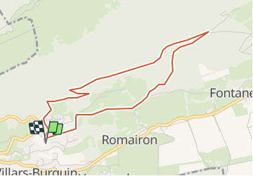

5.9 km | 8.5 km-effort


User


FREE GPS app for hiking
 SityTrail
IGN / Geographical institutes
SityTrail World
The world is yours!
Trail Other activity of 4.6 km to be discovered at Vaud, District du Jura-Nord vaudois, Tévenon. This trail is proposed by hrb.
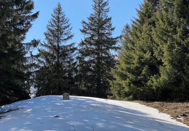
Weg von Pt 1123 bzw. 1127 relativ schlecht. Letzte Kurve (nach links aufwärts)im Bois de Cernil la Dame undeutlich.
On foot

On foot
On foot
On foot
On foot

Walking
Other activity
Other activity
Other activity