Trail Other activity Le Noirmont - Le Noirmont - St. Imier - Photo
 bffcuc
bffcuc

User

© OpenStreetMap contributors
Length
Length
14.7 km
Max alt
Max alt
1292 m
Uphill gradient
Uphill gradient
490 m
Km-Effort
Km-Effort  
22 km
Min alt
Min alt
794 m
Downhill gradient
Downhill gradient
664 m
Boucle
Boucle
No
Creation date :
2014-12-11 00:00:00.0
Updated on :
2014-12-11 00:00:00.0

(0 Reviews)

Other activity
Other activity
4h42
Difficulty : Unknown

Scan this QR Code to open this trail in the SityTrail application

FREE GPS app for hiking

Logo SityTrail SityTrail

IGN / Geographical institutes

Download SityTrail from the App Store Download SityTrail from Google Play

Logo SityTrail SityTrail World

The world is yours!

Download SityTrail from the App Store Download SityTrail from Google Play Download SityTrail on Huawei AppGallery

About

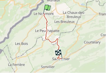
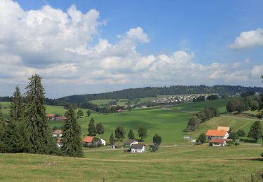
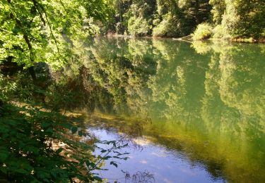
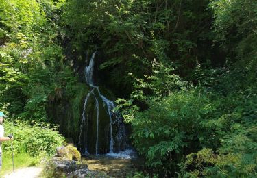
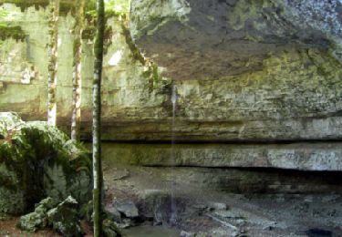
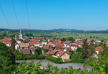
Trail Other activity of 14.7 km to be discovered at Jura, District des Franches-Montagnes, Le Noirmont. This trail is proposed by bffcuc.

Elevation profile

Positioning

Country:
Switzerland
Region :
Jura
Department/Province :
District des Franches-Montagnes
Municipality :
Le Noirmont
Location:
Unknown
Start:(UTM)
345324 ; 5232029 (32T) N.

Trails nearby

Trail On foot Le Noirmont - La Goule - fixme - Photo
On foot
GUIDE+

On foot

Easy
Le Noirmont, Jura, District des Franches-Montagnes, Switzerland
3.4 km | 4.5 km-effort
1h 0min
No
Trail On foot Le Noirmont - La Goule - fixme - Photo
On foot
GUIDE+

On foot

Easy
Le Noirmont, Jura, District des Franches-Montagnes, Switzerland
3.9 km | 8.2 km-effort
1h 51min
No
Trail On foot Muriaux - Muriaux - Goumois - Photo
On foot
GUIDE+

On foot

Easy
Muriaux, Jura, District des Franches-Montagnes, Switzerland
4 km | 6.7 km-effort
1h 31min
No
Trail Walking Goumois - Circuit du barrage de la Goule - Photo
Walking
dudu42

Walking

Medium
Goumois, Bourgogne-Franche-Comté, Doubs, France
13.8 km | 18.8 km-effort
3h 36min
Yes
Trail Walking Goumois - Les Sommêtres - Photo
Walking
tiene

Walking

Medium
Goumois, Bourgogne-Franche-Comté, Doubs, France
24 km | 37 km-effort
7h 54min
No
Trail Walking Charmauvillers - Goumois randonnée La Goule  - Photo
Walking
zazie

Walking

Medium
Charmauvillers, Bourgogne-Franche-Comté, Doubs, France
19.6 km | 35 km-effort
3h 5min
No
Trail Walking Goumois - Goumois  - Photo
Walking
klopbill

Walking

Easy
Goumois, Bourgogne-Franche-Comté, Doubs, France
13.6 km | 19.4 km-effort
5h 42min
Yes
Trail Walking Goumois - La Chute du Bief de Vautenaivre et le Château Cugny. - Photo
Walking
tracegps

Walking

Medium
Goumois, Bourgogne-Franche-Comté, Doubs, France
15.2 km | 23 km-effort
5h 30min
Yes
Trail Walking Belfays - Belfays Urtière Damprichard - Photo
Walking
randovoujo

Walking

Difficult
Belfays, Bourgogne-Franche-Comté, Doubs, France
13.5 km | 18.3 km-effort
4h 9min
Yes


Close
My subscriptions