![](/images/other/stat-length.png)
![Trail Walking Ferrières - Malacord - Le Herlot - Au Nokar -Malacord - Photo](https://media.geolcdn.com/t/1900/400/ext.pjpeg?maxdim=2&url=https%3A%2F%2Fstatic1.geolcdn.com%2Fsiteimages%2Fupload%2Ffiles%2F1553511878bg_sport_marche.png)
Malacord - Le Herlot - Au Nokar -Malacord
chrlouette
User
![Length](/images/other/stat-length.png)
Length
3.2 km
![Max alt](https://static1.geolcdn.com/siteimages/upload/files/1508320355ic_sort_altitude_max_24dp.png)
Max alt
294 m
![Uphill gradient](https://static1.geolcdn.com/siteimages/upload/files/1508320355ic_sort_den_pos_24dp.png)
Uphill gradient
88 m
![Km-Effort](/images/other/stat-length.png)
Km-Effort
4.3 km
![Min alt](https://static1.geolcdn.com/siteimages/upload/files/1508320355ic_sort_altitude_min_24dp.png)
Min alt
202 m
![Downhill gradient](https://static1.geolcdn.com/siteimages/upload/files/1508320355ic_sort_den_neg_24dp.png)
Downhill gradient
88 m
![Boucle](https://static1.geolcdn.com/siteimages/upload/files/16400158638029165_repeat_loop_refresh_sync_direction_icon.png)
Boucle
Yes
Creation date :
2020-04-06 16:21:41.091
Updated on :
2020-05-11 09:24:51.253
![Walking](https://static1.geolcdn.com/sitytour/trail-icons/101.png)
52m
Difficulty : Very easy
![Scan this QR Code to open this trail in the SityTrail application](https://capi.geolives.com/qq0zvz2zws4bq2lad0pu/sitytour/trails/2376135/qr.png?size=200)
FREE GPS app for hiking
About
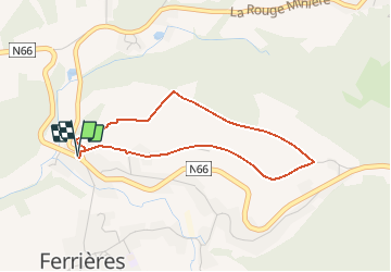
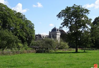
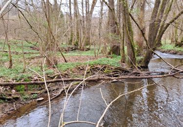
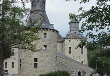
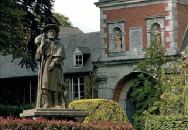
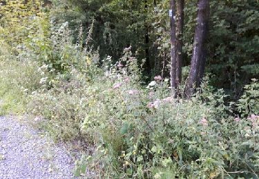
Trail Walking of 3.2 km to be discovered at Wallonia, Liège, Ferrières. This trail is proposed by chrlouette.
Description
Magnifiques points de vue. Ma promenade préférée. Possibilité de commencer la balade par un chemin quelques 200 m plus loin, plutôt qu'un sentier passant dans un champs où il peut y avoir du bétail.
Positioning
Country:
Belgium
Region :
Wallonia
Department/Province :
Liège
Municipality :
Ferrières
Location:
Ferrières
Start:(Dec)
Start:(UTM)
685097 ; 5586929 (31U) N.
Comments
Trails nearby
![Trail Walking Hamoir - RB-Lg-19_Hamoir - Photo](https://media.geolcdn.com/t/375/260/ext.jpg?maxdim=2&url=https%3A%2F%2Fservices.sitytrail.com%2FGeolivesWS%2FDownloadMedia.ashx%3FTrailID%3D400602%26Media%3Dc0745639-8ded-479e-9345-a8c68cd61e6a.jpg)
![Walking Walking](https://static1.geolcdn.com/sitytour/trail-icons/101.png)
RB-Lg-19_Hamoir
Walking
Very difficult
(6)
Hamoir,
Wallonia,
Liège,
Belgium
![](/images/other/stat-length.png)
22 km | 28 km-effort
6h 18min
![](https://static1.geolcdn.com/siteimages/upload/files/16400158638029165_repeat_loop_refresh_sync_direction_icon.png)
Yes
![Trail Walking Ferrières - Rouge-Minière. Natura 2000, des sites qui valent le détour ! Lg 3 - Photo](https://media.geolcdn.com/t/375/260/ext.jpg?maxdim=2&url=https%3A%2F%2Fservices.sitytrail.com%2FGeolivesWS%2FDownloadMedia.ashx%3FTrailID%3D142641%26Media%3Dc08233b4-27a6-486a-be6b-e1cb0ee623d1.JPG)
![Walking Walking](https://static1.geolcdn.com/sitytour/trail-icons/101.png)
Rouge-Minière. Natura 2000, des sites qui valent le détour ! Lg 3
Walking
Easy
(17)
Ferrières,
Wallonia,
Liège,
Belgium
![](/images/other/stat-length.png)
6.8 km | 8.9 km-effort
Unknown
![](https://static1.geolcdn.com/siteimages/upload/files/16400158638029165_repeat_loop_refresh_sync_direction_icon.png)
Yes
![Trail Walking Aywaille - RB-Lg-15 - À la porte de l’Ardenne - Photo](https://media.geolcdn.com/t/375/260/ext.jpg?maxdim=2&url=https%3A%2F%2Fservices.sitytrail.com%2FGeolivesWS%2FDownloadMedia.ashx%3FTrailID%3D179573%26Media%3D790acd11-a9eb-4644-bdd3-c1540608bba1.jpg)
![Walking Walking](https://static1.geolcdn.com/sitytour/trail-icons/101.png)
RB-Lg-15 - À la porte de l’Ardenne
Walking
Difficult
(7)
Aywaille,
Wallonia,
Liège,
Belgium
![](/images/other/stat-length.png)
22 km | 30 km-effort
6h 10min
![](https://static1.geolcdn.com/siteimages/upload/files/16400158638029165_repeat_loop_refresh_sync_direction_icon.png)
Yes
![Trail Walking Ferrières - Marche ADEPS BURNONTIGE (Ferrieres) 10/04/33 - Photo](https://media.geolcdn.com/t/375/260/6e9d890b-6b68-45d8-aaec-5de6224210eb.jpg&format=jpg&maxdim=2)
![Walking Walking](https://static1.geolcdn.com/sitytour/trail-icons/101.png)
Marche ADEPS BURNONTIGE (Ferrieres) 10/04/33
Walking
Medium
(1)
Ferrières,
Wallonia,
Liège,
Belgium
![](/images/other/stat-length.png)
15.4 km | 20 km-effort
3h 2min
![](https://static1.geolcdn.com/siteimages/upload/files/16400158638029165_repeat_loop_refresh_sync_direction_icon.png)
Yes
![Trail Walking Hamoir - Hamoir - Sy - Les Crêtes - Photo](https://media.geolcdn.com/t/375/260/2cd3e10e-e069-4884-9433-cbc8b49962aa.jpg&format=jpg&maxdim=2)
![Walking Walking](https://static1.geolcdn.com/sitytour/trail-icons/101.png)
Hamoir - Sy - Les Crêtes
Walking
Medium
(1)
Hamoir,
Wallonia,
Liège,
Belgium
![](/images/other/stat-length.png)
13.1 km | 17.2 km-effort
3h 17min
![](https://static1.geolcdn.com/siteimages/upload/files/16400158638029165_repeat_loop_refresh_sync_direction_icon.png)
Yes
![Walking Walking](https://static1.geolcdn.com/sitytour/trail-icons/101.png)
Harzé
Walking
Difficult
(1)
Aywaille,
Wallonia,
Liège,
Belgium
![](/images/other/stat-length.png)
10.1 km | 13.5 km-effort
3h 22min
![](https://static1.geolcdn.com/siteimages/upload/files/16400158638029165_repeat_loop_refresh_sync_direction_icon.png)
Yes
![Trail Walking Aywaille - RB-Lg-15-BC-2019-Rac2 - Photo](https://media.geolcdn.com/t/375/260/ext.jpg?maxdim=2&url=https%3A%2F%2Fservices.sitytrail.com%2FGeolivesWS%2FDownloadMedia.ashx%3FTrailID%3D209438%26Media%3D790acd11-a9eb-4644-bdd3-c1540608bba1.jpg)
![Walking Walking](https://static1.geolcdn.com/sitytour/trail-icons/101.png)
RB-Lg-15-BC-2019-Rac2
Walking
Medium
(7)
Aywaille,
Wallonia,
Liège,
Belgium
![](/images/other/stat-length.png)
11.4 km | 15.9 km-effort
3h 21min
![](https://static1.geolcdn.com/siteimages/upload/files/16400158638029165_repeat_loop_refresh_sync_direction_icon.png)
Yes
![Trail Mountain bike Ferrières - st-roch - Photo](https://media.geolcdn.com/t/375/260/ext.jpg?maxdim=2&url=https%3A%2F%2Fservices.sitytrail.com%2FGeolivesWS%2FDownloadMedia.ashx%3FTrailID%3D639793%26Media%3Dfix__20161002141250.jpg)
![Mountain bike Mountain bike](https://static1.geolcdn.com/sitytour/trail-icons/202.png)
st-roch
Mountain bike
Medium
(1)
Ferrières,
Wallonia,
Liège,
Belgium
![](/images/other/stat-length.png)
11.9 km | 14.9 km-effort
1h 45min
![](https://static1.geolcdn.com/siteimages/upload/files/16400158638029165_repeat_loop_refresh_sync_direction_icon.png)
Yes
![Trail Walking Ferrières - en passant par la chapelle Saint Roch - Photo](https://media.geolcdn.com/t/375/260/ext.jpg?maxdim=2&url=https%3A%2F%2Fservices.sitytrail.com%2FGeolivesWS%2FDownloadMedia.ashx%3FTrailID%3D611055%26Media%3Dfix__20160808180251.jpg)
![Walking Walking](https://static1.geolcdn.com/sitytour/trail-icons/101.png)
en passant par la chapelle Saint Roch
Walking
Easy
(3)
Ferrières,
Wallonia,
Liège,
Belgium
![](/images/other/stat-length.png)
4.8 km | 5.9 km-effort
58min
![](https://static1.geolcdn.com/siteimages/upload/files/16400158638029165_repeat_loop_refresh_sync_direction_icon.png)
Yes