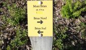
Trail Walking Grane - De Val Brian au Mont Brian - Photo

De Val Brian au Mont Brian

 crocau
crocau

User

© OpenStreetMap contributors
Length
Length
4.8 km
Max alt
Max alt
478 m
Uphill gradient
Uphill gradient
280 m
Km-Effort
Km-Effort  
8.5 km
Min alt
Min alt
201 m
Downhill gradient
Downhill gradient
272 m
Boucle
Boucle
Yes
Creation date :
2020-04-06 15:37:08.224
Updated on :
2020-04-06 20:49:42.791

(1 Reviews)

Walking
Walking
1h30
Difficulty : Very easy

Scan this QR Code to open this trail in the SityTrail application

FREE GPS app for hiking

Logo SityTrail SityTrail

IGN / Geographical institutes

Download SityTrail from the App Store Download SityTrail from Google Play

Logo SityTrail SityTrail World

The world is yours!

Download SityTrail from the App Store Download SityTrail from Google Play Download SityTrail on Huawei AppGallery

About

Trail Walking of 4.8 km to be discovered at Auvergne-Rhône-Alpes, Drôme, Grane. This trail is proposed by crocau.

Description

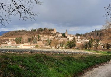
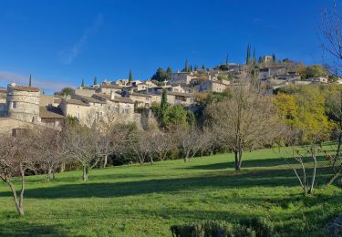
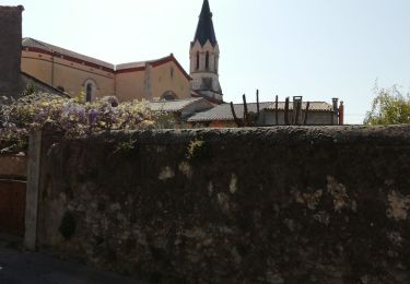
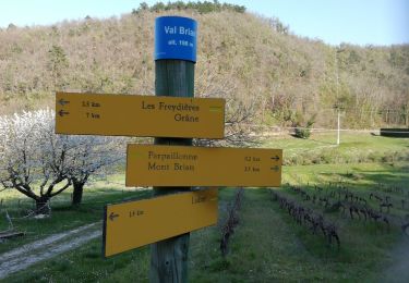
On traverse  l'IME de Val Brian et on se laisse guider jusqu'au sommet. Beaucoup de bestioles à 4 pattes pour les plus observateurs. Arrivé au sommet ( aucun intérêt) on reprend le même chemin pour bifurquer rapidement sur la gauche . Val Brian est alors annoncé à 5,4 km. On prend ce chemin malgré tout, c'est là où le point de vue est le plus sympa. Il y a un chemin marqué d'une croix jaune. Paradoxalement c'est lui qu'il faut prendre, en plus c'est assez joli. On arrive ensuite à un carrefour qui nous propose d'aller à Val Brian soit par Les Costes soit par ? . Je préfère passer par les Costes. La balade est réduite à 1h30/2h grand max.

Elevation profile

Photos

Positioning

Country:
France
Region :
Auvergne-Rhône-Alpes
Department/Province :
Drôme
Municipality :
Grane
Location:
Unknown
Start:(UTM)
648601 ; 4955274 (31T) N.

Comments

Please log in to post a review or rate the element


Trails nearby

Trail Walking Grane - Grane-Les Roberts 13km - Photo
Walking
GUIDE
thonyc

Walking

Easy
Grane, Auvergne-Rhône-Alpes, Drôme, France
13.1 km | 17.5 km-effort
3h 30min
Yes
Trail Walking Grane - grane bois de la dame Pierre sanglante  - Photo
Walking
Joel26400

Walking

Medium
(1)
Grane, Auvergne-Rhône-Alpes, Drôme, France
22 km | 30 km-effort
5h 55min
Yes
Trail Walking Mirmande - Mirmande - Photo
Walking
bob2023

Walking

Medium
(3)
Mirmande, Auvergne-Rhône-Alpes, Drôme, France
5.7 km | 9 km-effort
2h 5min
Yes
Trail Walking Allex - Balade des Ramieres à livron - Photo
Walking
fredlerandonneur

Walking

Easy
(1)
Allex, Auvergne-Rhône-Alpes, Drôme, France
16.6 km | 19.9 km-effort
5h 33min
Yes
Trail Walking Mirmande - Mirmande - Photo
Walking
Titus50

Walking

Very difficult
Mirmande, Auvergne-Rhône-Alpes, Drôme, France
14.7 km | 23 km-effort
4h 19min
Yes
Trail Walking Mirmande - 2023-09-29_07h20m46_Cirkwi-Balcon_du_Rhône(1) - Photo
Walking
chancha

Walking

Difficult
Mirmande, Auvergne-Rhône-Alpes, Drôme, France
11.3 km | 16.3 km-effort
3h 41min
Yes
Trail Walking Loriol-sur-Drôme - De Vaucourte à St Pierre ( Loriol sur Drôme) - Photo
Walking
crocau

Walking

Very easy
Loriol-sur-Drôme, Auvergne-Rhône-Alpes, Drôme, France
5.8 km | 8.4 km-effort
2h 10min
Yes
Trail Walking Grane - De Val Brian au lac sans nom - Photo
Walking
crocau

Walking

Very easy
Grane, Auvergne-Rhône-Alpes, Drôme, France
3.9 km | 5 km-effort
1h 40min
No
Trail Walking Loriol-sur-Drôme - Autour de Blanquinque- Bois de Lagier -Loriol - Photo
Walking
crocau

Walking

Very easy
Loriol-sur-Drôme, Auvergne-Rhône-Alpes, Drôme, France
5.9 km | 8.6 km-effort
2h 0min
Yes


Close
My subscriptions