Trail Walking Monteynard - connex - Photo
© OpenStreetMap contributors
Length
Length
5.5 km
Max alt
Max alt
1707 m
Uphill gradient
Uphill gradient
310 m
Km-Effort
Km-Effort  
11.4 km
Min alt
Min alt
848 m
Downhill gradient
Downhill gradient
853 m
Boucle
Boucle
No
Creation date :
2020-03-17 08:23:54.124
Updated on :
2020-04-03 15:10:12.727

(0 Reviews)

Walking
Walking
4h00
Difficulty : Easy

Scan this QR Code to open this trail in the SityTrail application

FREE GPS app for hiking

Logo SityTrail SityTrail

IGN / Geographical institutes

Download SityTrail from the App Store Download SityTrail from Google Play

Logo SityTrail SityTrail World

The world is yours!

Download SityTrail from the App Store Download SityTrail from Google Play Download SityTrail on Huawei AppGallery

About

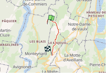
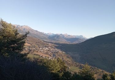
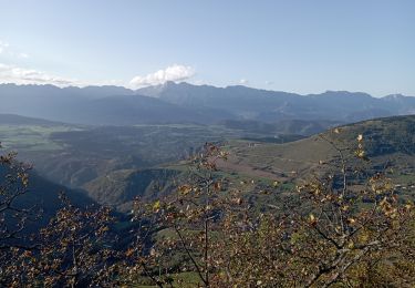
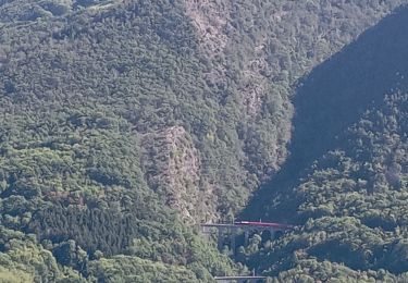
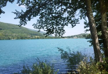
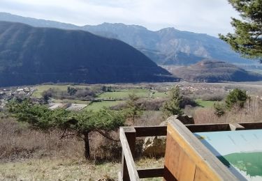
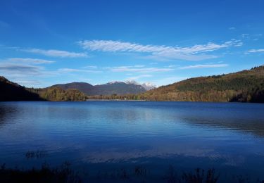
Trail Walking of 5.5 km to be discovered at Auvergne-Rhône-Alpes, Isère, Monteynard. This trail is proposed by paulin bruno.

Description

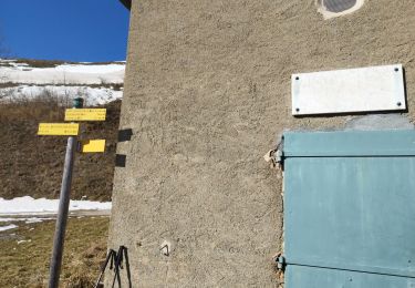
Départ 8h45 en direction de la peyrouse, retour à 11 h45.
Début de l'enregistrement en cours de la randonnée.

Elevation profile

Positioning

Country:
France
Region :
Auvergne-Rhône-Alpes
Department/Province :
Isère
Municipality :
Monteynard
Location:
Unknown
Start:(UTM)
714026 ; 4985434 (31T) N.

Trails nearby

Trail Walking La Motte-Saint-Martin - connex - Photo
Walking
paulin bruno

Walking

Medium
La Motte-Saint-Martin, Auvergne-Rhône-Alpes, Isère, France
15.6 km | 28 km-effort
6h 26min
Yes
Trail Walking Laffrey - tour du lac de la laffrey  - Photo
Walking
Youcef Atallah

Walking

Difficult
Laffrey, Auvergne-Rhône-Alpes, Isère, France
11.3 km | 15.6 km-effort
2h 59min
Yes
Trail Walking Saint-Georges-de-Commiers - Boucle autour de Saint Georges de Commiers - Photo
Walking
permanent 31

Walking

Difficult
Saint-Georges-de-Commiers, Auvergne-Rhône-Alpes, Isère, France
8.2 km | 12 km-effort
2h 26min
No
Trail Walking Saint-Jean-de-Vaulx - Beauregard  - Photo
Walking
Youcef Atallah

Walking

Difficult
Saint-Jean-de-Vaulx, Auvergne-Rhône-Alpes, Isère, France
10.3 km | 17.2 km-effort
3h 13min
Yes
Trail Walking Avignonet - Circuit des 3 Châteaux - Photo
Walking
Emelle

Walking

Medium
Avignonet, Auvergne-Rhône-Alpes, Isère, France
16.7 km | 24 km-effort
5h 55min
Yes
Trail Walking Laffrey - Tour du Grand Lac de Laffrey en circuit - Photo
Walking
Emelle

Walking

Medium
Laffrey, Auvergne-Rhône-Alpes, Isère, France
17.5 km | 25 km-effort
6h 33min
No
Trail Walking La Motte-Saint-Martin - Sinepi  - Photo
Walking
marc vitoria

Walking

(1)
La Motte-Saint-Martin, Auvergne-Rhône-Alpes, Isère, France
24 km | 40 km-effort
6h 0min
No
Trail Nordic walking Saint-Jean-de-Vaulx - Alpage du Conest en traversée  - Photo
Nordic walking
Emelle

Nordic walking

Medium
Saint-Jean-de-Vaulx, Auvergne-Rhône-Alpes, Isère, France
14 km | 21 km-effort
5h 41min
Yes
Trail Walking Saint-Théoffrey - chollonge villard saint Christophe  - Photo
Walking
bailleulherve

Walking

Very easy
Saint-Théoffrey, Auvergne-Rhône-Alpes, Isère, France
13 km | 18.4 km-effort
4h 10min
Yes


Close
My subscriptions