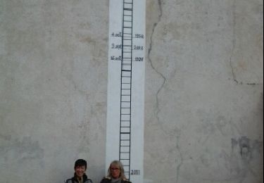
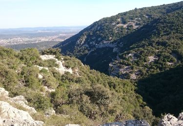
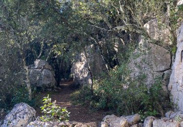
Trail Cycle Quissac - Quissac-Quissac - Photo

Quissac-Quissac

 bqu34
bqu34

User

© OpenStreetMap contributors
Length
Length
114 km
Max alt
Max alt
295 m
Uphill gradient
Uphill gradient
1405 m
Km-Effort
Km-Effort  
132 km
Min alt
Min alt
69 m
Downhill gradient
Downhill gradient
1404 m
Boucle
Boucle
Yes
Creation date :
2014-12-10 00:00:00.0
Updated on :
2014-12-10 00:00:00.0

(0 Reviews)

Cycle
Cycle
7h32
Difficulty : Very easy

Scan this QR Code to open this trail in the SityTrail application

FREE GPS app for hiking

Logo SityTrail SityTrail

IGN / Geographical institutes

Download SityTrail from the App Store Download SityTrail from Google Play

Logo SityTrail SityTrail World

The world is yours!

Download SityTrail from the App Store Download SityTrail from Google Play Download SityTrail on Huawei AppGallery

About

Trail Cycle of 114 km to be discovered at Occitania, Gard, Quissac. This trail is proposed by bqu34.

Description

Quissac. D35. D24.  Logrian (1). Puechredon. Canaules et Argentières. Saint Jean de Serres. D109. D907 vers Lédignan.  premier CV à gauche. CV  à gauche.  Mazac. CV. Lédignan. D6110. Massanes. Vezenobres (2). D116. Saint Etienne de l’Olm. près Euzet. Saint Just. D6. Seynes.D218. Belvezet .   Le  Mas de la Vieille Eglise (3). D218. D979. D125. Labaume. Mas Pontier (4). Gattigues. Foissac. Collorgues. Saint Dézery. D226.  Moussac (5). pont suspendu sur le Gardon. CV. La Réglisserie. Plagnol. D939. D8. Nozières. près Domessargues . D8xD124. D8. premier CV à droite. Fontaries. D724 à gauche . D907 à gauche. D215. D215b à droite. Manthes. D215b. D215bxD6110xCV en face. CV en face. CV à gauche. Savignargues. D8. D194. Saint Théodorit.Quissac.  

Elevation profile

Positioning

Country:
France
Region :
Occitania
Department/Province :
Gard
Municipality :
Quissac
Location:
Unknown
Start:(UTM)
580352 ; 4862221 (31T) N.

Trails nearby

Trail Walking Quissac - Quissac - Photo
Walking
JEANJOSY

Walking

Easy
(1)
Quissac, Occitania, Gard, France
11 km | 13.1 km-effort
2h 57min
Yes
Trail Walking Orthoux-Sérignac-Quilhan - Sérignac - les Mazes - Bragassargues - Photo
Walking
GUIDE
randotines

Walking

Easy
(1)
Orthoux-Sérignac-Quilhan, Occitania, Gard, France
14.2 km | 18.1 km-effort
3h 57min
Yes
Trail On foot Liouc - Les chênes de Coutach - Photo
On foot
GUIDE+

On foot

Easy
Liouc, Occitania, Gard, France
6.7 km | 10.6 km-effort
2h 24min
No
Trail Horseback riding Orthoux-Sérignac-Quilhan - mas bas - corconnes en boucle - Photo
Horseback riding
GUIDE
David25400

Horseback riding

Medium
Orthoux-Sérignac-Quilhan, Occitania, Gard, France
22 km | 26 km-effort
4h 51min
Yes
Trail Walking Corconne - 30 corconne - Photo
Walking
GUIDE
randodyssée

Walking

Easy
Corconne, Occitania, Gard, France
8.8 km | 12.4 km-effort
3h 45min
Yes
Trail Walking Sauve - Sauve, le sentier de l'Aven - Photo
Walking
PatCoria

Walking

Easy
(1)
Sauve, Occitania, Gard, France
4.2 km | 5.4 km-effort
1h 30min
Yes
Trail Walking Corconne - Corconne - Photo
Walking
Ptitjack30

Walking

Medium
(1)
Corconne, Occitania, Gard, France
11.4 km | 15.2 km-effort
3h 28min
No
Trail Walking Corconne - 30 le mazet des gardes Corconne 8/11/23 - Photo
Walking
silvestreclaudine

Walking

Very difficult
Corconne, Occitania, Gard, France
18.1 km | 24 km-effort
5h 21min
Yes
Trail Electric bike Quissac - 52 Km avec 429 de dénivelé - Photo
Electric bike
Eric BRUN

Electric bike

Easy
(1)
Quissac, Occitania, Gard, France
52 km | 62 km-effort
2h 30min
Yes


Close
My subscriptions