Trail Walking Gigors-et-Lozeron - Gigors-et-Lozeron 12km -LA-MONTAGNE-DE-LOZERON-fr-104201 - Photo

Gigors-et-Lozeron 12km -LA-MONTAGNE-DE-LOZERON-fr-104201

 thonyc
thonyc

User GUIDE

© OpenStreetMap contributors
Length
Length
12 km
Max alt
Max alt
922 m
Uphill gradient
Uphill gradient
484 m
Km-Effort
Km-Effort  
18.5 km
Min alt
Min alt
454 m
Downhill gradient
Downhill gradient
484 m
Boucle
Boucle
Yes
Creation date :
2020-03-13 16:05:30.419
Updated on :
2020-03-13 16:12:15.985

(0 Reviews)

Walking
Walking
3h49
Difficulty : Difficult

Scan this QR Code to open this trail in the SityTrail application

FREE GPS app for hiking

Logo SityTrail SityTrail

IGN / Geographical institutes

Download SityTrail from the App Store Download SityTrail from Google Play

Logo SityTrail SityTrail World

The world is yours!

Download SityTrail from the App Store Download SityTrail from Google Play Download SityTrail on Huawei AppGallery

About

Trail Walking of 12 km to be discovered at Auvergne-Rhône-Alpes, Drôme, Gigors-et-Lozeron. This trail is proposed by thonyc.

Description

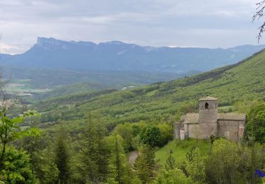
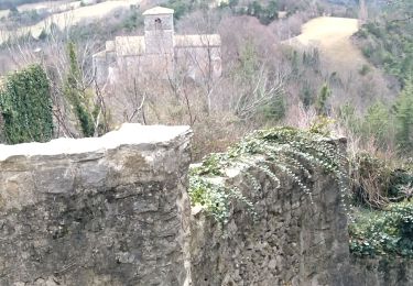
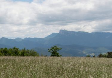
::D/A:: Depuis Jozonière (alt. 455m), s’engager sur le chemin à gauche. Il dessine un coude à droite après avoir dépassé deux maisons, oblique à gauche, puis grimpe plein nord et débouche sur une route goudronnée. Continuer tout droit. À la patte d’oie, bifurquer à gauche et atteindre Lozeron (alt. 550m).  ::1:: Poursuivre en face en suivant la direction Serre du Bois. Le large chemin d’abord à plat (vue sur le synclinal de Saoû) dépasse Rama, puis s’élève à flanc.  ::2:: Au poteau Serre du Bois (alt.592m), continuer tout droit l’ascension, direction Vautour. Bifurquer sur le sentier à gauche. A l’orée du bois, poursuivre par la piste qui longe le champ par la gauche, puis s’engager sur le sentier à droite. Vue sur le village de Gigors et le plateau du Savel dans la montée.  ::3:: Au poteau Vautour (alt. 839m), emprunter la piste forestière à droite, direction Perrache. Elle s’élève en sous-bois, serpente à flanc, dépasse une bergerie et traverse le plateau. Vue sur le Diois et le synclinal de Saoû.  ::4:: Au poteau Perrache (alt. 854m), descendre en face, direction Lozeron. Au poteau La Côte (alt. 802m), dévaler le chemin à droite jusqu’à Lozeron. Panorama à 260° de gauche à droite sur le rocher du Vellan, le sommet pyramidal du Merly, le synclinal perché de Saoû et celui de Saint-Pancrace.   ::5:: Par l’itinéraire utilisé à l’aller, redescendre au parking. ::D/A::

Elevation profile

Positioning

Country:
France
Region :
Auvergne-Rhône-Alpes
Department/Province :
Drôme
Municipality :
Gigors-et-Lozeron
Location:
Unknown
Start:(UTM)
669194 ; 4962440 (31T) N.

Trails nearby

Trail Walking Gigors-et-Lozeron - Gigors - Saint-Supière - Photo
Walking
Philindy26

Walking

Medium
(1)
Gigors-et-Lozeron, Auvergne-Rhône-Alpes, Drôme, France
11 km | 18.1 km-effort
4h 0min
Yes
Trail Walking Gigors-et-Lozeron - St Supière et Savel à Gigors et Lozeron - Photo
Walking
tracegps

Walking

Difficult
(1)
Gigors-et-Lozeron, Auvergne-Rhône-Alpes, Drôme, France
11.2 km | 17.9 km-effort
4h 0min
Yes
Trail Walking Beaufort-sur-Gervanne - 26 gervanne druise plan de baix - Photo
Walking
GUIDE
randodyssée

Walking

Medium
Beaufort-sur-Gervanne, Auvergne-Rhône-Alpes, Drôme, France
16.8 km | 23 km-effort
7h 57min
Yes
Trail Walking Beaufort-sur-Gervanne - Beaufort St Pancrace 17km - Photo
Walking
GUIDE
thonyc

Walking

Medium
(1)
Beaufort-sur-Gervanne, Auvergne-Rhône-Alpes, Drôme, France
15 km | 21 km-effort
5h 0min
Yes
Trail Walking Gigors-et-Lozeron - 26 st supporte gigors - Photo
Walking
GUIDE
randodyssée

Walking

Medium
Gigors-et-Lozeron, Auvergne-Rhône-Alpes, Drôme, France
16 km | 24 km-effort
5h 8min
Yes
Trail Walking Beaufort-sur-Gervanne - Beaufort - Gigors - Lozeron - Photo
Walking
Philindy26

Walking

Medium
Beaufort-sur-Gervanne, Auvergne-Rhône-Alpes, Drôme, France
18.9 km | 28 km-effort
5h 0min
Yes
Trail Walking Beaufort-sur-Gervanne - BEAUFORT ET GERVANNE - Photo
Walking
Fanchon_24

Walking

Easy
Beaufort-sur-Gervanne, Auvergne-Rhône-Alpes, Drôme, France
36 km | 42 km-effort
4h 8min
No
Trail Walking Plan-de-Baix - Canyon des Gueulards - Plateau du Vellan  - Photo
Walking
Philindy26

Walking

Medium
Plan-de-Baix, Auvergne-Rhône-Alpes, Drôme, France
18.7 km | 28 km-effort
4h 55min
Yes
Trail Walking Plan-de-Baix - Le Canyon des Gueulards - Photo
Walking
AIGUIER

Walking

Difficult
Plan-de-Baix, Auvergne-Rhône-Alpes, Drôme, France
14.2 km | 22 km-effort
4h 27min
Yes


Close
My subscriptions