![](/images/other/stat-length.png)
![Trail On foot Pierlas - Tour du mont LIEUCHE - Photo](https://media.geolcdn.com/t/1900/400/56f9418a-ca8c-413f-a5ce-dd0ad9df169e.jpg&format=pjpeg&maxdim=2)
Tour du mont LIEUCHE
domi06
User
![Length](/images/other/stat-length.png)
![Max alt](https://static1.geolcdn.com/siteimages/upload/files/1508320355ic_sort_altitude_max_24dp.png)
![Uphill gradient](https://static1.geolcdn.com/siteimages/upload/files/1508320355ic_sort_den_pos_24dp.png)
![Km-Effort](/images/other/stat-length.png)
![Min alt](https://static1.geolcdn.com/siteimages/upload/files/1508320355ic_sort_altitude_min_24dp.png)
![Downhill gradient](https://static1.geolcdn.com/siteimages/upload/files/1508320355ic_sort_den_neg_24dp.png)
![Boucle](https://static1.geolcdn.com/siteimages/upload/files/16400158638029165_repeat_loop_refresh_sync_direction_icon.png)
![On foot](https://static1.geolcdn.com/sitytour/trail-icons/100.png)
6h00
Difficulty : Medium
![Scan this QR Code to open this trail in the SityTrail application](https://capi.geolives.com/qq0zvz2zws4bq2lad0pu/sitytour/trails/2361659/qr.png?size=200)
FREE GPS app for hiking
About
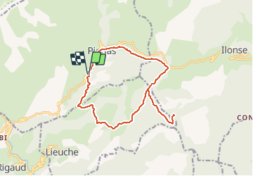
Trail On foot of 16.7 km to be discovered at Provence-Alpes-Côte d'Azur, Maritime Alps, Pierlas. This trail is proposed by domi06.
Description
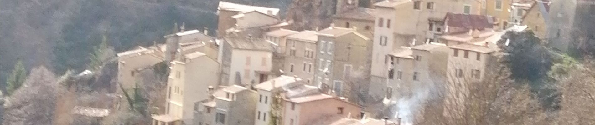
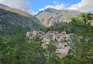
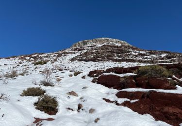
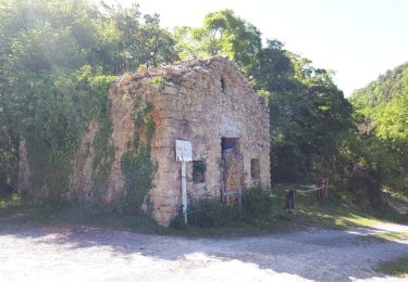
Un beau circuit peu pratiqué, le tour du Mont de Lieuche à partir du joli village de Pierlas situé sur le bassin versant de la vallée du Cians. Le départ se fera en dessous du village à la balise 112 (986m), cette route d'accès la D428, est très étroite et enchâssée dans des strates calcaire très particulières.
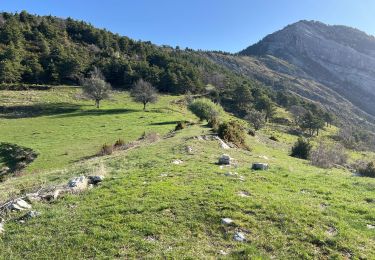
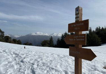
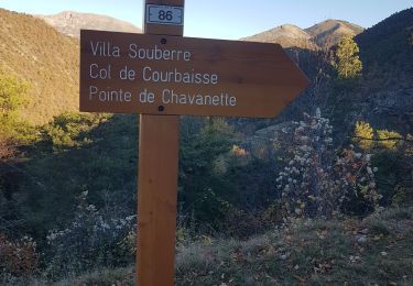
Après avoir franchi un ancien pont, la montée vers la crête de Pelau se fera par un versant escarpé jusqu'à 1183 m, de là descente au dessus des campagnes de Lieuche, au clot de Marre (1083 m), traverser l'ancien village de l'Arsilané. Remonter ensuite le vallon de St Pons, jusqu'au col éponyme (1457 m) pour atteindre la chapelle et admirer le point de vue.
Aller-retour jusqu'au brec d'Ilonse d’où la vue est encore plus belle (Tinée, Valdeblore et Mercantour).
Retour au col St Pons, puis traversée juqu'au col de la Sinne (1438 m), prendre le sentier en sous bois pour rejoindre le village de Pierelas (1100 m) où l'on pourra faire une pause découverte. Regagner ensuite le point de départ par quelques raccourcis en longeant la route sur 2 Km environ.
Positioning
Comments
Trails nearby
![Trail On foot Pierlas - Tour du Mont de Lieuche - Photo](https://media.geolcdn.com/t/375/260/21b88e85-708c-4489-9ada-9348a7269087.jpeg&format=jpg&maxdim=2)
![On foot On foot](https://static1.geolcdn.com/sitytour/trail-icons/100.png)
On foot
![](/images/other/stat-length.png)
![](https://static1.geolcdn.com/siteimages/upload/files/16400158638029165_repeat_loop_refresh_sync_direction_icon.png)
![Trail Walking Beuil - Gorges du Cians - AR sur les corniches - Photo](https://media.geolcdn.com/t/375/260/ext.jpg?maxdim=2&url=https%3A%2F%2Fservices.sitytrail.com%2FGeolivesWS%2FDownloadMedia.ashx%3FTrailID%3D348549%26Media%3Dfix__20140926113514.jpg)
![Walking Walking](https://static1.geolcdn.com/sitytour/trail-icons/101.png)
Walking
![](/images/other/stat-length.png)
![](https://static1.geolcdn.com/siteimages/upload/files/16400158638029165_repeat_loop_refresh_sync_direction_icon.png)
![Trail Walking Rigaud - Mairola de Rigaud, chapelles St Julien et St Sauveur - Photo](https://media.geolcdn.com/t/375/260/bfd975e4-5b26-4452-b5c4-4e8903bf1886.jpg&format=jpg&maxdim=2)
![Walking Walking](https://static1.geolcdn.com/sitytour/trail-icons/101.png)
Walking
![](/images/other/stat-length.png)
![](https://static1.geolcdn.com/siteimages/upload/files/16400158638029165_repeat_loop_refresh_sync_direction_icon.png)
![Trail Walking Thiéry - Brec d’ Ilonse - Photo](https://media.geolcdn.com/t/375/260/371e8790-f558-4bbf-8168-94a56f4b21b9.jpg&format=jpg&maxdim=2)
![Walking Walking](https://static1.geolcdn.com/sitytour/trail-icons/101.png)
Walking
![](/images/other/stat-length.png)
![](https://static1.geolcdn.com/siteimages/upload/files/16400158638029165_repeat_loop_refresh_sync_direction_icon.png)
![Trail Snowshoes Rigaud - Tête de Rigaud - Photo](https://media.geolcdn.com/t/375/260/2195a5b9-410c-4db3-8586-4f5db2113ca9.jpg&format=jpg&maxdim=2)
![Snowshoes Snowshoes](https://static1.geolcdn.com/sitytour/trail-icons/504.png)
Snowshoes
![](/images/other/stat-length.png)
![](https://static1.geolcdn.com/siteimages/upload/files/16400158638029165_repeat_loop_refresh_sync_direction_icon.png)
![Trail Snowshoes Ilonse - Lauvet d’Ilonse - Photo](https://media.geolcdn.com/t/375/260/27d6716b-7948-437f-a217-9ca86aa8eff9.jpg&format=jpg&maxdim=2)
![Snowshoes Snowshoes](https://static1.geolcdn.com/sitytour/trail-icons/504.png)
Snowshoes
![](/images/other/stat-length.png)
![](https://static1.geolcdn.com/siteimages/upload/files/16400158638029165_repeat_loop_refresh_sync_direction_icon.png)
![Trail Walking Thiéry - thiery Villa Soubere - Photo](https://media.geolcdn.com/t/375/260/152e54b1-7917-4f58-90c1-fbc432530c5c.jpg&format=jpg&maxdim=2)
![Walking Walking](https://static1.geolcdn.com/sitytour/trail-icons/101.png)
Walking
![](/images/other/stat-length.png)
![](https://static1.geolcdn.com/siteimages/upload/files/16400158638029165_repeat_loop_refresh_sync_direction_icon.png)
![Trail Walking Beuil - balcon sur les gorges du cians - Photo](https://media.geolcdn.com/t/375/260/fbada1da-e007-46e1-8b66-10b993ce8c89.jpg&format=jpg&maxdim=2)
![Walking Walking](https://static1.geolcdn.com/sitytour/trail-icons/101.png)
Walking
![](/images/other/stat-length.png)
![](https://static1.geolcdn.com/siteimages/upload/files/16400158638029165_repeat_loop_refresh_sync_direction_icon.png)
![Trail Walking Thiéry - Pointe de Chavanette Par chapelle Ste Madeleine/Thiery - Photo](https://media.geolcdn.com/t/375/260/bf4c4b25-1f2c-4c16-b282-1fd0acf4f8e0.jpg&format=jpg&maxdim=2)
![Walking Walking](https://static1.geolcdn.com/sitytour/trail-icons/101.png)
Walking
![](/images/other/stat-length.png)
![](https://static1.geolcdn.com/siteimages/upload/files/16400158638029165_repeat_loop_refresh_sync_direction_icon.png)