


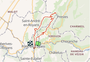

10.1 km | 22 km-effort

User


FREE GPS app for hiking
 SityTrail
IGN / Geographical institutes
SityTrail World
The world is yours!
Trail On foot of 15.5 km to be discovered at Auvergne-Rhône-Alpes, Isère, Pont-en-Royans. This trail is proposed by TOULAUDIN.
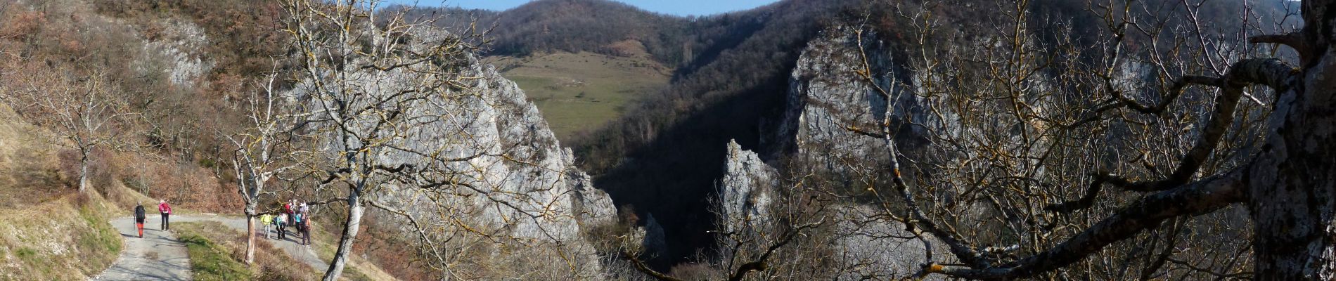
rando faite le 24/2/19 avec les Eisclops St Perollais au départ de Pont en Royans pas de difficultés mais assez long et partie route


Walking

Walking

Walking

Walking

Walking

Walking

Walking

Walking

Walking