Trail Walking Sainte-Geneviève-des-Bois - Pont des Templiers de Balizy - Photo
© OpenStreetMap contributors
Length
Length
13.3 km
Max alt
Max alt
88 m
Uphill gradient
Uphill gradient
112 m
Km-Effort
Km-Effort  
14.8 km
Min alt
Min alt
36 m
Downhill gradient
Downhill gradient
112 m
Boucle
Boucle
Yes
Creation date :
2020-02-28 18:50:07.517
Updated on :
2020-09-23 11:51:20.252

(0 Reviews)

Walking
Walking
3h20
Difficulty : Medium

Scan this QR Code to open this trail in the SityTrail application

FREE GPS app for hiking

Logo SityTrail SityTrail

IGN / Geographical institutes

Download SityTrail from the App Store Download SityTrail from Google Play

Logo SityTrail SityTrail World

The world is yours!

Download SityTrail from the App Store Download SityTrail from Google Play Download SityTrail on Huawei AppGallery

About

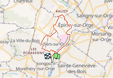
Trail Walking of 13.3 km to be discovered at Ile-de-France, Essonne, Sainte-Geneviève-des-Bois. This trail is proposed by dmatignon.

Description

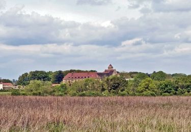
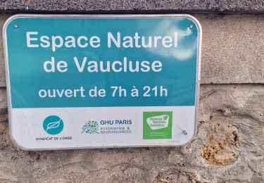
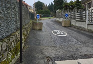
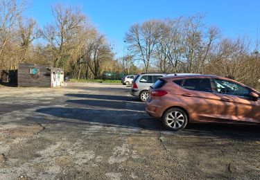
Randonnée permettant de découvrir un monument peu connu de l'Essonne. Ce pont, l'un des plus ancien d'Ile de France, a été bâti par les Templiers de la commanderie de Balisy (aujourd'hui disparue). Le lieu est magnifique.

Elevation profile

Positioning

Country:
France
Region :
Ile-de-France
Department/Province :
Essonne
Municipality :
Sainte-Geneviève-des-Bois
Location:
Unknown
Start:(UTM)
448346 ; 5388185 (31U) N.

Trails nearby

Trail Walking Ballainvilliers - GRP CV-IDF 2023 - Photo
Walking
clalaur

Walking

Very difficult
(1)
Ballainvilliers, Ile-de-France, Essonne, France
15.5 km | 19.1 km-effort
4h 20min
No
Trail Walking Marcoussis - Autour de Leuville sur Orge - Photo
Walking
tracegps

Walking

Medium
(1)
Marcoussis, Ile-de-France, Essonne, France
27 km | 32 km-effort
5h 30min
Yes
Trail Walking Saulx-les-Chartreux - Saulx les Chartreux vers Ville du Bois - Photo
Walking
tracegps

Walking

Medium
(1)
Saulx-les-Chartreux, Ile-de-France, Essonne, France
9.6 km | 12.2 km-effort
2h 30min
Yes
Trail Walking Brétigny-sur-Orge - Boucle Bretigny - Arpajon - Photo
Walking
GUIDE
chessyca

Walking

Difficult
Brétigny-sur-Orge, Ile-de-France, Essonne, France
30 km | 36 km-effort
6h 19min
Yes
Trail Walking Longjumeau - Boucle 23 km autour de Longjumeau - Photo
Walking
GUIDE
chessyca

Walking

Medium
Longjumeau, Ile-de-France, Essonne, France
23 km | 27 km-effort
4h 48min
Yes
Trail On foot Morsang-sur-Orge - Boucle 20 km Morsang sur Orge - Photo
On foot
GUIDE
chessyca

On foot

Easy
Morsang-sur-Orge, Ile-de-France, Essonne, France
20 km | 22 km-effort
5h 6min
Yes
Trail Walking Longpont-sur-Orge - SityTrail - Bassins du Carouge-Longpont sur Orge - Photo
Walking
albg

Walking

Medium
(1)
Longpont-sur-Orge, Ile-de-France, Essonne, France
9.3 km | 10.4 km-effort
2h 22min
Yes
Trail Walking Fleury-Mérogis - Fleury-Méfrogis - Forêt Régionale de Saint-Eutrope - Photo
Walking
guydu41

Walking

Easy
Fleury-Mérogis, Ile-de-France, Essonne, France
6.3 km | 7 km-effort
1h 35min
Yes
Trail Walking Longjumeau - Le pont des templiers  - Photo
Walking
c.chehere

Walking

Medium
Longjumeau, Ile-de-France, Essonne, France
15.4 km | 17.2 km-effort
3h 56min
Yes


Close
My subscriptions