Trail Nordic walking Wimereux - Le Mont Duez - Photo
© OpenStreetMap contributors
Length
Length
14.4 km
Max alt
Max alt
79 m
Uphill gradient
Uphill gradient
217 m
Km-Effort
Km-Effort  
17.3 km
Min alt
Min alt
5 m
Downhill gradient
Downhill gradient
217 m
Boucle
Boucle
Yes
Creation date :
2020-02-24 20:59:47.485
Updated on :
2022-02-05 13:08:08.641

(0 Reviews)

Nordic walking
Nordic walking
3h45
Difficulty : Difficult

Scan this QR Code to open this trail in the SityTrail application

FREE GPS app for hiking

Logo SityTrail SityTrail

IGN / Geographical institutes

Download SityTrail from the App Store Download SityTrail from Google Play

Logo SityTrail SityTrail World

The world is yours!

Download SityTrail from the App Store Download SityTrail from Google Play Download SityTrail on Huawei AppGallery

About

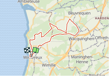
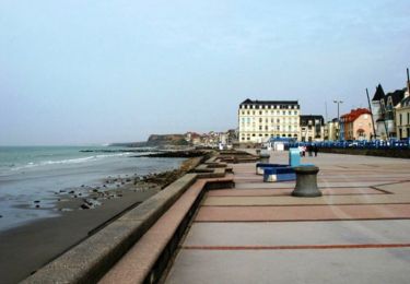
Trail Nordic walking of 14.4 km to be discovered at Hauts-de-France, Pas-de-Calais, Wimereux. This trail is proposed by denissculier.

Description

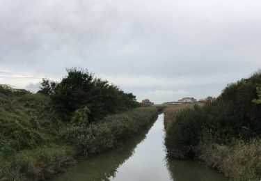
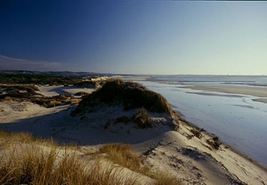
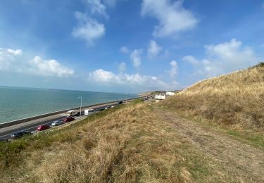
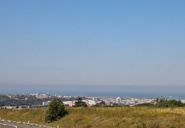
Le point culminant du Mont Duez (81 m) offre une magnifique vue sur la basse vallée de la Slack avec ses plans d’eau, ses prairies humides et ses dunes en toile de fond. Le sentier traverse des zones agricoles alternant cultures céréalières
et colza formant une palette de couleurs éclatantes au printemps.
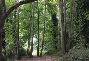
Les haies bocagères composées de prunelliers, sureaux, saules ou aubépines apportent le gîte et le couvert à de nombreux passereaux, qui accompagneront mélodieusement votre balade.

Elevation profile

Positioning

Country:
France
Region :
Hauts-de-France
Department/Province :
Pas-de-Calais
Municipality :
Wimereux
Location:
Unknown
Start:(UTM)
402056 ; 5625158 (31U) N.

Trails nearby

Trail Walking Wimereux - Promenade des Dunes de la Slack - Photo
Walking
GUIDE
Desrumaux

Walking

Very easy
(9)
Wimereux, Hauts-de-France, Pas-de-Calais, France
6 km | 6.8 km-effort
1h 30min
Yes
Trail Walking Wimille - Balade sur le sentier du Denacre - Photo
Walking
GUIDE
Desrumaux

Walking

Very easy
(4)
Wimille, Hauts-de-France, Pas-de-Calais, France
9.8 km | 11.4 km-effort
2h 30min
Yes
Trail Mountain bike Wimereux - Le littoral de Wimereux à Etaples - Photo
Mountain bike
tracegps

Mountain bike

Medium
(1)
Wimereux, Hauts-de-France, Pas-de-Calais, France
35 km | 41 km-effort
3h 0min
No
Trail Walking Wimereux - Wimereux - La Crèche - Photo
Walking
tracegps

Walking

Medium
(4)
Wimereux, Hauts-de-France, Pas-de-Calais, France
9.3 km | 11.4 km-effort
2h 15min
Yes
Trail Walking Boulogne-sur-Mer - Boulogne sur mer- street art partiel  - Photo
Walking
GUIDE
blechanteur

Walking

Easy
Boulogne-sur-Mer, Hauts-de-France, Pas-de-Calais, France
4.9 km | 6 km-effort
1h 22min
No
Trail Walking Wimereux - Boulogne-wimereux entre mer et terre  - Photo
Walking
GUIDE
blechanteur

Walking

Easy
Wimereux, Hauts-de-France, Pas-de-Calais, France
10.3 km | 12.5 km-effort
2h 42min
Yes
Trail Walking Wimereux - Wimereux Boulogne - Photo
Walking
FOUCAULT

Walking

Wimereux, Hauts-de-France, Pas-de-Calais, France
8.1 km | 10.1 km-effort
2h 35min
Yes
Trail Walking Saint-Martin-Boulogne - Sentier de la Colonne - Saint Martin Boulogne - Photo
Walking
tracegps

Walking

Easy
Saint-Martin-Boulogne, Hauts-de-France, Pas-de-Calais, France
8.7 km | 10.8 km-effort
2h 0min
Yes
Trail Walking Wimereux - GR Littoral Wimereux Audresselles - Photo
Walking
michelelfn

Walking

Easy
(2)
Wimereux, Hauts-de-France, Pas-de-Calais, France
17.1 km | 19 km-effort
4h 14min
Yes


Close
My subscriptions