


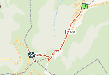

18.8 km | 28 km-effort


User


FREE GPS app for hiking
 SityTrail
IGN / Geographical institutes
SityTrail World
The world is yours!
Trail Walking of 5.2 km to be discovered at Auvergne-Rhône-Alpes, Cantal, Lavigerie. This trail is proposed by jcc24.
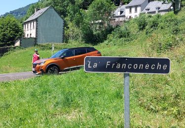
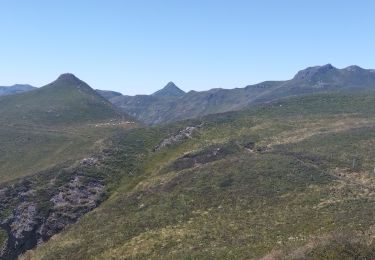
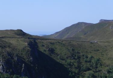
Marche familiale facile du parking du col de Serre, jusqu'au sommet du Puy Mary, en passant par le Pas de Peyrol. Réalisée en hiver, un partie longe la route qui est fermée à la circulation automobile car enneigée. En été il est possible de rester sur le GR4-GR400.
Walking

Walking

Walking

Walking

Walking
Walking
Walking
Trail
On foot