![](/images/other/stat-length.png)
![Trail Mountain bike Chazey-Bons - Marignieu St champs Musin - Photo](https://media.geolcdn.com/t/1900/400/ext.pjpeg?maxdim=2&url=https%3A%2F%2Fstatic1.geolcdn.com%2Fsiteimages%2Fupload%2Ffiles%2F1524743154velo.jpg)
Marignieu St champs Musin
sandrine-s01
User
![Length](/images/other/stat-length.png)
Length
29 km
![Max alt](https://static1.geolcdn.com/siteimages/upload/files/1508320355ic_sort_altitude_max_24dp.png)
Max alt
417 m
![Uphill gradient](https://static1.geolcdn.com/siteimages/upload/files/1508320355ic_sort_den_pos_24dp.png)
Uphill gradient
631 m
![Km-Effort](/images/other/stat-length.png)
Km-Effort
37 km
![Min alt](https://static1.geolcdn.com/siteimages/upload/files/1508320355ic_sort_altitude_min_24dp.png)
Min alt
228 m
![Downhill gradient](https://static1.geolcdn.com/siteimages/upload/files/1508320355ic_sort_den_neg_24dp.png)
Downhill gradient
591 m
![Boucle](https://static1.geolcdn.com/siteimages/upload/files/16400158638029165_repeat_loop_refresh_sync_direction_icon.png)
Boucle
No
Creation date :
2020-02-23 13:28:32.0
Updated on :
2020-02-23 16:05:38.624
![Mountain bike](https://static1.geolcdn.com/sitytour/trail-icons/202.png)
2h35
Difficulty : Difficult
![Scan this QR Code to open this trail in the SityTrail application](https://capi.geolives.com/qq0zvz2zws4bq2lad0pu/sitytour/trails/2344087/qr.png?size=200)
FREE GPS app for hiking
About
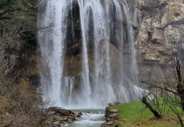
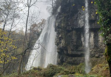
Trail Mountain bike of 29 km to be discovered at Auvergne-Rhône-Alpes, Ain, Chazey-Bons. This trail is proposed by sandrine-s01.
Description
Full Elec avec Laurent
Le passage sous la falaise et a évité.
Chemin dans l’épingle raté
Positioning
Country:
France
Region :
Auvergne-Rhône-Alpes
Department/Province :
Ain
Municipality :
Chazey-Bons
Location:
Unknown
Start:(Dec)
Start:(UTM)
707384 ; 5075263 (31T) N.
Comments
Trails nearby
![Trail Mountain bike Cuzieu - Chazey-Bons/ Vongnes - Photo](https://media.geolcdn.com/t/375/260/ext.jpg?maxdim=2&url=https%3A%2F%2Fstatic1.geolcdn.com%2Fsiteimages%2Fupload%2Ffiles%2F1524743154velo.jpg)
![Mountain bike Mountain bike](https://static1.geolcdn.com/sitytour/trail-icons/202.png)
Chazey-Bons/ Vongnes
Mountain bike
Medium
(1)
Cuzieu,
Auvergne-Rhône-Alpes,
Ain,
France
![](/images/other/stat-length.png)
16.4 km | 21 km-effort
2h 5min
![](https://static1.geolcdn.com/siteimages/upload/files/16400158638029165_repeat_loop_refresh_sync_direction_icon.png)
Yes
![Trail Mountain bike Andert-et-Condon - Boucle sous Gevrin - Photo](https://media.geolcdn.com/t/375/260/ext.jpg?maxdim=2&url=https%3A%2F%2Fstatic1.geolcdn.com%2Fsiteimages%2Fupload%2Ffiles%2F1524743154velo.jpg)
![Mountain bike Mountain bike](https://static1.geolcdn.com/sitytour/trail-icons/202.png)
Boucle sous Gevrin
Mountain bike
Easy
(1)
Andert-et-Condon,
Auvergne-Rhône-Alpes,
Ain,
France
![](/images/other/stat-length.png)
13.1 km | 17.1 km-effort
1h 1min
![](https://static1.geolcdn.com/siteimages/upload/files/16400158638029165_repeat_loop_refresh_sync_direction_icon.png)
Yes
![Trail Walking Virieu-le-Grand - virieu - Cascades de Dard - Photo](https://media.geolcdn.com/t/375/260/6cf5f770-e354-4589-b527-8e016bcd4eb8.jpg&format=jpg&maxdim=2)
![Walking Walking](https://static1.geolcdn.com/sitytour/trail-icons/101.png)
virieu - Cascades de Dard
Walking
Medium
(3)
Virieu-le-Grand,
Auvergne-Rhône-Alpes,
Ain,
France
![](/images/other/stat-length.png)
9.2 km | 11.9 km-effort
3h 53min
![](https://static1.geolcdn.com/siteimages/upload/files/16400158638029165_repeat_loop_refresh_sync_direction_icon.png)
Yes
![Trail Mountain bike Saint-Germain-les-Paroisses - 6-5-15 - Photo](https://media.geolcdn.com/t/375/260/ext.jpg?maxdim=2&url=https%3A%2F%2Fstatic1.geolcdn.com%2Fsiteimages%2Fupload%2Ffiles%2F1524743154velo.jpg)
![Mountain bike Mountain bike](https://static1.geolcdn.com/sitytour/trail-icons/202.png)
6-5-15
Mountain bike
Very easy
(1)
Saint-Germain-les-Paroisses,
Auvergne-Rhône-Alpes,
Ain,
France
![](/images/other/stat-length.png)
25 km | 37 km-effort
2h 57min
![](https://static1.geolcdn.com/siteimages/upload/files/16400158638029165_repeat_loop_refresh_sync_direction_icon.png)
Yes
![Trail Mountain bike Andert-et-Condon - Recherche suite chemin du dimanche vers Gramont - Photo](https://media.geolcdn.com/t/375/260/d41da1d3-b810-4024-b7a2-cd2c7e0101ba.jpg&format=jpg&maxdim=2)
![Mountain bike Mountain bike](https://static1.geolcdn.com/sitytour/trail-icons/202.png)
Recherche suite chemin du dimanche vers Gramont
Mountain bike
Very difficult
Andert-et-Condon,
Auvergne-Rhône-Alpes,
Ain,
France
![](/images/other/stat-length.png)
11.6 km | 16.6 km-effort
1h 7min
![](https://static1.geolcdn.com/siteimages/upload/files/16400158638029165_repeat_loop_refresh_sync_direction_icon.png)
Yes
![Trail Mountain bike Andert-et-Condon - Sous Gevrin et Veript - Photo](https://media.geolcdn.com/t/375/260/4d4e91d3-2188-41e8-88ef-ba46cc370e52.jpg&format=jpg&maxdim=2)
![Mountain bike Mountain bike](https://static1.geolcdn.com/sitytour/trail-icons/202.png)
Sous Gevrin et Veript
Mountain bike
Medium
Andert-et-Condon,
Auvergne-Rhône-Alpes,
Ain,
France
![](/images/other/stat-length.png)
16.7 km | 22 km-effort
1h 28min
![](https://static1.geolcdn.com/siteimages/upload/files/16400158638029165_repeat_loop_refresh_sync_direction_icon.png)
No
![Trail Walking Cheignieu-la-Balme - cascade de DARD - Photo](https://media.geolcdn.com/t/375/260/9ead54f0-e619-48e4-af16-cbea0eb6a317.jpg&format=jpg&maxdim=2)
![Walking Walking](https://static1.geolcdn.com/sitytour/trail-icons/101.png)
cascade de DARD
Walking
Very easy
Cheignieu-la-Balme,
Auvergne-Rhône-Alpes,
Ain,
France
![](/images/other/stat-length.png)
25 km | 34 km-effort
1h 32min
![](https://static1.geolcdn.com/siteimages/upload/files/16400158638029165_repeat_loop_refresh_sync_direction_icon.png)
No
![Trail Mountain bike Andert-et-Condon - Tour 4 - Photo](https://media.geolcdn.com/t/375/260/5962a690-6b6c-4a8d-80ae-f0e2f032ab55.jpg&format=jpg&maxdim=2)
![Mountain bike Mountain bike](https://static1.geolcdn.com/sitytour/trail-icons/202.png)
Tour 4
Mountain bike
Medium
Andert-et-Condon,
Auvergne-Rhône-Alpes,
Ain,
France
![](/images/other/stat-length.png)
12.6 km | 16.4 km-effort
1h 6min
![](https://static1.geolcdn.com/siteimages/upload/files/16400158638029165_repeat_loop_refresh_sync_direction_icon.png)
Yes
![Trail Mountain bike Andert-et-Condon - Petite sortie vers Sainte Anne - Photo](https://media.geolcdn.com/t/375/260/cad95e1b-0d39-479c-90f6-a86e3dc264b0.jpg&format=jpg&maxdim=2)
![Mountain bike Mountain bike](https://static1.geolcdn.com/sitytour/trail-icons/202.png)
Petite sortie vers Sainte Anne
Mountain bike
Difficult
Andert-et-Condon,
Auvergne-Rhône-Alpes,
Ain,
France
![](/images/other/stat-length.png)
19.4 km | 26 km-effort
2h 50min
![](https://static1.geolcdn.com/siteimages/upload/files/16400158638029165_repeat_loop_refresh_sync_direction_icon.png)
Yes