


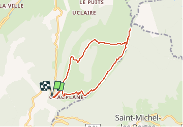

14.3 km | 31 km-effort

User


FREE GPS app for hiking
 SityTrail
IGN / Geographical institutes
SityTrail World
The world is yours!
Trail Walking of 7.9 km to be discovered at Auvergne-Rhône-Alpes, Isère, Gresse-en-Vercors. This trail is proposed by patjobou.
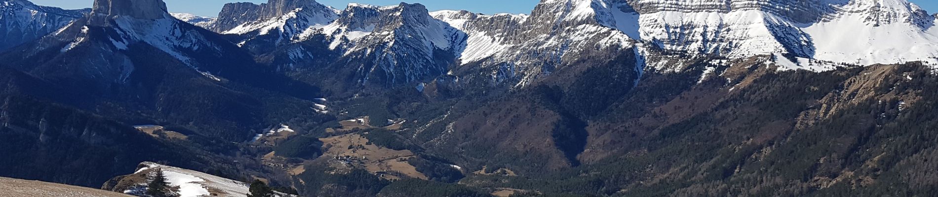
Edition 2020 des 'Rochers du Baconnet'. Cette année ce sera sans neige pour la première fois ! Descente droit dans la pente par une rare combe encore enneigée. Passage à travers les clairières et traversée du ruisseau sans problème à cette saison.


Walking

Walking

Walking

Walking

Walking

Walking

Walking

Walking

Walking