14.6 km | 26 km-effort
Les Anières-La Villette
guitounet83
User
Length
32 km
Max alt
1384 m
Uphill gradient
1295 m
Km-Effort
50 km
Min alt
580 m
Downhill gradient
1412 m
Boucle
No
Creation date :
2014-12-10 00:00:00.0
Updated on :
2014-12-10 00:00:00.0
6h06
Difficulty : Difficult
FREE GPS app for hiking
About
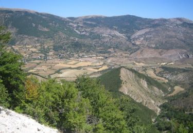
Trail Equestrian of 32 km to be discovered at Auvergne-Rhône-Alpes, Drôme, Montfroc. This trail is proposed by guitounet83.
Positioning
Country:
France
Region :
Auvergne-Rhône-Alpes
Department/Province :
Drôme
Municipality :
Montfroc
Location:
Unknown
Start:(Dec)
Start:(UTM)
710546 ; 4895341 (31T) N.
Comments
Trails nearby
Les Chaux - Curel
Running
Difficult
Curel,
Provence-Alpes-Côte d'Azur,
Alpes-de-Haute-Provence,
France
8.5 km | 16.2 km-effort
1h 21min
Yes
Les Chaux - Curel
Walking
Medium
Curel,
Provence-Alpes-Côte d'Azur,
Alpes-de-Haute-Provence,
France
8.5 km | 16.2 km-effort
2h 30min
Yes
La Montagne de Mare et le Pied du Mulet - Eourres
Walking
Difficult
Éourres,
Provence-Alpes-Côte d'Azur,
Hautes-Alpes,
France
14.8 km | 27 km-effort
6h 30min
Yes
t16315-MNT
Trail
Very difficult
Les Omergues,
Provence-Alpes-Côte d'Azur,
Alpes-de-Haute-Provence,
France
16.8 km | 27 km-effort
2h 30min
Yes
les Omergues à Montfroc
Walking
Easy
Les Omergues,
Provence-Alpes-Côte d'Azur,
Alpes-de-Haute-Provence,
France
84 km | 105 km-effort
6h 38min
No
Sommet de Larran (1379 m) - Les Omergues
Running
Difficult
Les Omergues,
Provence-Alpes-Côte d'Azur,
Alpes-de-Haute-Provence,
France
16.8 km | 27 km-effort
2h 30min
Yes
Randonnée 4/5 jours montagne de Lure
Mountain bike
Very difficult
Les Omergues,
Provence-Alpes-Côte d'Azur,
Alpes-de-Haute-Provence,
France
204 km | 285 km-effort
19h 47min
Yes
t16315-MNT
Trail
Difficult
Les Omergues,
Provence-Alpes-Côte d'Azur,
Alpes-de-Haute-Provence,
France
16.8 km | 27 km-effort
Unknown
Yes