![](/images/other/stat-length.png)
![Trail Walking Basse-Pointe - Boucle Habitations Gradis et Hackaert - Photo](https://media.geolcdn.com/t/1900/400/4cf0b191-d0be-4326-ab51-5e44c3c72511.jpg&format=pjpeg&maxdim=2)
Boucle Habitations Gradis et Hackaert
Lamartiniere
User GUIDE
![Length](/images/other/stat-length.png)
![Max alt](https://static1.geolcdn.com/siteimages/upload/files/1508320355ic_sort_altitude_max_24dp.png)
![Uphill gradient](https://static1.geolcdn.com/siteimages/upload/files/1508320355ic_sort_den_pos_24dp.png)
![Km-Effort](/images/other/stat-length.png)
![Min alt](https://static1.geolcdn.com/siteimages/upload/files/1508320355ic_sort_altitude_min_24dp.png)
![Downhill gradient](https://static1.geolcdn.com/siteimages/upload/files/1508320355ic_sort_den_neg_24dp.png)
![Boucle](https://static1.geolcdn.com/siteimages/upload/files/16400158638029165_repeat_loop_refresh_sync_direction_icon.png)
![Walking](https://static1.geolcdn.com/sitytour/trail-icons/101.png)
3h15
Difficulty : Medium
![Scan this QR Code to open this trail in the SityTrail application](https://capi.geolives.com/qq0zvz2zws4bq2lad0pu/sitytour/trails/2332350/qr.png?size=200)
FREE GPS app for hiking
About
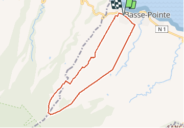
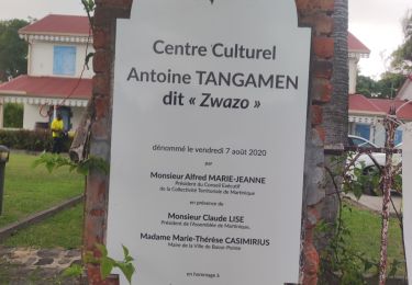
Trail Walking of 10.8 km to be discovered at Martinique, Unknown, Basse-Pointe. This trail is proposed by Lamartiniere.
Description
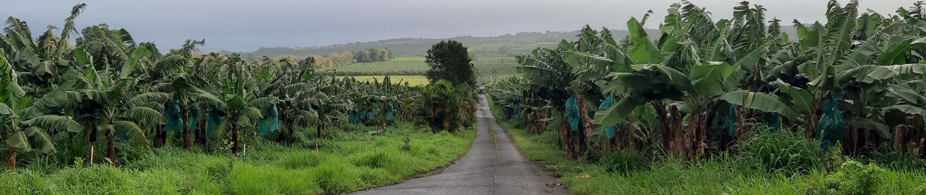
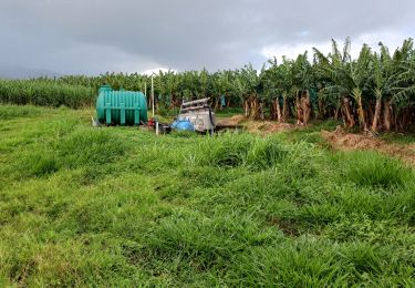
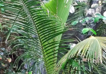
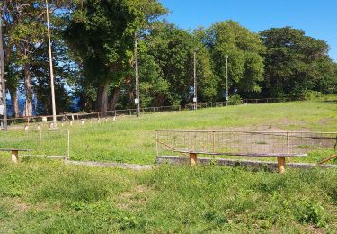
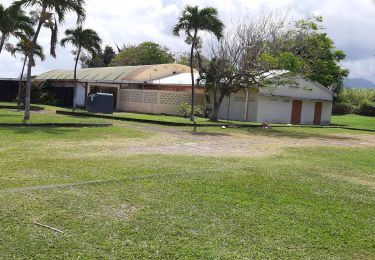
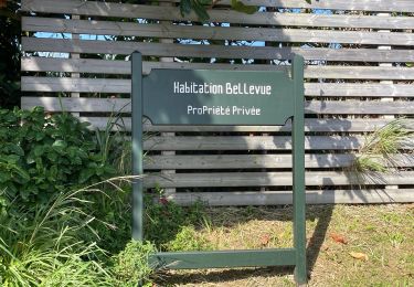
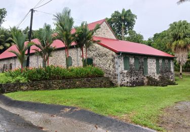
Cette randonnée nécessite deux autorisations de passages pour les habitations Gradis et Hackaert. Surtout, éviter de randonner en semaine pour ne pas perturber l'activité de ces exploitations agricoles. Très belle montée vers le bois Leyritz à partir du centre commercial d'AKR. Descente sur traces composées de pierre ponce à partir de Savane du Potiche sur la Commune de Macouba, sans oublier le quartier Hauteur Bourdon. Au niveau du champ de canne, passage à gué de la rivière Hackaert pour revenir sur le secteur de Basse-Pointe, en l'occurrence sur le Gros-Morne. Grande descente vers le centre Cial d'AKR pour l'arrivée. Très belle rando constituée de larges panoramas sur les secteurs environnants, les contreforts de la montagne Pelée puis les cultures variées. Vestiges de l'habitation Hackaert.
Positioning
Comments
Trails nearby
![Trail Walking L'Ajoupa-Bouillon - Cascade Dany - Photo](https://media.geolcdn.com/t/375/260/3f4633dd-5480-45ae-9d52-d53ad8f8f6d0.jpg&format=jpg&maxdim=2)
![Walking Walking](https://static1.geolcdn.com/sitytour/trail-icons/101.png)
Walking
![](/images/other/stat-length.png)
![](https://static1.geolcdn.com/siteimages/upload/files/16400158638029165_repeat_loop_refresh_sync_direction_icon.png)
![Trail Walking Basse-Pointe - Exploitations agricoles en boucle N°1 - Photo](https://media.geolcdn.com/t/375/260/25d4e89e-0741-47b9-9c1b-39c4a8472812.jpg&format=jpg&maxdim=2)
![Walking Walking](https://static1.geolcdn.com/sitytour/trail-icons/101.png)
Walking
![](/images/other/stat-length.png)
![](https://static1.geolcdn.com/siteimages/upload/files/16400158638029165_repeat_loop_refresh_sync_direction_icon.png)
![Trail Walking Basse-Pointe - Boucle de chalvet, Pécoule vers Chalvet. - Photo](https://media.geolcdn.com/t/375/260/1e4cabaa-63c0-46f7-b111-2c87348cf0ee.jpg&format=jpg&maxdim=2)
![Walking Walking](https://static1.geolcdn.com/sitytour/trail-icons/101.png)
Walking
![](/images/other/stat-length.png)
![](https://static1.geolcdn.com/siteimages/upload/files/16400158638029165_repeat_loop_refresh_sync_direction_icon.png)
![Trail Walking Basse-Pointe - Grande Boucle sur Basse pointe. - Photo](https://media.geolcdn.com/t/375/260/08174d61-6359-47a0-ac79-c9191649aa79.jpg&format=jpg&maxdim=2)
![Walking Walking](https://static1.geolcdn.com/sitytour/trail-icons/101.png)
Walking
![](/images/other/stat-length.png)
![](https://static1.geolcdn.com/siteimages/upload/files/16400158638029165_repeat_loop_refresh_sync_direction_icon.png)
![Trail Walking Basse-Pointe - Stèle Anse Chalvet - Boulodrome Basse-Pointe - Photo](https://media.geolcdn.com/t/375/260/4492c87a-6138-4e25-8023-ed3682547b8b.jpg&format=jpg&maxdim=2)
![Walking Walking](https://static1.geolcdn.com/sitytour/trail-icons/101.png)
Walking
![](/images/other/stat-length.png)
![](https://static1.geolcdn.com/siteimages/upload/files/16400158638029165_repeat_loop_refresh_sync_direction_icon.png)
![Trail Walking Basse-Pointe - Rondes des Habitations - Photo](https://media.geolcdn.com/t/375/260/5f89952c-65e5-4451-8506-589133283762.jpg&format=jpg&maxdim=2)
![Walking Walking](https://static1.geolcdn.com/sitytour/trail-icons/101.png)
Walking
![](/images/other/stat-length.png)
![](https://static1.geolcdn.com/siteimages/upload/files/16400158638029165_repeat_loop_refresh_sync_direction_icon.png)
![Trail sport Macouba - Boucle Macouba (habitation Bellevue) - Photo](https://media.geolcdn.com/t/375/260/3626c4e3-2e17-4d1d-84a9-6fddff1152eb.jpg&format=jpg&maxdim=2)
sport
![](/images/other/stat-length.png)
![](https://static1.geolcdn.com/siteimages/upload/files/16400158638029165_repeat_loop_refresh_sync_direction_icon.png)
![Trail Walking Macouba - Boucle Macouba 3 - Photo](https://media.geolcdn.com/t/375/260/3f6ece05-8d1d-40e9-a775-58018ef6d410.jpg&format=jpg&maxdim=2)
![Walking Walking](https://static1.geolcdn.com/sitytour/trail-icons/101.png)
Walking
![](/images/other/stat-length.png)
![](https://static1.geolcdn.com/siteimages/upload/files/16400158638029165_repeat_loop_refresh_sync_direction_icon.png)
![Trail Walking Le Lorrain - Rando des quartiers, Le Lorrain. - Photo](https://media.geolcdn.com/t/375/260/35f1c47d-981c-4d03-a2b7-a5ce668fde73.jpg&format=jpg&maxdim=2)
![Walking Walking](https://static1.geolcdn.com/sitytour/trail-icons/101.png)
Walking
![](/images/other/stat-length.png)
![](https://static1.geolcdn.com/siteimages/upload/files/16400158638029165_repeat_loop_refresh_sync_direction_icon.png)