Trail Horseback riding Saint-Bonnet-de-Chavagne - ff - Photo
© OpenStreetMap contributors
Length
Length
655 m
Max alt
Max alt
281 m
Uphill gradient
Uphill gradient
3 m
Km-Effort
Km-Effort  
721 m
Min alt
Min alt
264 m
Downhill gradient
Downhill gradient
11 m
Boucle
Boucle
No
Creation date :
2020-02-12 14:00:13.55
Updated on :
2020-02-12 14:26:57.906

(0 Reviews)

Horseback riding
Horseback riding
26m
Difficulty : Very easy

Scan this QR Code to open this trail in the SityTrail application

FREE GPS app for hiking

Logo SityTrail SityTrail

IGN / Geographical institutes

Download SityTrail from the App Store Download SityTrail from Google Play

Logo SityTrail SityTrail World

The world is yours!

Download SityTrail from the App Store Download SityTrail from Google Play Download SityTrail on Huawei AppGallery

About

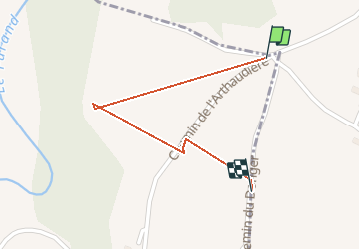
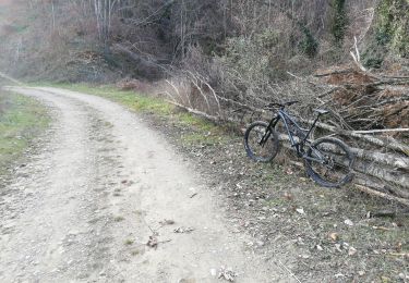
Trail Horseback riding of 655 m to be discovered at Auvergne-Rhône-Alpes, Isère, Saint-Bonnet-de-Chavagne. This trail is proposed by Lesliedoud.

Elevation profile

Positioning

Country:
France
Region :
Auvergne-Rhône-Alpes
Department/Province :
Isère
Municipality :
Saint-Bonnet-de-Chavagne
Location:
Unknown
Start:(UTM)
677347 ; 4999666 (31T) N.

Trails nearby

Trail Walking Saint-Lattier - 2013_07_14 St-Lattier - Rallye - Photo
Walking
Sigmut

Walking

Medium
(1)
Saint-Lattier, Auvergne-Rhône-Alpes, Isère, France
12.1 km | 16.5 km-effort
3h 34min
Yes
Trail Mountain bike Chatte - De Chatte à St Antoine en passant par Chevrière - Photo
Mountain bike
gilder89

Mountain bike

Very difficult
(1)
Chatte, Auvergne-Rhône-Alpes, Isère, France
44 km | 60 km-effort
3h 53min
Yes
Trail Road bike Chatte - chatte2 - Photo
Road bike
BELLETGE

Road bike

Very easy
(1)
Chatte, Auvergne-Rhône-Alpes, Isère, France
57 km | 71 km-effort
3h 18min
Yes
Trail Walking Saint-Lattier - Saint Lattier village  - Photo
Walking
meillon

Walking

Easy
Saint-Lattier, Auvergne-Rhône-Alpes, Isère, France
9.4 km | 12.1 km-effort
2h 38min
Yes
Trail Mountain bike Chatte - chemin du tram part1 - Photo
Mountain bike
Julien Rodriguez

Mountain bike

Very easy
Chatte, Auvergne-Rhône-Alpes, Isère, France
11.4 km | 14.1 km-effort
1h 16min
Yes
Trail Mountain bike Chatte - grp st Marcellin st Antoine  - Photo
Mountain bike
lpascal

Mountain bike

Very difficult
Chatte, Auvergne-Rhône-Alpes, Isère, France
99 km | 133 km-effort
9h 12min
No
Trail Walking Saint-Bonnet-de-Chavagne - Chateau de l Arthaudiere  - Photo
Walking
meillon

Walking

Easy
Saint-Bonnet-de-Chavagne, Auvergne-Rhône-Alpes, Isère, France
8.7 km | 11.2 km-effort
2h 44min
Yes
Trail Walking Chatte - CHATTE - Photo
Walking
000151.528cee2ba5ea499bb7720e62b4a3eb52.0056

Walking

Difficult
Chatte, Auvergne-Rhône-Alpes, Isère, France
10.6 km | 12.1 km-effort
1h 42min
Yes
Trail Walking Chatte - Chatte - Photo
Walking
000151.528cee2ba5ea499bb7720e62b4a3eb52.0056

Walking

Medium
Chatte, Auvergne-Rhône-Alpes, Isère, France
10.2 km | 11.9 km-effort
1h 41min
Yes


Close
My subscriptions