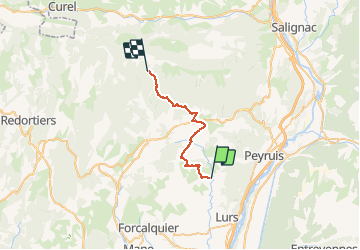
Trail Horseback riding Sigonce - Chemins secrets H-P ( Près Giraud - Gite des Crêtes de Lure) - Photo

Chemins secrets H-P ( Près Giraud - Gite des Crêtes de Lure)

© OpenStreetMap contributors
Length
Length
25 km
Max alt
Max alt
1579 m
Uphill gradient
Uphill gradient
1377 m
Km-Effort
Km-Effort  
39 km
Min alt
Min alt
488 m
Downhill gradient
Downhill gradient
292 m
Boucle
Boucle
No
Creation date :
2020-02-11 09:28:54.727
Updated on :
2020-10-31 19:47:50.053

(0 Reviews)

Horseback riding
Horseback riding
4h57
Difficulty : Difficult

Scan this QR Code to open this trail in the SityTrail application

FREE GPS app for hiking

Logo SityTrail SityTrail

IGN / Geographical institutes

Download SityTrail from the App Store Download SityTrail from Google Play

Logo SityTrail SityTrail World

The world is yours!

Download SityTrail from the App Store Download SityTrail from Google Play Download SityTrail on Huawei AppGallery

About

Trail Horseback riding of 25 km to be discovered at Provence-Alpes-Côte d'Azur, Alpes-de-Haute-Provence, Sigonce. This trail is proposed by les granges.

Description

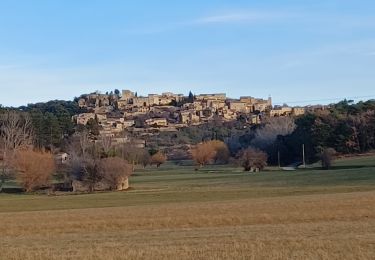
Blache - Cruis - Jas Roche - Chapelle ND Lure - Station de Ski

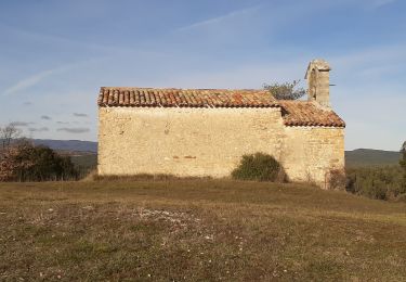
Gite des Crêtes de Lure 0492731914
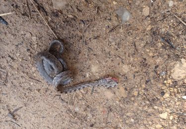
Elevation profile

Photos

Points of interest

Point of interest Saint-Étienne-les-Orgues - Passage accidenter  - Photo
les granges
SAINT-ÉTIENNE-LES-ORGUES 
Point of interest Saint-Étienne-les-Orgues - Fontaine de Morteiron - Photo
les granges
SAINT-ÉTIENNE-LES-ORGUES 
Point of interest Cruis - Point d'eau + pique-nique  - Photo
les granges
Point of interest Montlaux - Rivière du Lauzon - Photo
les granges
Point of interest Montlaux - Branches basses - Photo
les granges
MONTLAUX 
Point of interest Revest-Saint-Martin - Problème avec parcs à moton - Photo
les granges
REVEST-SAINT-MARTIN 
Point of interest Revest-Saint-Martin - Magnifique hamau de la Blache - Photo
les granges
REVEST-SAINT-MARTIN 

Positioning

Country:
France
Region :
Provence-Alpes-Côte d'Azur
Department/Province :
Alpes-de-Haute-Provence
Municipality :
Sigonce
Location:
Unknown
Start:(UTM)
729879 ; 4876681 (31T) N.

Trails nearby

Trail Walking Ganagobie - Plateau de Ganagobie - Photo
Walking
tracegps

Walking

Medium
(2)
Ganagobie, Provence-Alpes-Côte d'Azur, Alpes-de-Haute-Provence, France
7.6 km | 10.9 km-effort
3h 0min
Yes
Trail Mountain bike Lurs - Lurs/Tour de la Beaume - Photo
Mountain bike
remizzi

Mountain bike

Medium
(2)
Lurs, Provence-Alpes-Côte d'Azur, Alpes-de-Haute-Provence, France
18.5 km | 24 km-effort
2h 40min
Yes
Trail Walking Montlaux - montlaux.lablache - Photo
Walking
Roger

Walking

Medium
Montlaux, Provence-Alpes-Côte d'Azur, Alpes-de-Haute-Provence, France
8.4 km | 11.8 km-effort
3h 6min
Yes
Trail Walking Ganagobie - 2024-02-27 Ganagobie  - Photo
Walking
GUIDE
Kargil

Walking

Easy
Ganagobie, Provence-Alpes-Côte d'Azur, Alpes-de-Haute-Provence, France
10.2 km | 15.1 km-effort
3h 25min
Yes
Trail Walking Revest-Saint-Martin - Le revest 04.la  blache 04 - Photo
Walking
Roger

Walking

Very easy
Revest-Saint-Martin, Provence-Alpes-Côte d'Azur, Alpes-de-Haute-Provence, France
4.5 km | 5.5 km-effort
2h 8min
Yes
Trail Walking Lurs - lurs à pierrerue.  Le chemin de compostelle  - Photo
Walking
Roger

Walking

Medium
Lurs, Provence-Alpes-Côte d'Azur, Alpes-de-Haute-Provence, France
8.8 km | 11.2 km-effort
2h 32min
Yes
Trail On foot Ganagobie - PR - Photo
On foot
GUIDE+

On foot

Easy
Ganagobie, Provence-Alpes-Côte d'Azur, Alpes-de-Haute-Provence, France
3.6 km | 5.8 km-effort
1h 19min
No
Trail On foot Ganagobie - La Forêt du Prieuré - Photo
On foot
GUIDE+

On foot

Easy
Ganagobie, Provence-Alpes-Côte d'Azur, Alpes-de-Haute-Provence, France
10.2 km | 15.3 km-effort
3h 28min
No
Trail Walking Lurs - ganagobie - Photo
Walking
MicDul

Walking

Very difficult
Lurs, Provence-Alpes-Côte d'Azur, Alpes-de-Haute-Provence, France
15.9 km | 23 km-effort
5h 17min
Yes


Close
My subscriptions