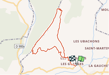
Trail Walking Marcoux - MARCOUX . Cretes de Liman o - Photo
© OpenStreetMap contributors
Length
Length
9.9 km
Max alt
Max alt
1239 m
Uphill gradient
Uphill gradient
598 m
Km-Effort
Km-Effort  
17.9 km
Min alt
Min alt
667 m
Downhill gradient
Downhill gradient
598 m
Boucle
Boucle
Yes
Creation date :
2020-02-10 08:17:41.33
Updated on :
2020-02-10 20:17:57.745

(0 Reviews)

Walking
Walking
6h10
Difficulty : Difficult

Scan this QR Code to open this trail in the SityTrail application

FREE GPS app for hiking

Logo SityTrail SityTrail

IGN / Geographical institutes

Download SityTrail from the App Store Download SityTrail from Google Play

Logo SityTrail SityTrail World

The world is yours!

Download SityTrail from the App Store Download SityTrail from Google Play Download SityTrail on Huawei AppGallery

About

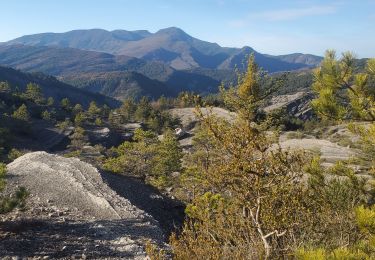
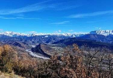
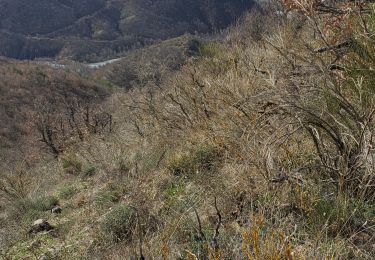
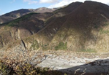
Trail Walking of 9.9 km to be discovered at Provence-Alpes-Côte d'Azur, Alpes-de-Haute-Provence, Marcoux. This trail is proposed by RobinMicheline.

Description

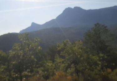
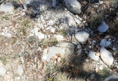
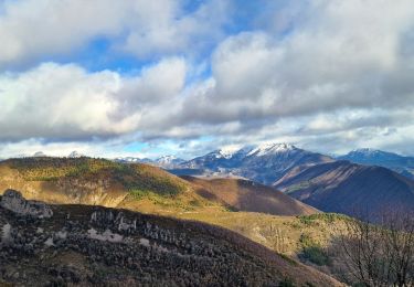
Bien indiquer , ne pas faire sous grosse chaleur , montee un peu raide , belle vue sommet des 2 vallees , ne pas faire par temps humide grosses pierres glissantes

Elevation profile

Positioning

Country:
France
Region :
Provence-Alpes-Côte d'Azur
Department/Province :
Alpes-de-Haute-Provence
Municipality :
Marcoux
Location:
Unknown
Start:(UTM)
281623 ; 4890391 (32T) N.

Trails nearby

Trail Walking Marcoux - Marcoux crete de liman 950m 15kms  - Photo
Walking
GUIDE
Danielba

Walking

Medium
Marcoux, Provence-Alpes-Côte d'Azur, Alpes-de-Haute-Provence, France
14.7 km | 25 km-effort
7h 31min
No
Trail On foot Marcoux - La Crête de Liman - Photo
On foot
GUIDE+

On foot

Easy
Marcoux, Provence-Alpes-Côte d'Azur, Alpes-de-Haute-Provence, France
10 km | 18.5 km-effort
4h 12min
No
Trail Walking Marcoux - DIGNE . LES ROBINES DU BANASTRE  n ol - Photo
Walking
RobinMicheline

Walking

Easy
Marcoux, Provence-Alpes-Côte d'Azur, Alpes-de-Haute-Provence, France
11.4 km | 17.2 km-effort
3h 27min
Yes
Trail Walking Le Brusquet - LE MOUSTEIRET. Ruine Chalvet .Col de l Escuichiere . Le Villard o m s  - Photo
Walking
RobinMicheline

Walking

Medium
Le Brusquet, Provence-Alpes-Côte d'Azur, Alpes-de-Haute-Provence, France
10.1 km | 17.3 km-effort
3h 25min
Yes
Trail Mountain bike Digne-les-Bains - La dalle aux Ammonites - Digne-les-Bains  - Photo
Mountain bike
tracegps

Mountain bike

Very difficult
Digne-les-Bains, Provence-Alpes-Côte d'Azur, Alpes-de-Haute-Provence, France
23 km | 37 km-effort
3h 30min
Yes
Trail Running Digne-les-Bains - Caguerenard et la Baisse de Blanchard - Digne-les-Bains - Photo
Running
tracegps

Running

Difficult
Digne-les-Bains, Provence-Alpes-Côte d'Azur, Alpes-de-Haute-Provence, France
10.4 km | 16.6 km-effort
1h 19min
Yes
Trail Walking Digne-les-Bains - Caguerenard et la Baisse de Blanchard - Digne-les-Bains - Photo
Walking
tracegps

Walking

Difficult
Digne-les-Bains, Provence-Alpes-Côte d'Azur, Alpes-de-Haute-Provence, France
10.4 km | 16.6 km-effort
3h 0min
Yes
Trail Walking La Robine-sur-Galabre - L’Ichtyosaure  - Photo
Walking
MarcVachet

Walking

Easy
La Robine-sur-Galabre, Provence-Alpes-Côte d'Azur, Alpes-de-Haute-Provence, France
4.1 km | 6.5 km-effort
1h 33min
Yes
Trail Nordic walking Digne-les-Bains - Digne-les-Bains / landran - Photo
Nordic walking
Claudiu

Nordic walking

Medium
Digne-les-Bains, Provence-Alpes-Côte d'Azur, Alpes-de-Haute-Provence, France
10 km | 18.3 km-effort
2h 54min
No


Close
My subscriptions