


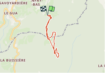


10.9 km | 26 km-effort

User


FREE GPS app for hiking
 SityTrail
IGN / Geographical institutes
SityTrail World
The world is yours!
Trail Walking of 3.2 km to be discovered at Auvergne-Rhône-Alpes, Isère, Proveysieux. This trail is proposed by crocau.


32 photos in total. Please click on a photo to see them all in the gallery.

Walking

Walking

Walking

Walking

Walking

Walking

Touring skiing

Walking

Touring skiing
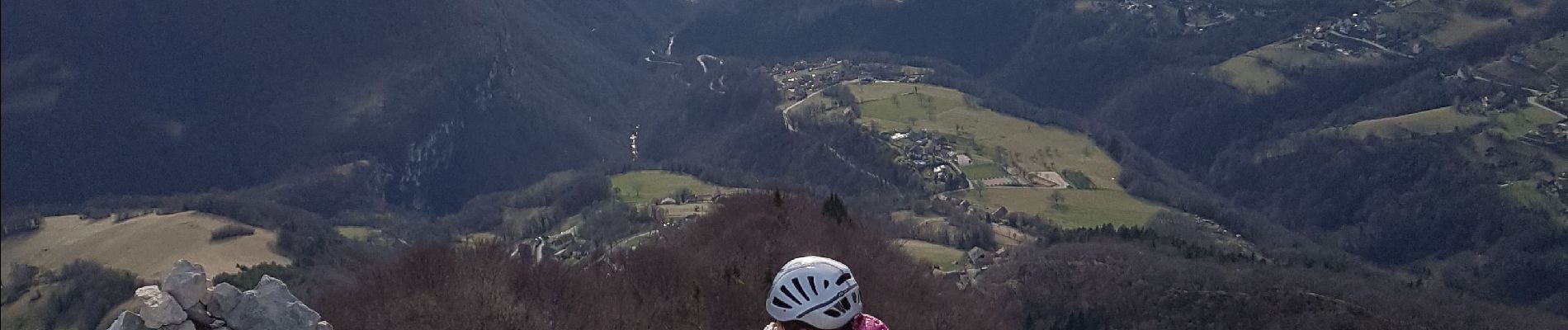
chemin très boueux en hiver mais du monde sur le chemin. spectacle hors norme depuis l'aiguille