Trail Walking Le Coudray-Saint-Germer - Les Routis - Lalandelle MCP - Photo

Les Routis - Lalandelle MCP

© OpenStreetMap contributors
Length
Length
9.6 km
Max alt
Max alt
224 m
Uphill gradient
Uphill gradient
161 m
Km-Effort
Km-Effort  
11.7 km
Min alt
Min alt
143 m
Downhill gradient
Downhill gradient
162 m
Boucle
Boucle
Yes
Creation date :
2020-02-04 12:59:25.778
Updated on :
2020-02-05 09:36:14.923

(0 Reviews)

Walking
Walking
2h44
Difficulty : Medium

Scan this QR Code to open this trail in the SityTrail application

FREE GPS app for hiking

Logo SityTrail SityTrail

IGN / Geographical institutes

Download SityTrail from the App Store Download SityTrail from Google Play

Logo SityTrail SityTrail World

The world is yours!

Download SityTrail from the App Store Download SityTrail from Google Play Download SityTrail on Huawei AppGallery

About

Trail Walking of 9.6 km to be discovered at Hauts-de-France, Oise, Le Coudray-Saint-Germer. This trail is proposed by Marie-Claire-mcp.

Description

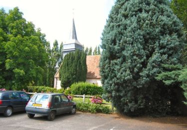
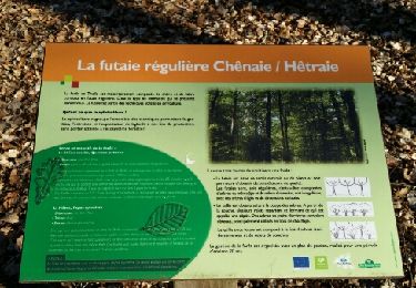
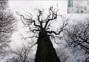
Départ du village des Routis (Coudray Saint Germer), Prendre le chemin au bout du village direction Bois du Coudray, un ruisseau coule le long du chemin. puis tout droit, continuer après le carrefour du Coudray. Plus loin, le chemin bifurque légèrement sur la gauche, on se retrouve en plaine et avant le village de Lalandelle, on tourne à droite pour se retrouver dans le bois. Continuer dans le bois jusqu'au carrefour de la route de l'eclat et route de gisors, tourner à droite. Au bout tourner à gauche par un beau cheminpour se retrouver au carrefour des sapins. Ensuite remonter en longeant l'herbage jusqu'au chemin par lequel on est descendu. Une belle randonnée en forêt, plus agréable au printemps ou en été qu'en hiver.

Elevation profile

Positioning

Country:
France
Region :
Hauts-de-France
Department/Province :
Oise
Municipality :
Le Coudray-Saint-Germer
Location:
Unknown
Start:(UTM)
415019 ; 5471783 (31U) N.

Trails nearby

Trail Walking Flavacourt - Flavacourt - Vexin Français - Photo
Walking
tracegps

Walking

Medium
(1)
Flavacourt, Hauts-de-France, Oise, France
28 km | 33 km-effort
5h 30min
Yes
Trail Walking Le Coudray-Saint-Germer - Les Routis La petite Landelle  - Photo
Walking
Marie-Claire-mcp

Walking

Medium
Le Coudray-Saint-Germer, Hauts-de-France, Oise, France
9.9 km | 12.1 km-effort
1h 59min
Yes
Trail Walking Sérifontaine - Sérifontaine - ferme de Champignolle - le grand chêne var 2 - Photo
Walking
marcel.F

Walking

Easy
Sérifontaine, Hauts-de-France, Oise, France
10 km | 12 km-effort
2h 21min
Yes
Trail Walking Lalande-en-Son - Lalande en son, le fil - Photo
Walking
Marie-Claire-mcp

Walking

Medium
Lalande-en-Son, Hauts-de-France, Oise, France
7.9 km | 9.6 km-effort
2h 10min
Yes
Trail Walking Lalandelle - Lalandelle - La boutonnière du pays de Bray - Photo
Walking
Marie-Claire-mcp

Walking

Difficult
Lalandelle, Hauts-de-France, Oise, France
10.4 km | 12.5 km-effort
2h 50min
Yes
Trail Walking Lalande-en-Son - Lalande en son - La sente des landes par Le Fil 8.3 km - Photo
Walking
Marie-Claire-mcp

Walking

Medium
Lalande-en-Son, Hauts-de-France, Oise, France
8.3 km | 10.1 km-effort
2h 17min
Yes
Trail Walking Lalande-en-Son - Lalande en Son - La sente des landes - Photo
Walking
Marie-Claire-mcp

Walking

Difficult
Lalande-en-Son, Hauts-de-France, Oise, France
11.1 km | 13.9 km-effort
3h 9min
Yes
Trail Walking Le Coudray-Saint-Germer - Les Routis - Forêt Domaniale de Thelle - Photo
Walking
Marie-Claire-mcp

Walking

Medium
Le Coudray-Saint-Germer, Hauts-de-France, Oise, France
8.2 km | 9.8 km-effort
2h 13min
Yes
Trail Walking Lalandelle - Forêt domaniale de Thelle à partir de Lalandelle - Photo
Walking
Marie-Claire-mcp

Walking

Difficult
Lalandelle, Hauts-de-France, Oise, France
11 km | 13.1 km-effort
2h 59min
Yes


Close
My subscriptions