


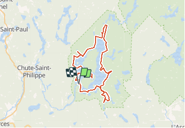
Lac Kiamika

DaVinci
User

Length
62 km

Max alt
280 m

Uphill gradient
17 m
Km-Effort
62 km

Min alt
265 m

Downhill gradient
17 m
Boucle
Yes
Creation date :
2020-02-04 18:40:07.4
Updated on :
2020-02-04 18:41:00.117
10h20
Difficulty : Medium

FREE GPS app for hiking
 SityTrail
IGN / Geographical institutes
SityTrail World
The world is yours!
About
Trail Canoe - kayak of 62 km to be discovered at Quebec, Antoine-Labelle, Chute-Saint-Philippe. This trail is proposed by DaVinci.
Positioning
Country:
Canada
Region :
Quebec
Department/Province :
Antoine-Labelle
Municipality :
Chute-Saint-Philippe
Location:
Unknown
Start:(Dec)
Start:(UTM)
490823 ; 5164002 (18T) N.
Comments
Trails nearby