


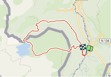

10.4 km | 19.6 km-effort


User GUIDE


FREE GPS app for hiking
 SityTrail
IGN / Geographical institutes
SityTrail World
The world is yours!
Trail On foot of 9.9 km to be discovered at New Aquitaine, Pyrénées-Atlantiques, Borce. This trail is proposed by marmotte65.
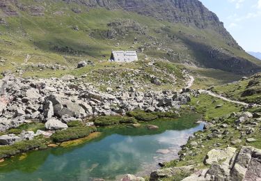
Extraordinaire balade avec quand même un passage délicat sur le retour le passage de l’échelle de fer, sinon le lac est magnifique surtout par un jour sans vent ou la montagne se reflète dans l’eau c'est tout simplement magique.

On foot
On foot

On foot

Walking
Walking

Walking

Walking

Walking
Walking