


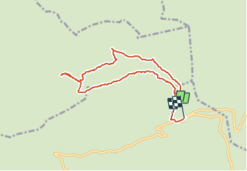

8 km | 11.6 km-effort


User


FREE GPS app for hiking
 SityTrail
IGN / Geographical institutes
SityTrail World
The world is yours!
Trail Snowshoes of 8.4 km to be discovered at Auvergne-Rhône-Alpes, Upper Savoy, Manigod. This trail is proposed by PhilippeLegault.
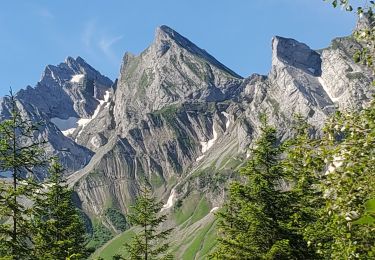
Montée en forêt puis continuation sur ligne de crête jusqu’à la ferme .Très belles vues.
Descente moins agréable

Snowshoes

Walking

Walking

Snowshoes

Snowshoes

Mountain bike
Mountain bike

Motor
Walking