![](/images/other/stat-length.png)
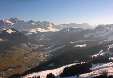
![Trail Winter sports Schwellbrunn - Challenge 07/1 - Photo](https://media.geolcdn.com/t/1900/400/ext.pjpeg?maxdim=2&url=https%3A%2F%2Fstatic1.geolcdn.com%2Fsiteimages%2Fupload%2Ffiles%2F1524743153ski.jpg)
Challenge 07/1
merlot
User
![Length](/images/other/stat-length.png)
Length
12 km
![Max alt](https://static1.geolcdn.com/siteimages/upload/files/1508320355ic_sort_altitude_max_24dp.png)
Max alt
1048 m
![Uphill gradient](https://static1.geolcdn.com/siteimages/upload/files/1508320355ic_sort_den_pos_24dp.png)
Uphill gradient
414 m
![Km-Effort](/images/other/stat-length.png)
Km-Effort
17.7 km
![Min alt](https://static1.geolcdn.com/siteimages/upload/files/1508320355ic_sort_altitude_min_24dp.png)
Min alt
801 m
![Downhill gradient](https://static1.geolcdn.com/siteimages/upload/files/1508320355ic_sort_den_neg_24dp.png)
Downhill gradient
480 m
![Boucle](https://static1.geolcdn.com/siteimages/upload/files/16400158638029165_repeat_loop_refresh_sync_direction_icon.png)
Boucle
No
Creation date :
2014-12-11 00:00:00.0
Updated on :
2014-12-11 00:00:00.0
![Winter sports](https://static1.geolcdn.com/sitytour/trail-icons/500.png)
--
Difficulty : Unknown
![Scan this QR Code to open this trail in the SityTrail application](https://capi.geolives.com/qq0zvz2zws4bq2lad0pu/sitytour/trails/23059/qr.png?size=200)
FREE GPS app for hiking
About
Trail Winter sports of 12 km to be discovered at Appenzell Ausserrhoden, Hinterland, Schwellbrunn. This trail is proposed by merlot.
Description
Herisau,Flawiler Egg, Wolfertswil,Böschenbach,Hoffeld, Ebersol,Necker, Spreitenbach, Reitenberg, Heiterswil, Hemberg, Bächli,Schönau, Urnäsch, Gonten, Appenzell, Haslen,Stein, Hundwil, Herisau
Positioning
Country:
Switzerland
Region :
Appenzell Ausserrhoden
Department/Province :
Hinterland
Municipality :
Schwellbrunn
Location:
Unknown
Start:(Dec)
Start:(UTM)
518603 ; 5244540 (32T) N.
Comments
Trails nearby
![Trail On foot Neckertal - Ziegelhütte-Ebersol - Photo](https://media.geolcdn.com/t/375/260/a9387f16-27d5-457e-8472-d100254310b3.jpeg&format=jpg&maxdim=2)
![On foot On foot](https://static1.geolcdn.com/sitytour/trail-icons/100.png)
Ziegelhütte-Ebersol
On foot
Easy
Neckertal,
Sankt Gallen,
Wahlkreis Toggenburg,
Switzerland
![](/images/other/stat-length.png)
3.9 km | 7 km-effort
1h 35min
![](https://static1.geolcdn.com/siteimages/upload/files/16400158638029165_repeat_loop_refresh_sync_direction_icon.png)
No
![Trail On foot Urnäsch - CH-Schönau-Berggasthaus Hochhamm-Parkplatz Hochhamm - Photo](https://media.geolcdn.com/t/375/260/029ba061-1981-4534-b5d6-9d170dcffbbc.jpeg&format=jpg&maxdim=2)
![On foot On foot](https://static1.geolcdn.com/sitytour/trail-icons/100.png)
CH-Schönau-Berggasthaus Hochhamm-Parkplatz Hochhamm
On foot
Easy
Urnäsch,
Appenzell Ausserrhoden,
Hinterland,
Switzerland
![](/images/other/stat-length.png)
3.1 km | 6.1 km-effort
1h 23min
![](https://static1.geolcdn.com/siteimages/upload/files/16400158638029165_repeat_loop_refresh_sync_direction_icon.png)
No
![Trail Walking Urnäsch - sf_e2b - Photo](https://media.geolcdn.com/t/375/260/ext.jpg?maxdim=2&url=https%3A%2F%2Fstatic1.geolcdn.com%2Fsiteimages%2Fupload%2Ffiles%2F1553511878bg_sport_marche.png)
![Walking Walking](https://static1.geolcdn.com/sitytour/trail-icons/101.png)
sf_e2b
Walking
Very easy
Urnäsch,
Appenzell Ausserrhoden,
Hinterland,
Switzerland
![](/images/other/stat-length.png)
12.9 km | 26 km-effort
4h 32min
![](https://static1.geolcdn.com/siteimages/upload/files/16400158638029165_repeat_loop_refresh_sync_direction_icon.png)
No
![Trail Other activity Schwellbrunn - Schwellbrunn - Wattwil - Photo](https://media.geolcdn.com/t/375/260/ext.jpg?maxdim=2&url=https%3A%2F%2Fstatic1.geolcdn.com%2Fsiteimages%2Fupload%2Ffiles%2F1545311037marcheuse_200dpi.jpg)
![Other activity Other activity](https://static1.geolcdn.com/sitytour/trail-icons/900.png)
Schwellbrunn - Wattwil
Other activity
Very easy
Schwellbrunn,
Appenzell Ausserrhoden,
Hinterland,
Switzerland
![](/images/other/stat-length.png)
16.2 km | 25 km-effort
Unknown
![](https://static1.geolcdn.com/siteimages/upload/files/16400158638029165_repeat_loop_refresh_sync_direction_icon.png)
No
![Trail Other activity Neckertal - JW Urnäsch-Wattwil REG Teil 3 - Photo](https://media.geolcdn.com/t/375/260/ext.jpg?maxdim=2&url=https%3A%2F%2Fstatic1.geolcdn.com%2Fsiteimages%2Fupload%2Ffiles%2F1545311037marcheuse_200dpi.jpg)
![Other activity Other activity](https://static1.geolcdn.com/sitytour/trail-icons/900.png)
JW Urnäsch-Wattwil REG Teil 3
Other activity
Very easy
Neckertal,
Sankt Gallen,
Wahlkreis Toggenburg,
Switzerland
![](/images/other/stat-length.png)
9.2 km | 14.4 km-effort
Unknown
![](https://static1.geolcdn.com/siteimages/upload/files/16400158638029165_repeat_loop_refresh_sync_direction_icon.png)
No
![Trail Other activity Schönengrund - JW Urnäsch-Wattwil REG Teil 2 - Photo](https://media.geolcdn.com/t/375/260/ext.jpg?maxdim=2&url=https%3A%2F%2Fstatic1.geolcdn.com%2Fsiteimages%2Fupload%2Ffiles%2F1545311037marcheuse_200dpi.jpg)
![Other activity Other activity](https://static1.geolcdn.com/sitytour/trail-icons/900.png)
JW Urnäsch-Wattwil REG Teil 2
Other activity
Very easy
Schönengrund,
Appenzell Ausserrhoden,
Hinterland,
Switzerland
![](/images/other/stat-length.png)
5 km | 6.4 km-effort
Unknown
![](https://static1.geolcdn.com/siteimages/upload/files/16400158638029165_repeat_loop_refresh_sync_direction_icon.png)
No
![Trail Other activity Urnäsch - JW Urnäsch-Wattwil REG Teil 1 - Photo](https://media.geolcdn.com/t/375/260/ext.jpg?maxdim=2&url=https%3A%2F%2Fstatic1.geolcdn.com%2Fsiteimages%2Fupload%2Ffiles%2F1545311037marcheuse_200dpi.jpg)
![Other activity Other activity](https://static1.geolcdn.com/sitytour/trail-icons/900.png)
JW Urnäsch-Wattwil REG Teil 1
Other activity
Very easy
Urnäsch,
Appenzell Ausserrhoden,
Hinterland,
Switzerland
![](/images/other/stat-length.png)
4.2 km | 7.9 km-effort
Unknown
![](https://static1.geolcdn.com/siteimages/upload/files/16400158638029165_repeat_loop_refresh_sync_direction_icon.png)
No
![Trail Other activity Herisau - Challenge09_T4 - Photo](https://media.geolcdn.com/t/375/260/ext.jpg?maxdim=2&url=https%3A%2F%2Fstatic1.geolcdn.com%2Fsiteimages%2Fupload%2Ffiles%2F1545311037marcheuse_200dpi.jpg)
![Other activity Other activity](https://static1.geolcdn.com/sitytour/trail-icons/900.png)
Challenge09_T4
Other activity
Very easy
Herisau,
Appenzell Ausserrhoden,
Hinterland,
Switzerland
![](/images/other/stat-length.png)
10.1 km | 14.7 km-effort
2h 36min
![](https://static1.geolcdn.com/siteimages/upload/files/16400158638029165_repeat_loop_refresh_sync_direction_icon.png)
No
![Trail Other activity Schwellbrunn - Challenge09_T1 - Photo](https://media.geolcdn.com/t/375/260/ext.jpg?maxdim=2&url=https%3A%2F%2Fstatic1.geolcdn.com%2Fsiteimages%2Fupload%2Ffiles%2F1545311037marcheuse_200dpi.jpg)
![Other activity Other activity](https://static1.geolcdn.com/sitytour/trail-icons/900.png)
Challenge09_T1
Other activity
Very easy
Schwellbrunn,
Appenzell Ausserrhoden,
Hinterland,
Switzerland
![](/images/other/stat-length.png)
15.1 km | 21 km-effort
3h 36min
![](https://static1.geolcdn.com/siteimages/upload/files/16400158638029165_repeat_loop_refresh_sync_direction_icon.png)
No