![](/images/other/stat-length.png)
![Trail Walking Beaufort-sur-Gervanne - Chapelle Saint-Pancrace (Suze) - Photo](https://media.geolcdn.com/t/1900/400/0951165a-7033-499f-80b8-179b6fa1e8b4.jpg&format=pjpeg&maxdim=2)
Chapelle Saint-Pancrace (Suze)
Philindy26
User
![Length](/images/other/stat-length.png)
![Max alt](https://static1.geolcdn.com/siteimages/upload/files/1508320355ic_sort_altitude_max_24dp.png)
![Uphill gradient](https://static1.geolcdn.com/siteimages/upload/files/1508320355ic_sort_den_pos_24dp.png)
![Km-Effort](/images/other/stat-length.png)
![Min alt](https://static1.geolcdn.com/siteimages/upload/files/1508320355ic_sort_altitude_min_24dp.png)
![Downhill gradient](https://static1.geolcdn.com/siteimages/upload/files/1508320355ic_sort_den_neg_24dp.png)
![Boucle](https://static1.geolcdn.com/siteimages/upload/files/16400158638029165_repeat_loop_refresh_sync_direction_icon.png)
![Walking](https://static1.geolcdn.com/sitytour/trail-icons/101.png)
4h00
Difficulty : Easy
![Scan this QR Code to open this trail in the SityTrail application](https://capi.geolives.com/qq0zvz2zws4bq2lad0pu/sitytour/trails/2302340/qr.png?size=200)
FREE GPS app for hiking
About
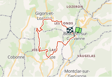
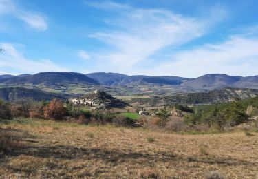
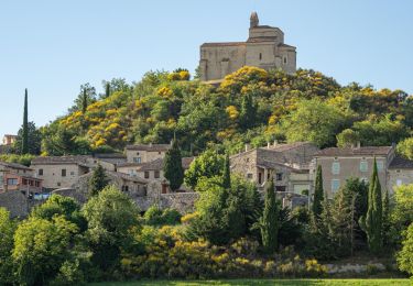
Trail Walking of 14.9 km to be discovered at Auvergne-Rhône-Alpes, Drôme, Beaufort-sur-Gervanne. This trail is proposed by Philindy26.
Description
Départ du village de Beaufort-sur-Gervanne...
Géolocalisation (Google Maps) : https://goo.gl/maps/mnRsbNsLEbaT1TX36
Prendre la direction du hameau des Jaux (357 m), commune de Suze par la D70A.
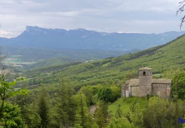
Montée au vieux village de Suze (450 m) puis direction la Croix de Saint-Pancrace par Les Châteaux (495 m).
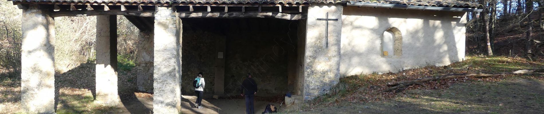
Un aller-retour à la Croix (688 m) et direction la Chapelle Saint-Pancrace (643 m).
Le retour s'effectue en direction de Gigors, par Rabisson (500 m), Les Blaches (515 m), puis la route (D732) jusqu'à Beaufort-sur-Gervanne.
Positioning
Comments
Trails nearby
![Trail Walking Gigors-et-Lozeron - Gigors - Saint-Supière - Photo](https://media.geolcdn.com/t/375/260/7a89f170-854d-4e76-988d-32a2f6e427fd.jpg&format=jpg&maxdim=2)
![Walking Walking](https://static1.geolcdn.com/sitytour/trail-icons/101.png)
Walking
![](/images/other/stat-length.png)
![](https://static1.geolcdn.com/siteimages/upload/files/16400158638029165_repeat_loop_refresh_sync_direction_icon.png)
![Trail Walking Gigors-et-Lozeron - St Supière et Savel à Gigors et Lozeron - Photo](https://media.geolcdn.com/t/375/260/ext.jpg?maxdim=2&url=https%3A%2F%2Fservices.sitytrail.com%2FGeolivesWS%2FDownloadMedia.ashx%3FTrailID%3D103208%26Media%3D5080_3.jpg)
![Walking Walking](https://static1.geolcdn.com/sitytour/trail-icons/101.png)
Walking
![](/images/other/stat-length.png)
![](https://static1.geolcdn.com/siteimages/upload/files/16400158638029165_repeat_loop_refresh_sync_direction_icon.png)
![Trail Walking Montclar-sur-Gervanne - Montclar sur Gervanne-Col Gerbe-Chple St Christophe 17km - Photo](https://media.geolcdn.com/t/375/260/1c8b8899-04e8-4a27-b14a-14d516682923.jpg&format=jpg&maxdim=2)
![Walking Walking](https://static1.geolcdn.com/sitytour/trail-icons/101.png)
Walking
![](/images/other/stat-length.png)
![](https://static1.geolcdn.com/siteimages/upload/files/16400158638029165_repeat_loop_refresh_sync_direction_icon.png)
![Trail Walking Montclar-sur-Gervanne - 2023-02-26_18h25m27_Montclar sur Gervanne 16km - Photo](https://media.geolcdn.com/t/375/260/ebf5c7b8-3682-4aaf-a165-5eb68ffb7b11.jpg&format=jpg&maxdim=2)
![Walking Walking](https://static1.geolcdn.com/sitytour/trail-icons/101.png)
Walking
![](/images/other/stat-length.png)
![](https://static1.geolcdn.com/siteimages/upload/files/16400158638029165_repeat_loop_refresh_sync_direction_icon.png)
![Trail Walking Beaufort-sur-Gervanne - 26 gervanne druise plan de baix - Photo](https://media.geolcdn.com/t/375/260/cef04867-033e-4aa7-8c70-c5079a2317fe.jpg&format=jpg&maxdim=2)
![Walking Walking](https://static1.geolcdn.com/sitytour/trail-icons/101.png)
Walking
![](/images/other/stat-length.png)
![](https://static1.geolcdn.com/siteimages/upload/files/16400158638029165_repeat_loop_refresh_sync_direction_icon.png)
![Trail Walking Beaufort-sur-Gervanne - Beaufort St Pancrace 17km - Photo](https://media.geolcdn.com/t/375/260/ext.jpg?maxdim=2&url=https%3A%2F%2Fstatic1.geolcdn.com%2Fsiteimages%2Fupload%2Ffiles%2F1553511878bg_sport_marche.png)
![Walking Walking](https://static1.geolcdn.com/sitytour/trail-icons/101.png)
Walking
![](/images/other/stat-length.png)
![](https://static1.geolcdn.com/siteimages/upload/files/16400158638029165_repeat_loop_refresh_sync_direction_icon.png)
![Trail Walking Gigors-et-Lozeron - 26 st supporte gigors - Photo](https://media.geolcdn.com/t/375/260/c169c5cd-1ed9-4b41-908c-c962ab944e47.jpg&format=jpg&maxdim=2)
![Walking Walking](https://static1.geolcdn.com/sitytour/trail-icons/101.png)
Walking
![](/images/other/stat-length.png)
![](https://static1.geolcdn.com/siteimages/upload/files/16400158638029165_repeat_loop_refresh_sync_direction_icon.png)
![Trail Walking Gigors-et-Lozeron - 26 gigors zel 24.01.25 - Photo](https://media.geolcdn.com/t/375/260/6d773d26-45d9-491c-869c-836081a35829.jpg&format=jpg&maxdim=2)
![Walking Walking](https://static1.geolcdn.com/sitytour/trail-icons/101.png)
Walking
![](/images/other/stat-length.png)
![](https://static1.geolcdn.com/siteimages/upload/files/16400158638029165_repeat_loop_refresh_sync_direction_icon.png)
![Trail Walking Beaufort-sur-Gervanne - Beaufort - Gigors - Lozeron - Photo](https://media.geolcdn.com/t/375/260/8cacbdb2-dbdb-432d-83ba-9c60bb3f8279.jpg&format=jpg&maxdim=2)
![Walking Walking](https://static1.geolcdn.com/sitytour/trail-icons/101.png)
Walking
![](/images/other/stat-length.png)
![](https://static1.geolcdn.com/siteimages/upload/files/16400158638029165_repeat_loop_refresh_sync_direction_icon.png)
Belle balade. Beaux paysages. Mais trop de goudron !!!