![](/images/other/stat-length.png)
![Trail Walking Sommières - Sommieres 09/01/20 - Photo](https://media.geolcdn.com/t/1900/400/a6b5eb3b-1a15-4c76-bf2d-afa20d2dbbfa.png&format=pjpeg&maxdim=2)
Sommieres 09/01/20
fario
User
![Length](/images/other/stat-length.png)
Length
14.6 km
![Max alt](https://static1.geolcdn.com/siteimages/upload/files/1508320355ic_sort_altitude_max_24dp.png)
Max alt
85 m
![Uphill gradient](https://static1.geolcdn.com/siteimages/upload/files/1508320355ic_sort_den_pos_24dp.png)
Uphill gradient
166 m
![Km-Effort](/images/other/stat-length.png)
Km-Effort
16.8 km
![Min alt](https://static1.geolcdn.com/siteimages/upload/files/1508320355ic_sort_altitude_min_24dp.png)
Min alt
24 m
![Downhill gradient](https://static1.geolcdn.com/siteimages/upload/files/1508320355ic_sort_den_neg_24dp.png)
Downhill gradient
167 m
![Boucle](https://static1.geolcdn.com/siteimages/upload/files/16400158638029165_repeat_loop_refresh_sync_direction_icon.png)
Boucle
Yes
Creation date :
2020-01-09 09:00:32.158
Updated on :
2020-01-09 19:18:52.95
![Walking](https://static1.geolcdn.com/sitytour/trail-icons/101.png)
5h07
Difficulty : Very easy
![Scan this QR Code to open this trail in the SityTrail application](https://capi.geolives.com/qq0zvz2zws4bq2lad0pu/sitytour/trails/2301016/qr.png?size=200)
FREE GPS app for hiking
About
Trail Walking of 14.6 km to be discovered at Occitania, Gard, Sommières. This trail is proposed by fario.
Description
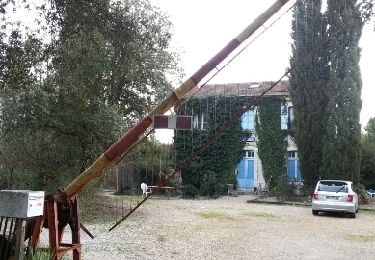
Randonnée très agréable par une belle journée ensoleillée de Janvier
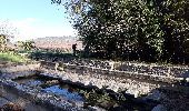
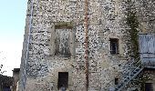
En chemin une chapelle, des moulins et le Vidourle , très beau bien en eau.
Chemins doux , balade idéale pour cette reprise après 2 mois d'inactivité
10P
Positioning
Country:
France
Region :
Occitania
Department/Province :
Gard
Municipality :
Sommières
Location:
Unknown
Start:(Dec)
Start:(UTM)
587436 ; 4848744 (31T) N.
Comments
Trails nearby
![Trail Walking Fontanès - FONTANÉS 30 - SALINELLES - PONDRES - ballade autour du Vidourle - Photo](https://media.geolcdn.com/t/375/260/ext.jpg?maxdim=2&url=https%3A%2F%2Fservices.sitytrail.com%2FGeolivesWS%2FDownloadMedia.ashx%3FTrailID%3D446731%26Media%3D20150718095958.jpg)
![Walking Walking](https://static1.geolcdn.com/sitytour/trail-icons/101.png)
FONTANÉS 30 - SALINELLES - PONDRES - ballade autour du Vidourle
Walking
Medium
(3)
Fontanès,
Occitania,
Gard,
France
![](/images/other/stat-length.png)
10.7 km | 12.7 km-effort
1h 59min
![](https://static1.geolcdn.com/siteimages/upload/files/16400158638029165_repeat_loop_refresh_sync_direction_icon.png)
Yes
![Trail Walking Sommières - SOMMIERES 30 - VILLEVIEILLE châteaux- JUNAS les carrières - Photo](https://media.geolcdn.com/t/375/260/ext.jpg?maxdim=2&url=https%3A%2F%2Fservices.sitytrail.com%2FGeolivesWS%2FDownloadMedia.ashx%3FTrailID%3D421587%26Media%3D20150516132041.jpg)
![Walking Walking](https://static1.geolcdn.com/sitytour/trail-icons/101.png)
SOMMIERES 30 - VILLEVIEILLE châteaux- JUNAS les carrières
Walking
Medium
(2)
Sommières,
Occitania,
Gard,
France
![](/images/other/stat-length.png)
14 km | 16.9 km-effort
2h 34min
![](https://static1.geolcdn.com/siteimages/upload/files/16400158638029165_repeat_loop_refresh_sync_direction_icon.png)
Yes
![Trail Walking Saussines - Saussines - Photo](https://media.geolcdn.com/t/375/260/ext.jpg?maxdim=2&url=https%3A%2F%2Fstatic1.geolcdn.com%2Fsiteimages%2Fupload%2Ffiles%2F1553511878bg_sport_marche.png)
![Walking Walking](https://static1.geolcdn.com/sitytour/trail-icons/101.png)
Saussines
Walking
Very easy
(1)
Saussines,
Occitania,
Hérault,
France
![](/images/other/stat-length.png)
13.3 km | 14.9 km-effort
4h 13min
![](https://static1.geolcdn.com/siteimages/upload/files/16400158638029165_repeat_loop_refresh_sync_direction_icon.png)
Yes
![Trail Walking Junas - Entre Junas et Aujargues - Photo](https://media.geolcdn.com/t/375/260/ext.jpg?maxdim=2&url=https%3A%2F%2Fservices.sitytrail.com%2FGeolivesWS%2FDownloadMedia.ashx%3FTrailID%3D243757%26Media%3Dfix__20140120160354.jpg)
![Walking Walking](https://static1.geolcdn.com/sitytour/trail-icons/101.png)
Entre Junas et Aujargues
Walking
Easy
Junas,
Occitania,
Gard,
France
![](/images/other/stat-length.png)
7.9 km | 9.4 km-effort
2h 2min
![](https://static1.geolcdn.com/siteimages/upload/files/16400158638029165_repeat_loop_refresh_sync_direction_icon.png)
Yes
![Trail Walking Sommières - Autour de Villevielle 30 - Photo](https://media.geolcdn.com/t/375/260/ext.jpg?maxdim=2&url=https%3A%2F%2Fstatic1.geolcdn.com%2Fsiteimages%2Fupload%2Ffiles%2F1553511878bg_sport_marche.png)
![Walking Walking](https://static1.geolcdn.com/sitytour/trail-icons/101.png)
Autour de Villevielle 30
Walking
Easy
(2)
Sommières,
Occitania,
Gard,
France
![](/images/other/stat-length.png)
10.5 km | 12.3 km-effort
3h 0min
![](https://static1.geolcdn.com/siteimages/upload/files/16400158638029165_repeat_loop_refresh_sync_direction_icon.png)
Yes
![Trail Walking Sommières - Les boucles du Vidourle - Photo](https://media.geolcdn.com/t/375/260/60623f25-e960-4316-892a-026a76081c35.jpg&format=jpg&maxdim=2)
![Walking Walking](https://static1.geolcdn.com/sitytour/trail-icons/101.png)
Les boucles du Vidourle
Walking
Difficult
Sommières,
Occitania,
Gard,
France
![](/images/other/stat-length.png)
13 km | 15.5 km-effort
3h 30min
![](https://static1.geolcdn.com/siteimages/upload/files/16400158638029165_repeat_loop_refresh_sync_direction_icon.png)
Yes
![Trail Walking Aspères - Aspères - Photo](https://media.geolcdn.com/t/375/260/3aa1cad7-a037-4103-94ea-4f508e99c3ef.jpg&format=jpg&maxdim=2)
![Walking Walking](https://static1.geolcdn.com/sitytour/trail-icons/101.png)
![Trail Walking Saussines - Circuit des capot elles - Photo](https://media.geolcdn.com/t/375/260/6f4a9959-1f02-425b-b581-c3419555dbfc.jpg&format=jpg&maxdim=2)
![Walking Walking](https://static1.geolcdn.com/sitytour/trail-icons/101.png)
Circuit des capot elles
Walking
Difficult
Saussines,
Occitania,
Hérault,
France
![](/images/other/stat-length.png)
11.7 km | 13.4 km-effort
3h 56min
![](https://static1.geolcdn.com/siteimages/upload/files/16400158638029165_repeat_loop_refresh_sync_direction_icon.png)
Yes
![Trail sport Junas - Carrières de Jonas - Photo](https://media.geolcdn.com/t/375/260/32e42789-febd-4072-a1cf-d057581247ef.jpg&format=jpg&maxdim=2)
Carrières de Jonas
sport
Very easy
Junas,
Occitania,
Gard,
France
![](/images/other/stat-length.png)
3.5 km | 4.1 km-effort
Unknown
![](https://static1.geolcdn.com/siteimages/upload/files/16400158638029165_repeat_loop_refresh_sync_direction_icon.png)
Yes