![](/images/other/stat-length.png)
![Trail Walking Baztan - ALKURRUNTZ depuis le parling de Lizarmeak - Photo](https://media.geolcdn.com/t/1900/400/8e46e580-3773-4095-8da1-5fb11edfdedc.jpg&format=pjpeg&maxdim=2)
ALKURRUNTZ depuis le parling de Lizarmeak
jaja64
User
![Length](/images/other/stat-length.png)
Length
8.6 km
![Max alt](https://static1.geolcdn.com/siteimages/upload/files/1508320355ic_sort_altitude_max_24dp.png)
Max alt
911 m
![Uphill gradient](https://static1.geolcdn.com/siteimages/upload/files/1508320355ic_sort_den_pos_24dp.png)
Uphill gradient
402 m
![Km-Effort](/images/other/stat-length.png)
Km-Effort
13.8 km
![Min alt](https://static1.geolcdn.com/siteimages/upload/files/1508320355ic_sort_altitude_min_24dp.png)
Min alt
546 m
![Downhill gradient](https://static1.geolcdn.com/siteimages/upload/files/1508320355ic_sort_den_neg_24dp.png)
Downhill gradient
366 m
![Boucle](https://static1.geolcdn.com/siteimages/upload/files/16400158638029165_repeat_loop_refresh_sync_direction_icon.png)
Boucle
No
Creation date :
2020-01-05 09:23:12.0
Updated on :
2020-01-05 16:40:01.737
![Walking](https://static1.geolcdn.com/sitytour/trail-icons/101.png)
2h52
Difficulty : Easy
![Scan this QR Code to open this trail in the SityTrail application](https://capi.geolives.com/qq0zvz2zws4bq2lad0pu/sitytour/trails/2297574/qr.png?size=200)
FREE GPS app for hiking
About
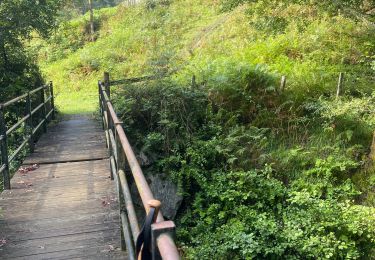
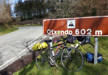
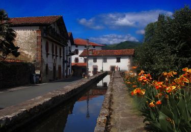
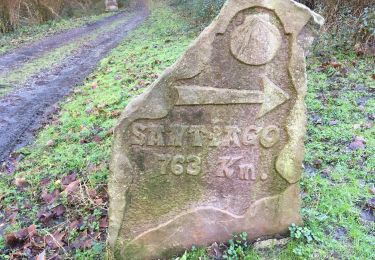
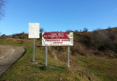
Trail Walking of 8.6 km to be discovered at Navarre, Unknown, Baztan. This trail is proposed by jaja64.
Description
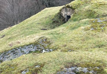
Boucle gauche pour les paresseux comme moi. ;) Boucle droite pour les sportifs. Concernant la boucle gauche retour par crête de l'Aizkotz et visite aux cromlech.
Positioning
Country:
Spain
Region :
Navarre
Department/Province :
Unknown
Municipality :
Baztan
Location:
Unknown
Start:(Dec)
Start:(UTM)
621901 ; 4787817 (30T) N.
Comments
Trails nearby
![Trail Walking Urdazubi/Urdax - urdax - Photo](https://media.geolcdn.com/t/375/260/eb9329a6-8a81-4e34-9565-1e6fabf40cde.jpg&format=jpg&maxdim=2)
![Walking Walking](https://static1.geolcdn.com/sitytour/trail-icons/101.png)
![Trail On foot Urdazubi/Urdax - SL-NA 15 Otsondottiki - Photo](https://media.geolcdn.com/t/375/260/52f4bcee-e0a0-4b91-9588-fad8a39e9c22.jpeg&format=jpg&maxdim=2)
![On foot On foot](https://static1.geolcdn.com/sitytour/trail-icons/100.png)
SL-NA 15 Otsondottiki
On foot
Easy
Urdazubi/Urdax,
Navarre,
Unknown,
Spain
![](/images/other/stat-length.png)
8.4 km | 13.4 km-effort
3h 2min
![](https://static1.geolcdn.com/siteimages/upload/files/16400158638029165_repeat_loop_refresh_sync_direction_icon.png)
Yes
![Trail On foot Baztan - SL-NA 14 Azkarreko itzulia - Photo](https://media.geolcdn.com/t/375/260/35dd0ce1-14a9-48e7-90fb-900f8c18165c.jpeg&format=jpg&maxdim=2)
![On foot On foot](https://static1.geolcdn.com/sitytour/trail-icons/100.png)
SL-NA 14 Azkarreko itzulia
On foot
Easy
Baztan,
Navarre,
Unknown,
Spain
![](/images/other/stat-length.png)
6.7 km | 10.8 km-effort
2h 27min
![](https://static1.geolcdn.com/siteimages/upload/files/16400158638029165_repeat_loop_refresh_sync_direction_icon.png)
Yes
![Trail On foot Urdazubi/Urdax - SL-NA 17 Axularren txokoa - Photo](https://media.geolcdn.com/t/375/260/4ea81041-0789-4918-a312-4afe472a85c1.jpeg&format=jpg&maxdim=2)
![On foot On foot](https://static1.geolcdn.com/sitytour/trail-icons/100.png)
SL-NA 17 Axularren txokoa
On foot
Easy
Urdazubi/Urdax,
Navarre,
Unknown,
Spain
![](/images/other/stat-length.png)
4.9 km | 8.1 km-effort
1h 50min
![](https://static1.geolcdn.com/siteimages/upload/files/16400158638029165_repeat_loop_refresh_sync_direction_icon.png)
Yes
![Trail Walking Urdazubi/Urdax - Urdax Lizartzu circuit des bunkers - Photo](https://media.geolcdn.com/t/375/260/ext.jpg?maxdim=2&url=https%3A%2F%2Fservices.sitytrail.com%2FGeolivesWS%2FDownloadMedia.ashx%3FTrailID%3D892962%26Media%3Dc7436390-fb72-4d0d-9b84-00caadd8f947.jpg)
![Walking Walking](https://static1.geolcdn.com/sitytour/trail-icons/101.png)
Urdax Lizartzu circuit des bunkers
Walking
Medium
(1)
Urdazubi/Urdax,
Navarre,
Unknown,
Spain
![](/images/other/stat-length.png)
15.5 km | 26 km-effort
5h 22min
![](https://static1.geolcdn.com/siteimages/upload/files/16400158638029165_repeat_loop_refresh_sync_direction_icon.png)
Yes
![Trail Walking Urdazubi/Urdax - Boucle au sud d'Urdax - Photo](https://media.geolcdn.com/t/375/260/ext.jpg?maxdim=2&url=https%3A%2F%2Fservices.sitytrail.com%2FGeolivesWS%2FDownloadMedia.ashx%3FTrailID%3D896614%26Media%3D91fefb7a-2db5-4c01-9cb7-918d34f0cda3.jpg)
![Walking Walking](https://static1.geolcdn.com/sitytour/trail-icons/101.png)
Boucle au sud d'Urdax
Walking
Difficult
Urdazubi/Urdax,
Navarre,
Unknown,
Spain
![](/images/other/stat-length.png)
10.6 km | 16.6 km-effort
3h 45min
![](https://static1.geolcdn.com/siteimages/upload/files/16400158638029165_repeat_loop_refresh_sync_direction_icon.png)
Yes
![Trail Walking Baztan - MAILARRETA OTSONDO Frontières en béton dans le massif du Gorramendi 300m. - Photo](https://media.geolcdn.com/t/375/260/8b1035fc-8a50-4048-9924-4944066be27d.jpg&format=jpg&maxdim=2)
![Walking Walking](https://static1.geolcdn.com/sitytour/trail-icons/101.png)
MAILARRETA OTSONDO Frontières en béton dans le massif du Gorramendi 300m.
Walking
Difficult
Baztan,
Navarre,
Unknown,
Spain
![](/images/other/stat-length.png)
8.5 km | 12.5 km-effort
2h 50min
![](https://static1.geolcdn.com/siteimages/upload/files/16400158638029165_repeat_loop_refresh_sync_direction_icon.png)
Yes
![Trail Walking Baztan - MAILARRETA OTSONDO Frontières en béton dans le massif du Gorramendi - Photo](https://media.geolcdn.com/t/375/260/ext.jpg?maxdim=2&url=https%3A%2F%2Fservices.sitytrail.com%2FGeolivesWS%2FDownloadMedia.ashx%3FTrailID%3D526426%26Media%3Dfix__20160208095835.jpg)
![Walking Walking](https://static1.geolcdn.com/sitytour/trail-icons/101.png)
MAILARRETA OTSONDO Frontières en béton dans le massif du Gorramendi
Walking
Difficult
Baztan,
Navarre,
Unknown,
Spain
![](/images/other/stat-length.png)
10 km | 15.3 km-effort
3h 29min
![](https://static1.geolcdn.com/siteimages/upload/files/16400158638029165_repeat_loop_refresh_sync_direction_icon.png)
Yes
![Trail On foot Urdazubi/Urdax - urdax - Photo](https://media.geolcdn.com/t/375/260/82188c64-6e8c-4f63-a051-a505306623e0.jpg&format=jpg&maxdim=2)
![On foot On foot](https://static1.geolcdn.com/sitytour/trail-icons/100.png)