


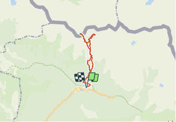

13.3 km | 20 km-effort

User GUIDE


FREE GPS app for hiking
 SityTrail
IGN / Geographical institutes
SityTrail World
The world is yours!
Trail Touring skiing of 11.9 km to be discovered at Provence-Alpes-Côte d'Azur, Maritime Alps, Saint-Martin-Vésubie. This trail is proposed by nadd73.
Boréon du gîte du Boréon.
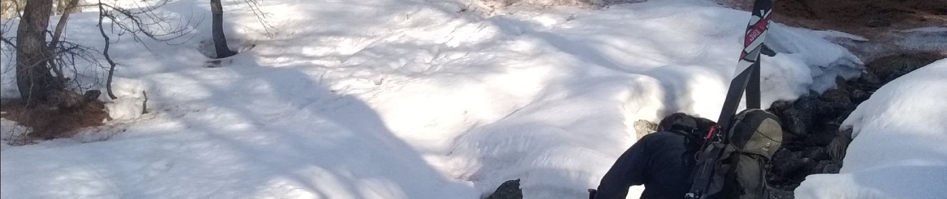
Avec Les skis sur le sac nous sommes montés sur le sentier pédestre (gelé) mais il est préférable de faire comme la descente. c'est à dire passer entre le GR et serre des gardes.
monter au col Descente sud repeauter vers 2300 et monter au lac du Mercantour. Descente comme décrit en haut.
couteaux appréciables.


Walking

Walking

Walking

Walking

On foot

On foot

On foot

On foot

Walking