


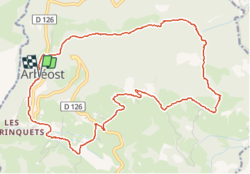


11.4 km | 26 km-effort


User GUIDE


FREE GPS app for hiking
 SityTrail
IGN / Geographical institutes
SityTrail World
The world is yours!
Trail On foot of 6.7 km to be discovered at Occitania, Hautespyrenees, Arbéost. This trail is proposed by marmotte65.
Départ de l’église d’Arbeost. Face au cimetière partir à G.
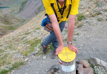
suivre le balisage jaune du PR.
sympathique balade un peu trop de goudron à mon gout, mais compensée par de beaux points de vue.

Walking

Running


sport

On foot

On foot

Walking
Walking

Walking
Walking