![](/images/other/stat-length.png)
![Trail Walking Pouilley-Français - Pouilley Français - Photo](https://media.geolcdn.com/t/1900/400/ee34702d-9f11-422b-a660-e895a27dbabb.jpg&format=pjpeg&maxdim=2)
Pouilley Français
eltonnermou
User
![Length](/images/other/stat-length.png)
Length
13.3 km
![Max alt](https://static1.geolcdn.com/siteimages/upload/files/1508320355ic_sort_altitude_max_24dp.png)
Max alt
295 m
![Uphill gradient](https://static1.geolcdn.com/siteimages/upload/files/1508320355ic_sort_den_pos_24dp.png)
Uphill gradient
241 m
![Km-Effort](/images/other/stat-length.png)
Km-Effort
16.5 km
![Min alt](https://static1.geolcdn.com/siteimages/upload/files/1508320355ic_sort_altitude_min_24dp.png)
Min alt
220 m
![Downhill gradient](https://static1.geolcdn.com/siteimages/upload/files/1508320355ic_sort_den_neg_24dp.png)
Downhill gradient
242 m
![Boucle](https://static1.geolcdn.com/siteimages/upload/files/16400158638029165_repeat_loop_refresh_sync_direction_icon.png)
Boucle
Yes
Creation date :
2019-12-28 12:38:45.761
Updated on :
2019-12-28 17:22:05.095
![Walking](https://static1.geolcdn.com/sitytour/trail-icons/101.png)
2h02
Difficulty : Easy
![Scan this QR Code to open this trail in the SityTrail application](https://capi.geolives.com/qq0zvz2zws4bq2lad0pu/sitytour/trails/2291842/qr.png?size=200)
FREE GPS app for hiking
About
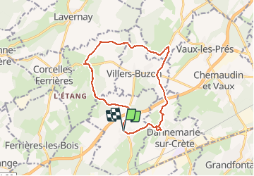
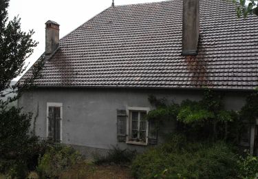
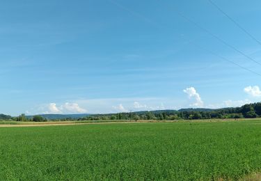
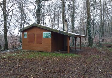
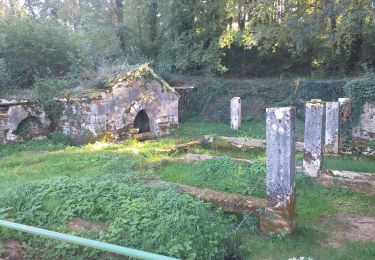
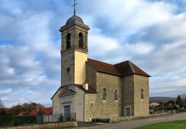
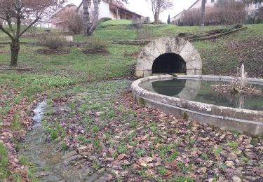
Trail Walking of 13.3 km to be discovered at Bourgogne-Franche-Comté, Doubs, Pouilley-Français. This trail is proposed by eltonnermou.
Description
randonnée pieds 3/4 propres.
à travers monts et vaux, de belles perspectives. Se laisser porter par les facéties d'un historien naturaliste au détour du sentier sur la partie finale.
Positioning
Country:
France
Region :
Bourgogne-Franche-Comté
Department/Province :
Doubs
Municipality :
Pouilley-Français
Location:
Unknown
Start:(Dec)
Start:(UTM)
715345 ; 5232206 (31T) N.
Comments
Trails nearby
![Trail On foot Grandfontaine - Sentier de Béthanier-la-Marne - Photo](https://media.geolcdn.com/t/375/260/2cb68c4b-5f12-47bc-b1b4-9a02447cfa53.jpeg&format=jpg&maxdim=2)
![On foot On foot](https://static1.geolcdn.com/sitytour/trail-icons/100.png)
Sentier de Béthanier-la-Marne
On foot
Easy
Grandfontaine,
Bourgogne-Franche-Comté,
Doubs,
France
![](/images/other/stat-length.png)
8.5 km | 10.2 km-effort
2h 18min
![](https://static1.geolcdn.com/siteimages/upload/files/16400158638029165_repeat_loop_refresh_sync_direction_icon.png)
Yes
![Trail On foot Montferrand-le-Château - Sentier de Crête et Bois Rapin - Photo](https://media.geolcdn.com/t/375/260/c8b25516-529e-4f5c-85cb-5313429ddb47.jpeg&format=jpg&maxdim=2)
![On foot On foot](https://static1.geolcdn.com/sitytour/trail-icons/100.png)
Sentier de Crête et Bois Rapin
On foot
Easy
(1)
Montferrand-le-Château,
Bourgogne-Franche-Comté,
Doubs,
France
![](/images/other/stat-length.png)
10.1 km | 14.1 km-effort
3h 11min
![](https://static1.geolcdn.com/siteimages/upload/files/16400158638029165_repeat_loop_refresh_sync_direction_icon.png)
Yes
![Trail On foot Thoraise - Sentier de Notre Dame du Mont - Photo](https://media.geolcdn.com/t/375/260/e4c78328-7a72-4c70-b054-e885f49e43ee.jpeg&format=jpg&maxdim=2)
![On foot On foot](https://static1.geolcdn.com/sitytour/trail-icons/100.png)
Sentier de Notre Dame du Mont
On foot
Easy
Thoraise,
Bourgogne-Franche-Comté,
Doubs,
France
![](/images/other/stat-length.png)
5.2 km | 7.7 km-effort
1h 44min
![](https://static1.geolcdn.com/siteimages/upload/files/16400158638029165_repeat_loop_refresh_sync_direction_icon.png)
Yes
![Trail Walking Saint-Vit - saint vit - velesmes-essarts / autour du bois des saussottes - Photo](https://media.geolcdn.com/t/375/260/61dd1ddd-a496-4aed-80ab-95d6bd5de239.jpg&format=jpg&maxdim=2)
![Walking Walking](https://static1.geolcdn.com/sitytour/trail-icons/101.png)
saint vit - velesmes-essarts / autour du bois des saussottes
Walking
Easy
Saint-Vit,
Bourgogne-Franche-Comté,
Doubs,
France
![](/images/other/stat-length.png)
13.4 km | 16.4 km-effort
3h 27min
![](https://static1.geolcdn.com/siteimages/upload/files/16400158638029165_repeat_loop_refresh_sync_direction_icon.png)
Yes
![Trail Walking Chemaudin et Vaux - chemin des vignes - Photo](https://media.geolcdn.com/t/375/260/09f8fdc7-9eee-478c-a43b-c779e5a0f3b9.jpg&format=jpg&maxdim=2)
![Walking Walking](https://static1.geolcdn.com/sitytour/trail-icons/101.png)
chemin des vignes
Walking
Difficult
Chemaudin et Vaux,
Bourgogne-Franche-Comté,
Doubs,
France
![](/images/other/stat-length.png)
12.3 km | 14.5 km-effort
3h 18min
![](https://static1.geolcdn.com/siteimages/upload/files/16400158638029165_repeat_loop_refresh_sync_direction_icon.png)
Yes
![Trail Walking Saint-Vit - Saint vit-longtemps - Photo](https://media.geolcdn.com/t/375/260/1f8a244b-11a6-4aff-9675-4b70887e3976.jpg&format=jpg&maxdim=2)
![Walking Walking](https://static1.geolcdn.com/sitytour/trail-icons/101.png)
Saint vit-longtemps
Walking
Easy
(1)
Saint-Vit,
Bourgogne-Franche-Comté,
Doubs,
France
![](/images/other/stat-length.png)
15.2 km | 18.5 km-effort
4h 12min
![](https://static1.geolcdn.com/siteimages/upload/files/16400158638029165_repeat_loop_refresh_sync_direction_icon.png)
Yes
![Trail Walking Ferrières-les-Bois - Ferrières les bois - Photo](https://media.geolcdn.com/t/375/260/4aeeec34-c040-4993-adf2-b738b54dc94e.jpg&format=jpg&maxdim=2)
![Walking Walking](https://static1.geolcdn.com/sitytour/trail-icons/101.png)
Ferrières les bois
Walking
Easy
Ferrières-les-Bois,
Bourgogne-Franche-Comté,
Doubs,
France
![](/images/other/stat-length.png)
13 km | 16.6 km-effort
2h 25min
![](https://static1.geolcdn.com/siteimages/upload/files/16400158638029165_repeat_loop_refresh_sync_direction_icon.png)
Yes
![Trail On foot Osselle-Routelle - Sentier de la Fontaine des Baroques - Photo](https://media.geolcdn.com/t/375/260/9ef84639-8e8c-4f61-babc-29d251b3eba8.jpeg&format=jpg&maxdim=2)
![On foot On foot](https://static1.geolcdn.com/sitytour/trail-icons/100.png)
Sentier de la Fontaine des Baroques
On foot
Easy
Osselle-Routelle,
Bourgogne-Franche-Comté,
Doubs,
France
![](/images/other/stat-length.png)
6.4 km | 8.5 km-effort
1h 56min
![](https://static1.geolcdn.com/siteimages/upload/files/16400158638029165_repeat_loop_refresh_sync_direction_icon.png)
Yes
![Trail Walking Corcondray - corcondray - Photo](https://media.geolcdn.com/t/375/260/d98283d1-4554-484f-9a27-55a0c4c36ada.jpg&format=jpg&maxdim=2)
![Walking Walking](https://static1.geolcdn.com/sitytour/trail-icons/101.png)
corcondray
Walking
Medium
Corcondray,
Bourgogne-Franche-Comté,
Doubs,
France
![](/images/other/stat-length.png)
28 km | 34 km-effort
4h 23min
![](https://static1.geolcdn.com/siteimages/upload/files/16400158638029165_repeat_loop_refresh_sync_direction_icon.png)
Yes